MyTopo
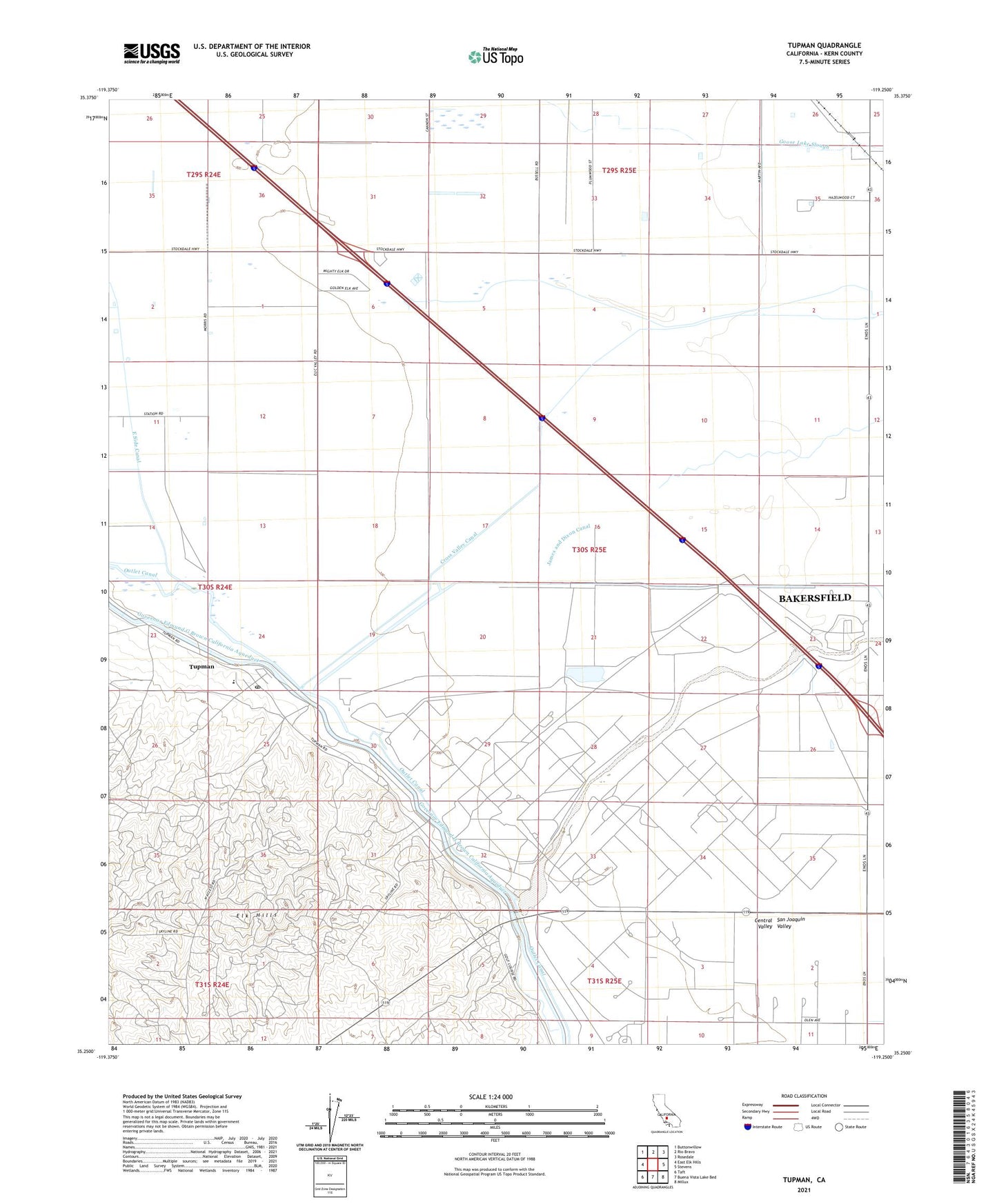
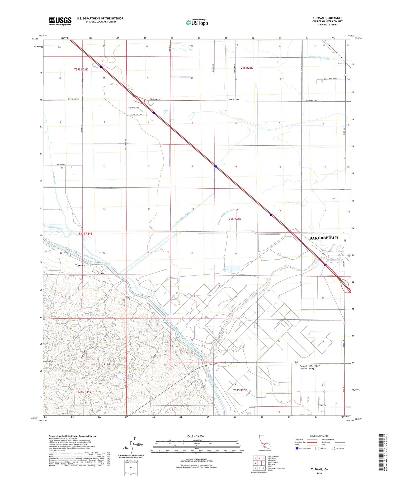
Tupman California US Topo Map
Couldn't load pickup availability
2021 topographic map quadrangle Tupman in the state of California. Scale: 1:24000. Based on the newly updated USGS 7.5' US Topo map series, this map is in the following counties: Kern. The map contains contour data, water features, and other items you are used to seeing on USGS maps, but also has updated roads and other features. This is the next generation of topographic maps. Printed on high-quality waterproof paper with UV fade-resistant inks.
Quads adjacent to this one:
West: East Elk Hills
Northwest: Buttonwillow
North: Rio Bravo
Northeast: Rosedale
East: Stevens
Southeast: Millux
South: Buena Vista Lake Bed
Southwest: Taft
This map covers the same area as the classic USGS quad with code o35119c3.
Contains the following named places: AJB Ranch Dairy, Buena Vista Ranch, California Highway Patrol 426 Buttonwillow, Camp Thirty Five-S, Elk Hill Elementary School, Goose Lake Slough, Inlet Canal, James and Dixon Canal, Kern River, Mesquite Hunting Club, North Coles Levee Oil Field, Outlet Canal, Richfield Weir, South Coles Levee Oil Field, Tule Elk State Natural Reserve, Tupman, Tupman Camp, Tupman Census Designated Place, Tupman Post Office, Western Water Country Camp, ZIP Code: 93276