MyTopo
Stevens California US Topo Map
Couldn't load pickup availability
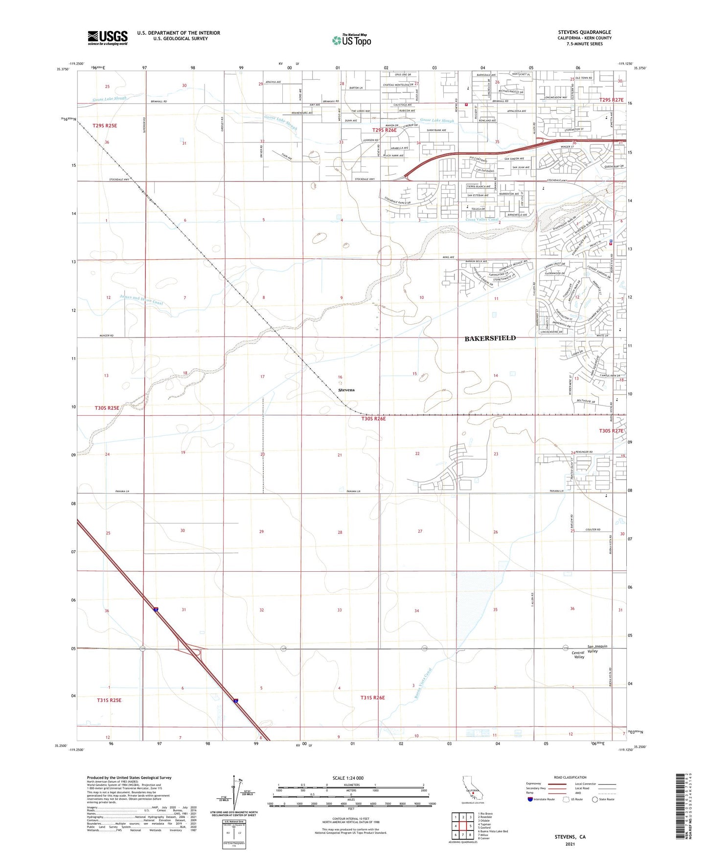
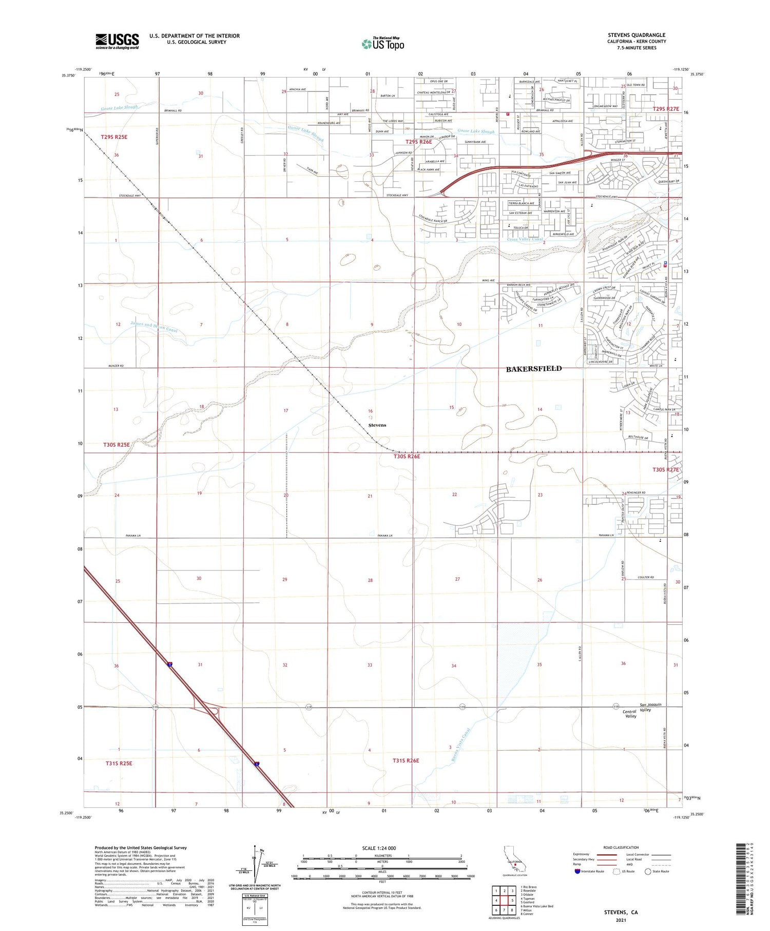
2021 topographic map quadrangle Stevens in the state of California. Scale: 1:24000. Based on the newly updated USGS 7.5' US Topo map series, this map is in the following counties: Kern. The map contains contour data, water features, and other items you are used to seeing on USGS maps, but also has updated roads and other features. This is the next generation of topographic maps. Printed on high-quality waterproof paper with UV fade-resistant inks.
Quads adjacent to this one:
West: Tupman
Northwest: Rio Bravo
North: Rosedale
Northeast: Oildale
East: Gosford
Southeast: Conner
South: Millux
Southwest: Buena Vista Lake Bed
This map covers the same area as the classic USGS quad with code o35119c2.
Contains the following named places: Bakersfield Fire Department Station 15, Bakersfield Police Department West Side Substation, Bellevue Oil Field, Buena Vista Canal, Buena Vista Elementary School, Canal Oil Field, Canfield Ranch, Canfield Ranch Oil Field, Cross Valley Canal, James Canal, Joe Gottlieb Field Airport, Kern County Fire Department Station 67 Rosedale, Munzer School, Pioneer Canal, Rio Bravo Pumping Station, Stevens, Strand, Strand Oil Field, Ten Section Oil Field, Ten Section Refinery