MyTopo
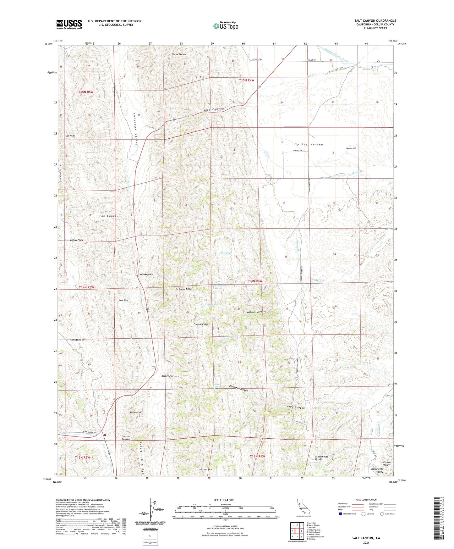
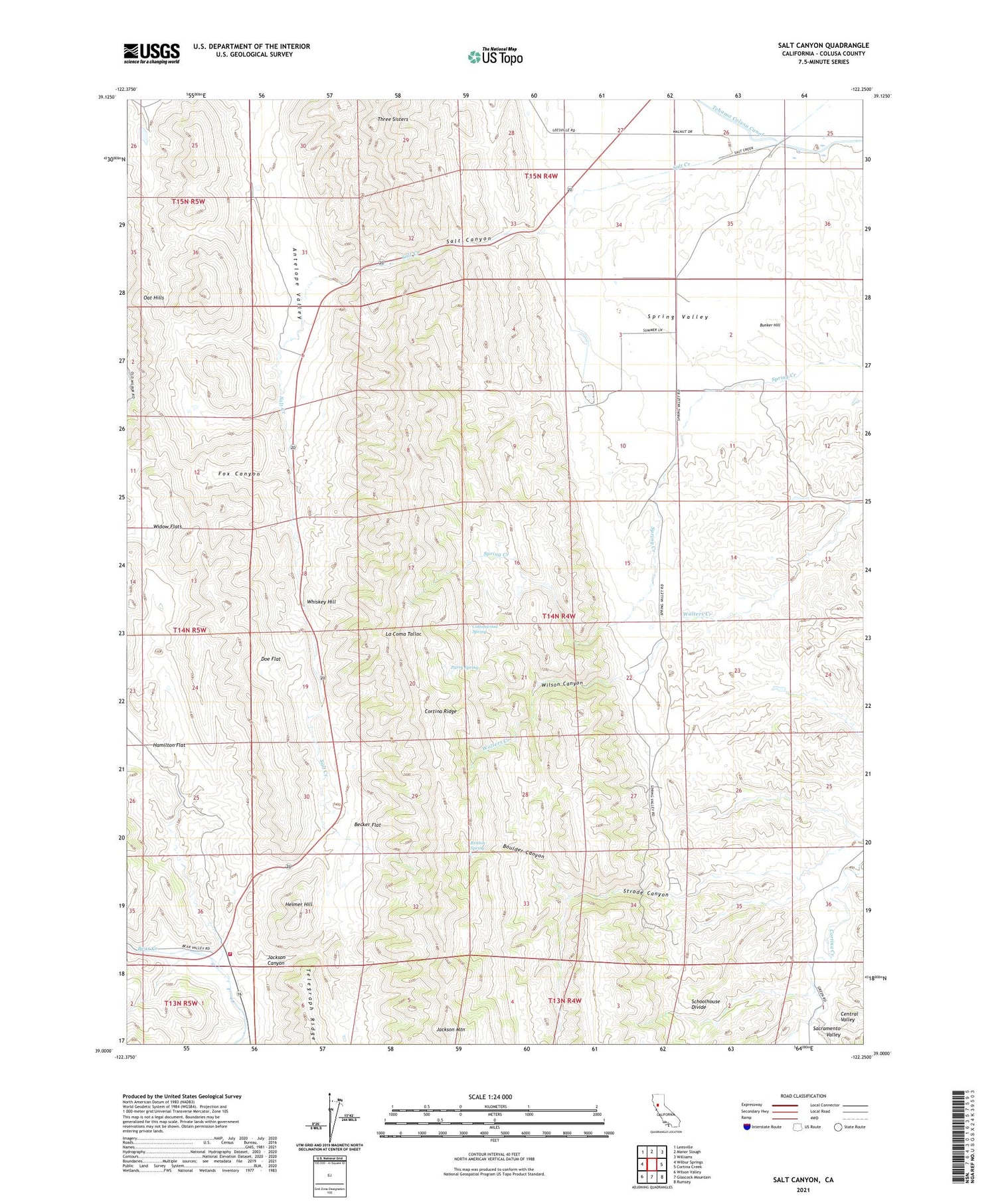
Salt Canyon California US Topo Map
Couldn't load pickup availability
2021 topographic map quadrangle Salt Canyon in the state of California. Scale: 1:24000. Based on the newly updated USGS 7.5' US Topo map series, this map is in the following counties: Colusa. The map contains contour data, water features, and other items you are used to seeing on USGS maps, but also has updated roads and other features. This is the next generation of topographic maps. Printed on high-quality waterproof paper with UV fade-resistant inks.
Quads adjacent to this one:
West: Wilbur Springs
Northwest: Leesville
North: Manor Slough
Northeast: Williams
East: Cortina Creek
Southeast: Rumsey
South: Glascock Mountain
Southwest: Wilson Valley
This map covers the same area as the classic USGS quad with code o39122a3.
Contains the following named places: Becker Flat, Boulder Canyon, Britton Spring, Bunker Hill, California Department of Forestry and Fire Protection Colusa County, Cortina Indian Rancheria, Cortina Ridge, Cottonwood Spring, Doe Flat, Fox Canyon, Helmer Hill, Jackson Canyon, Jackson Mountain, La Coma Tallac, Manzanita Creek, Parry Spring, Plum Orchard, Salt Canyon, Schoolhouse Divide, Strode Canyon, Telegraph Ridge, Three Sisters, Whiskey Hill, Wilbur Springs Station California Division, Wilson Canyon, ZIP Code: 95987