MyTopo
Half Moon Bay California US Topo Map
Couldn't load pickup availability
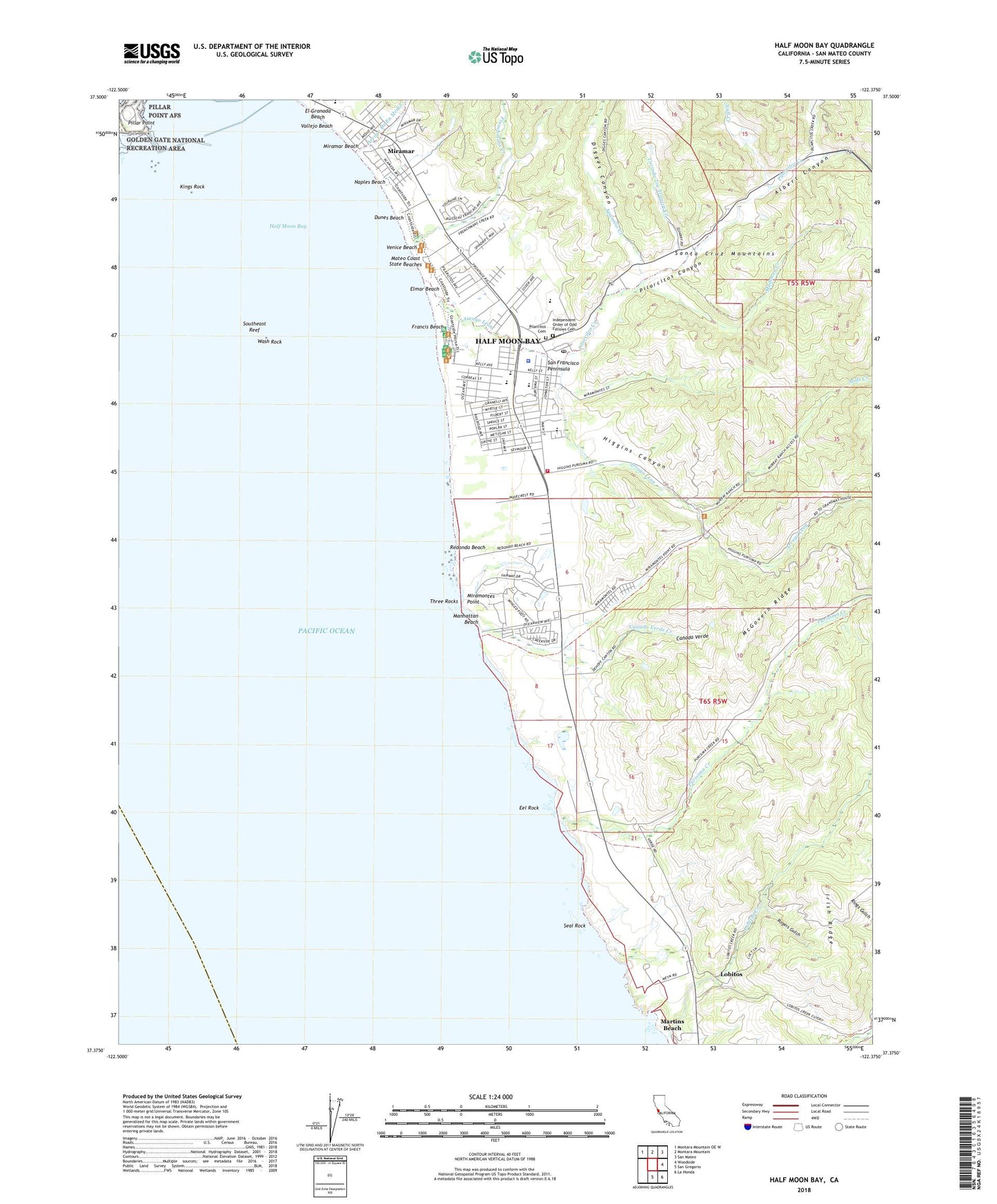
2021 topographic map quadrangle Half Moon Bay in the state of California. Scale: 1:24000. Based on the newly updated USGS 7.5' US Topo map series, this map is in the following counties: San Mateo. The map contains contour data, water features, and other items you are used to seeing on USGS maps, but also has updated roads and other features. This is the next generation of topographic maps. Printed on high-quality waterproof paper with UV fade-resistant inks.
Quads adjacent to this one:
Northwest: Montara Mountain OE W
North: Montara Mountain
Northeast: San Mateo
East: Woodside
Southeast: La Honda
South: San Gregorio
This map covers the same area as the classic USGS quad with code o37122d4.
Contains the following named places: Accent Homes Mobile Home Park, Albert Canyon, Amesport Landing, Apanolio Creek, Arroyo De En Medio, Arroyo Leon, Burleigh Murray Ranch, Burleigh Murray Ranch State Park, Cabrillo Adult School, Canada De Verde Y Arroyo De La Purisima, Canada Home Mobile Home Park, Canada Verde, Canada Verde Creek, City of Half Moon Bay, Coastside Community Center, Coastside Fire Protection District Station 40, Coastside Health Center, Corinda Los Trancos Creek, Corral De Tierra, Digges Canyon, Dunes Beach, East Breakwater, Eel Rock, El Granada Elementary School, Elmar Beach, Francis Beach, Francis Beach Campground, Frenchmans Creek, Frenchmans Creek Community Park, Half Moon Bay, Half Moon Bay Branch San Mateo County Library, Half Moon Bay Country Club, Half Moon Bay High School, Half Moon Bay Police Department, Half Moon Bay Post Office, Half Moon Bay State Beach, Hatch Elementary School, Higgins Canyon, Independent Order of Odd Fellows Cemetery, Johnson House Historic Site, Johnston 605-002 Dam, Kings Mountain Elementary School, Kings Rock, Lobitos, Lobitos Creek, Madonna Creek, Manhattan Beach, Manuel F Cunha Intermediate School, Mateo Coast State Beaches, McGovern Ridge, Mills Creek, Miramar, Miramar Beach, Miramar School, Miramontes, Miramontes Point, Naples Beach, Nuestra Senora Del Pilar Church, Nuff Creek, Obester Winery, Pilarcitos Canyon, Pilarcitos Cemetery, Pilarcitos Creek, Pilarcitos High School, Pilarcitos School, Pillar Point, Pillar Point Harbor, Poplar Beach, Purisima, Purisima Creek, Purisima School, Redondo Beach, Rogers Gulch, San Mateo County Sheriff's Office Half Moon Bay Substation, Schoolhouse Creek, Sea Crest School, Seal Rock, Smith Field Little League Park, Southeast Reef, Strawflower Village Shopping Center, Sweetwood Group Camp, Three Rocks, Tunitas School, Vallejo Beach, Venice Beach, Wash Rock, ZIP Code: 94019