MyTopo
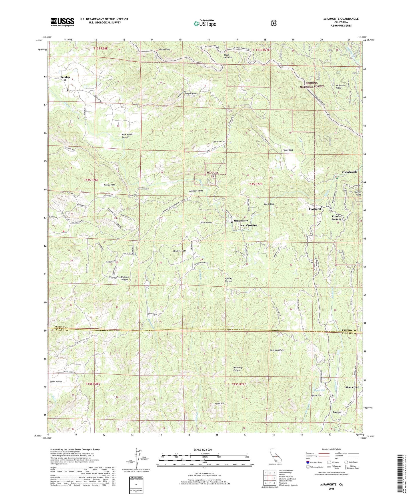
Miramonte California US Topo Map
Couldn't load pickup availability
Also explore the Miramonte Forest Service Topo of this same quad for updated USFS data
2021 topographic map quadrangle Miramonte in the state of California. Scale: 1:24000. Based on the newly updated USGS 7.5' US Topo map series, this map is in the following counties: Fresno, Tulare. The map contains contour data, water features, and other items you are used to seeing on USGS maps, but also has updated roads and other features. This is the next generation of topographic maps. Printed on high-quality waterproof paper with UV fade-resistant inks.
Quads adjacent to this one:
West: Tucker Mountain
Northwest: Luckett Mountain
North: Verplank Ridge
Northeast: Hume
East: General Grant Grove
Southeast: Shadequarter Mountain
South: Auckland
Southwest: Stokes Mountain
This map covers the same area as the classic USGS quad with code o36119f1.
Contains the following named places: Badger, Badger Fire Control Station, Black Oak Flat, Burns Flat, Cedarbrook, Cedarbrook Picnic Area, Deer Crossing, Deer Park School, Depot Flat, Dunlap, Dunlap Baptist Church, Dunlap K - 8 School, Dunlap Post Office, Etheda Springs, Greeley Ranger Station, Hilltop Chapel, Indian Hill, Johnson Flat, Johnson Point, McKenzie Ridge, Meadows Ridge, Milk Ranch Canyon, Millwood, Miramonte, Miramonte Conservation Camp, Miramonte Elementary School, Miramonte Post Office, Miramonte Ranch, Mitchell Peak, Morlar Flat, Mountain Valley Volunteer Fire Department, Neffs Camp, Oak Flat School, Pinehurst, Pinehurst Work Center, Sierra Elementary School, Sierra Glen, Stillwell Ranch, Stony Flat, Todd Ranch, United States Forest Service Sierra National Forest, Whale Rock, Wild Hog Canyon, Wildwood Farm, ZIP Code: 93641