MyTopo
Shadow Mountains SE California US Topo Map
Couldn't load pickup availability
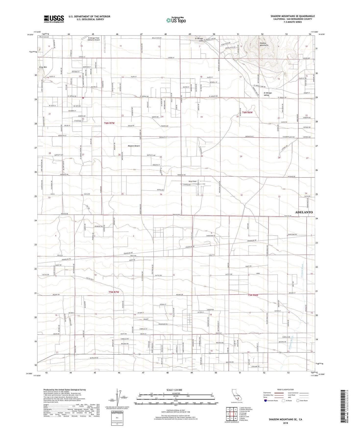
2021 topographic map quadrangle Shadow Mountains SE in the state of California. Scale: 1:24000. Based on the newly updated USGS 7.5' US Topo map series, this map is in the following counties: San Bernardino. The map contains contour data, water features, and other items you are used to seeing on USGS maps, but also has updated roads and other features. This is the next generation of topographic maps. Printed on high-quality waterproof paper with UV fade-resistant inks.
Quads adjacent to this one:
West: El Mirage
Northwest: Adobe Mountain
North: Shadow Mountains
Northeast: Victorville NW
East: Adelanto
Southeast: Baldy Mesa
South: Phelan
Southwest: Mescal Creek
This map covers the same area as the classic USGS quad with code o34117e5.
Contains the following named places: Church of the Lake, El Mirage Field Adelanto Airport, El Mirage Valley, Krey Field, San Bernardino County Fire Department Station 11 El Mirage