MyTopo
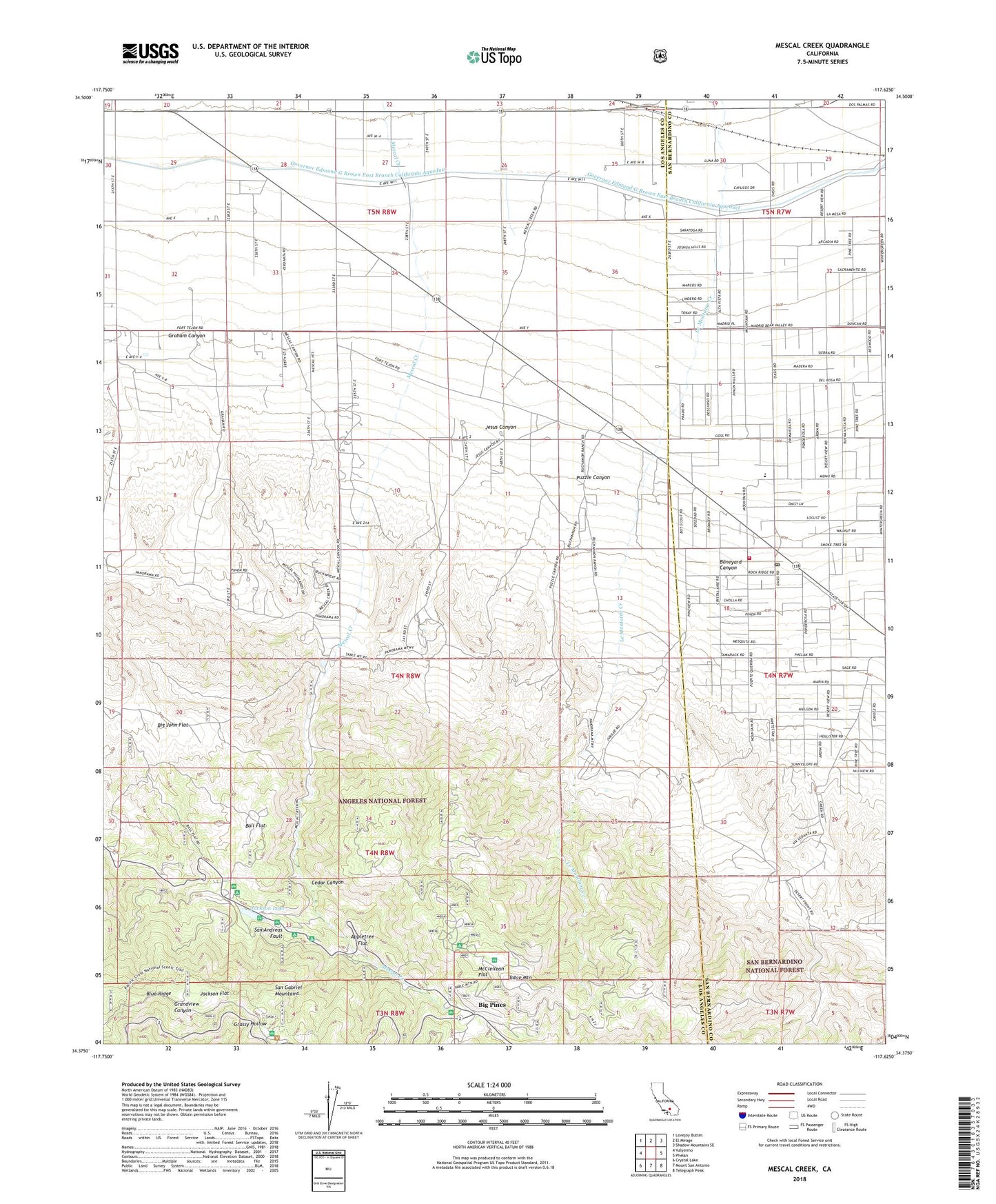
Mescal Creek California US Topo Map
Couldn't load pickup availability
Also explore the Mescal Creek Forest Service Topo of this same quad for updated USFS data
2021 topographic map quadrangle Mescal Creek in the state of California. Scale: 1:24000. Based on the newly updated USGS 7.5' US Topo map series, this map is in the following counties: Los Angeles, San Bernardino. The map contains contour data, water features, and other items you are used to seeing on USGS maps, but also has updated roads and other features. This is the next generation of topographic maps. Printed on high-quality waterproof paper with UV fade-resistant inks.
Quads adjacent to this one:
West: Valyermo
Northwest: Lovejoy Buttes
North: El Mirage
Northeast: Shadow Mountains SE
East: Phelan
Southeast: Telegraph Peak
South: Mount San Antonio
Southwest: Crystal Lake
This map covers the same area as the classic USGS quad with code o34117d6.
Contains the following named places: All Nations Camp, Appletree Campground, Appletree Flat, Arch Picnic Ground, Ball Flat, Ball Target Shooting Area, Big John Flat, Big Pines, Big Pines Camp, Big Pines Guard Station, Boneyard Canyon, Camp Ester, Camp Harmony Pines, Camp Hawthorne, Camp Hemohme, Camp Jubilee, Camp Junipero Serra, Camp Kassab, Camp Manzanita, Camp Marion, Camp McClellan, Camp McKiwanis, Camp Metaka, Camp Teresita Pines, Camp Verdugo Pines, Cedar Canyon, Centinela Valley Camp, Deer Ridge Camp, Graham Canyon, Grassy Hollow, Grassy Hollow Campground, Hagenbaugh Ranch, Jackson Flat, Jackson Flat Campground, Jackson Lake, Jesus Canyon, Kare Camp Campground, Kassab Camp, Lake Campground, McClellean Flat, Mescal Campground, Mount Oak Campground, Oak Spring Ranch, Peavine Campground, Pinon Hills, Pinon Hills Elementary School, Pinon Hills Estates, Pinon Hills Post Office, Puzzle Canyon, San Bernardino County Fire Department Station 13 - Pinon Hills, Smithsonian Observatory, Sunrise Ski Area, Table Mountain, Table Mountain Campground, Twin Valley Camp, Y M C A Camp