MyTopo
El Mirage California US Topo Map
Couldn't load pickup availability
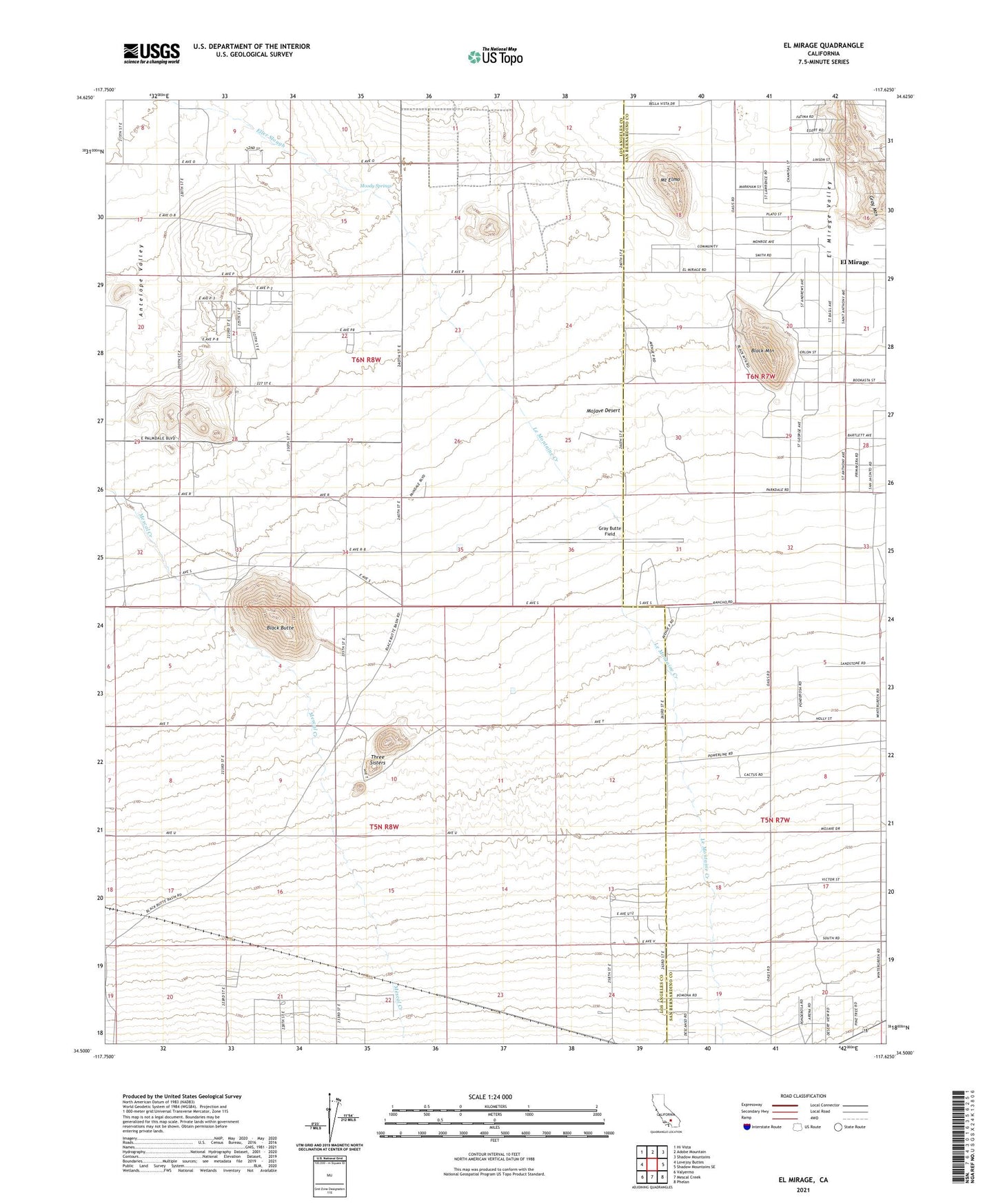
2021 topographic map quadrangle El Mirage in the state of California. Scale: 1:24000. Based on the newly updated USGS 7.5' US Topo map series, this map is in the following counties: Los Angeles, San Bernardino. The map contains contour data, water features, and other items you are used to seeing on USGS maps, but also has updated roads and other features. This is the next generation of topographic maps. Printed on high-quality waterproof paper with UV fade-resistant inks.
Quads adjacent to this one:
West: Lovejoy Buttes
Northwest: Hi Vista
North: Adobe Mountain
Northeast: Shadow Mountains
East: Shadow Mountains SE
Southeast: Phelan
South: Mescal Creek
Southwest: Valyermo
This map covers the same area as the classic USGS quad with code o34117e6.
Contains the following named places: Black Butte, Black Mountain, Brase Ranch, El Mirage, Engelbrecht Place, ER-B Ranch, Gray Butte Field, Gray Mountain, Hibbard Ranch, Le Montaine Creek, Mescal Creek, Moody Springs, Mount Elmo, Three Sisters, Vanderburg Ranch