MyTopo
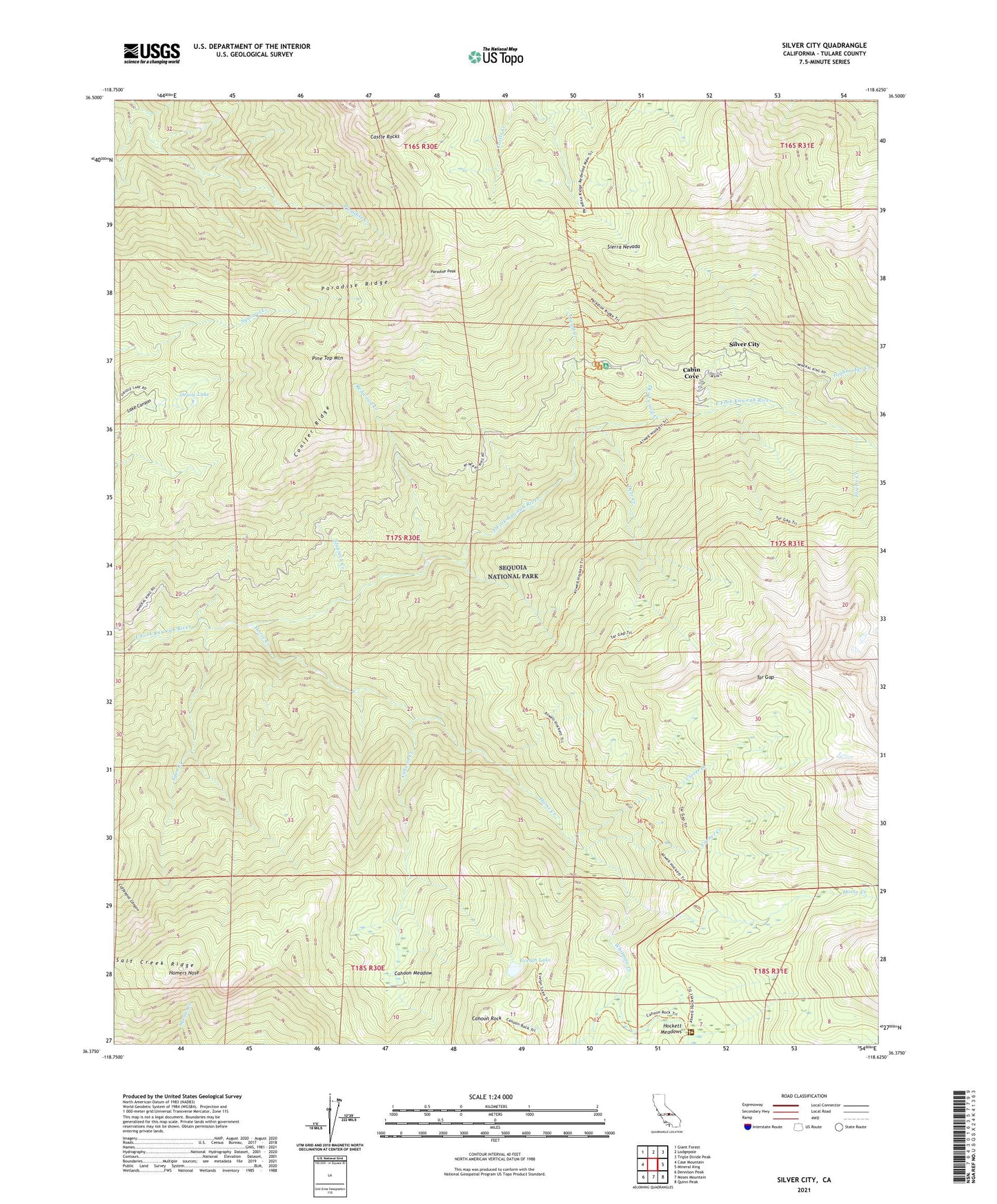
Silver City California US Topo Map
Couldn't load pickup availability
Also explore the Silver City Forest Service Topo of this same quad for updated USFS data
2023 topographic map quadrangle Silver City in the state of California. Scale: 1:24000. Based on the newly updated USGS 7.5' US Topo map series, this map is in the following counties: Tulare. The map contains contour data, water features, and other items you are used to seeing on USGS maps, but also has updated roads and other features. This is the next generation of topographic maps. Printed on high-quality waterproof paper with UV fade-resistant inks.
Quads adjacent to this one:
West: Case Mountain
Northwest: Giant Forest
North: Lodgepole
Northeast: Triple Divide Peak
East: Mineral King
Southeast: Quinn Peak
South: Moses Mountain
Southwest: Dennison Peak
This map covers the same area as the classic USGS quad with code o36118d6.
Contains the following named places: Atwell Creek, Atwell Grove, Atwell Hockett Trail, Atwell Mill Campground, Atwell Mill Ranger Station, Cabin Cove, Cahoon Creek, Cahoon Meadow, Cahoon Rock, Cahoon Rock Lookout, Camp Conifer, Castle Rocks, Clover Creek, Conifer Ridge, Corner Creek, Deadwood Creek, Deer Creek, East Fork Grove, Eden Creek, Eden Creek Grove, Evelyn Lake, Fowler Creek, Highbridge Creek, Hockett Meadow Trail, Hockett Meadows, Hockett Ranger Station, Homers Nose, Horse Creek, Horse Creek Grove, John Krebs Wilderness, Oriole Grove, Oriole Lake, Paradise Peak, Paradise Ridge, Pine Top Mountain, Redwood Creek, Salt Creek Ridge, Silver City, Silver City Census Designated Place, Slapjack Creek, Tar Gap, Whitman Creek