MyTopo
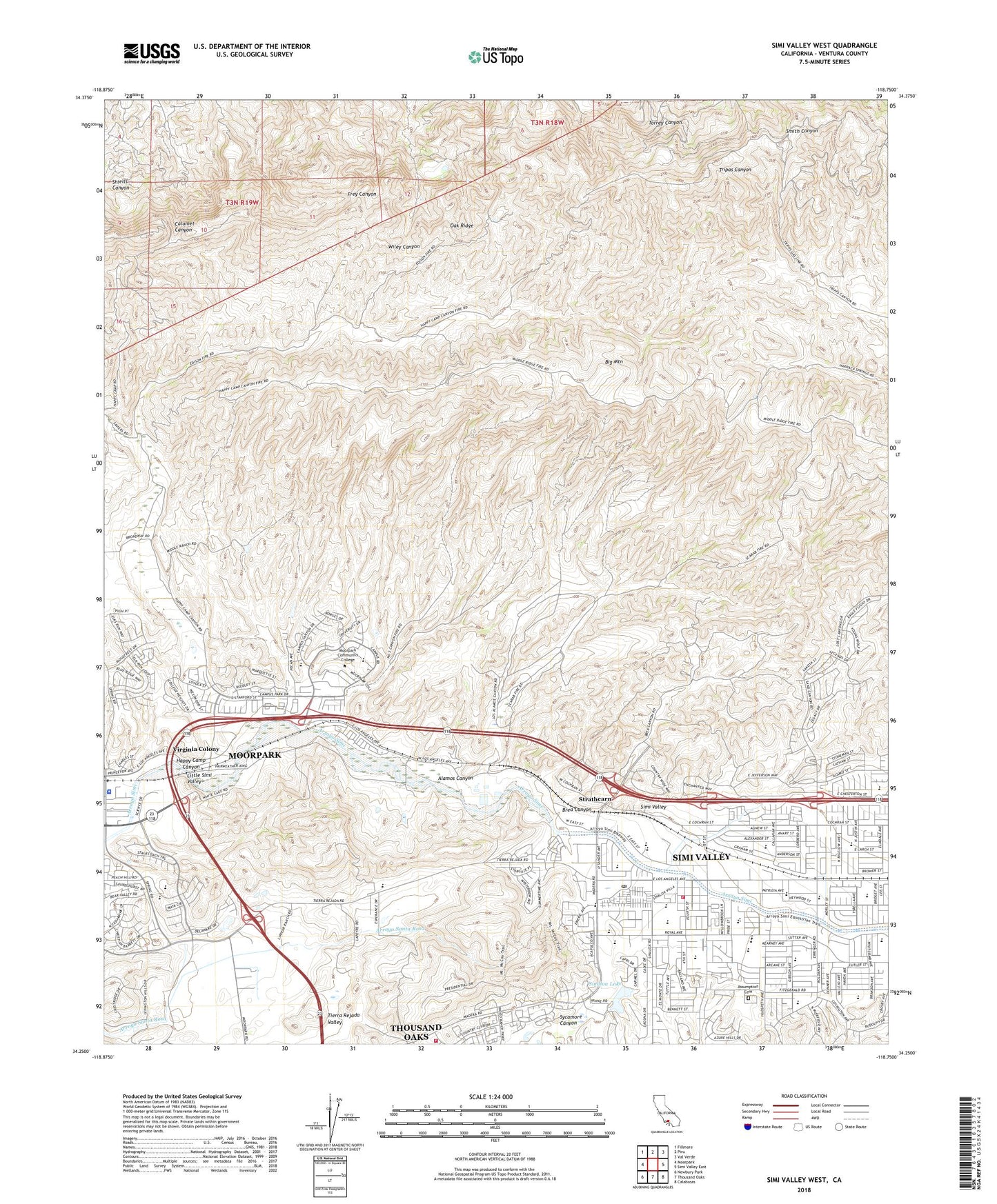
Simi Valley West California US Topo Map
Couldn't load pickup availability
2022 topographic map quadrangle Simi Valley West in the state of California. Scale: 1:24000. Based on the newly updated USGS 7.5' US Topo map series, this map is in the following counties: Ventura. The map contains contour data, water features, and other items you are used to seeing on USGS maps, but also has updated roads and other features. This is the next generation of topographic maps. Printed on high-quality waterproof paper with UV fade-resistant inks.
Quads adjacent to this one:
West: Moorpark
Northwest: Fillmore
North: Piru
Northeast: Val Verde
East: Simi Valley East
Southeast: Calabasas
South: Thousand Oaks
Southwest: Newbury Park
This map covers the same area as the classic USGS quad with code o34118c7.
Contains the following named places: Alamos Canyon, Alliance Church, American Medical Response Moorpark, Arcane School, Arroyo Park, Arroyo School, Assumption Cemetery, Atherwood Elementary School, Atherwood Park, Berrington Ranch, Berylwood Elementary School, Berylwood Park, Big Mountain, Big Mountain Oil Field, Blessed Hope Chapel, Brea Canyon, California Highway Patrol - Moorpark, Campus Canyon Park, Campus Canyon School, Campus Park, Church of Christ, Church of the Nazarene, Citrus Grove Park, East County Animal Control Facility, El Rancho Simi Pioneer Cemetery, Frey Ranch, Friendly Village Mobile Home Park, Frontier Park, Happy Camp, Happy Camp Canyon, Happy Camp Canyon Regional Park, Hillside Junior High School, Hollow Hills Elementary School, Home Club Plaza Shopping Center, Inglesio de Dios, Justin Elementary School, Lincoln Elementary School, Lincoln Park, Madera Elementary School, Mayfair Park, Monte Vista Nature Park, Moorpark College, Moorpark Division, Moorpark Plaza Shopping Center, Mount McCoy Post Office, Mountain Gate Plaza Shopping Center, New Life Center, Oak Park, Oakridge Oil Field, Ornandez Ranch, Park View Elementary School, Paul Griffin Park, Rancho Simi Community Park, Regency Plaza Shopping Center, Religious Science Church of Simi Valley, Robert P Strathearn Historic Park, Ronald Reagan Presidential Library and Museum, Royal High School, Royal Plaza Shopping Center, Saint Francis of Assisi Episcopal Church, Saint Rose of Lima Church, Saint Rose Of Lima Elementary School, Simi, Simi Congregation Kingdom Hall of Jehovahs Witnesses, Simi Station, Simi Valley, Simi Valley Community Church, Simi Valley Historical Society Archives, Simi Valley Hospital Behavioral Health Center, Simi Valley Sanitary Landfill, Simi Valley Second Missionary Baptist Church, Simi Valley Unified School District Office, Sinaloa Golf Course, Sinaloa Junior High School, Sinaloa Lake, Sinaloa Lake 1760 Dam, Sinaloa Shopping Plaza Shopping Center, Southwest Plaza Shopping Center, Stargaze Park, Strathearn, Strathearn Museum, Sunrise Preschool, Sycamore Canyon, Tierra Regada Park, Tierra Regada Youth Camp, Tierra Rejada Valley, Tiny Tot Preschool, Tod Ford Ranch, Towne Center Shopping Center, True Spirit Community Church, Valley Center Shopping Center, Ventura County Fire Protection District Station 44, Ventura County Fire Protection District Station 45, Ventura County Sheriff's Office - Moorpark Patrol / Moorpark Police Services, Villa del Arroyo Mobile Home Estates, Virginia Colony, Virginia Colony Park, Walnut Grove School, Willowbrook Park, ZIP Code: 93065


