MyTopo
Soberanes Point California US Topo Map
Couldn't load pickup availability
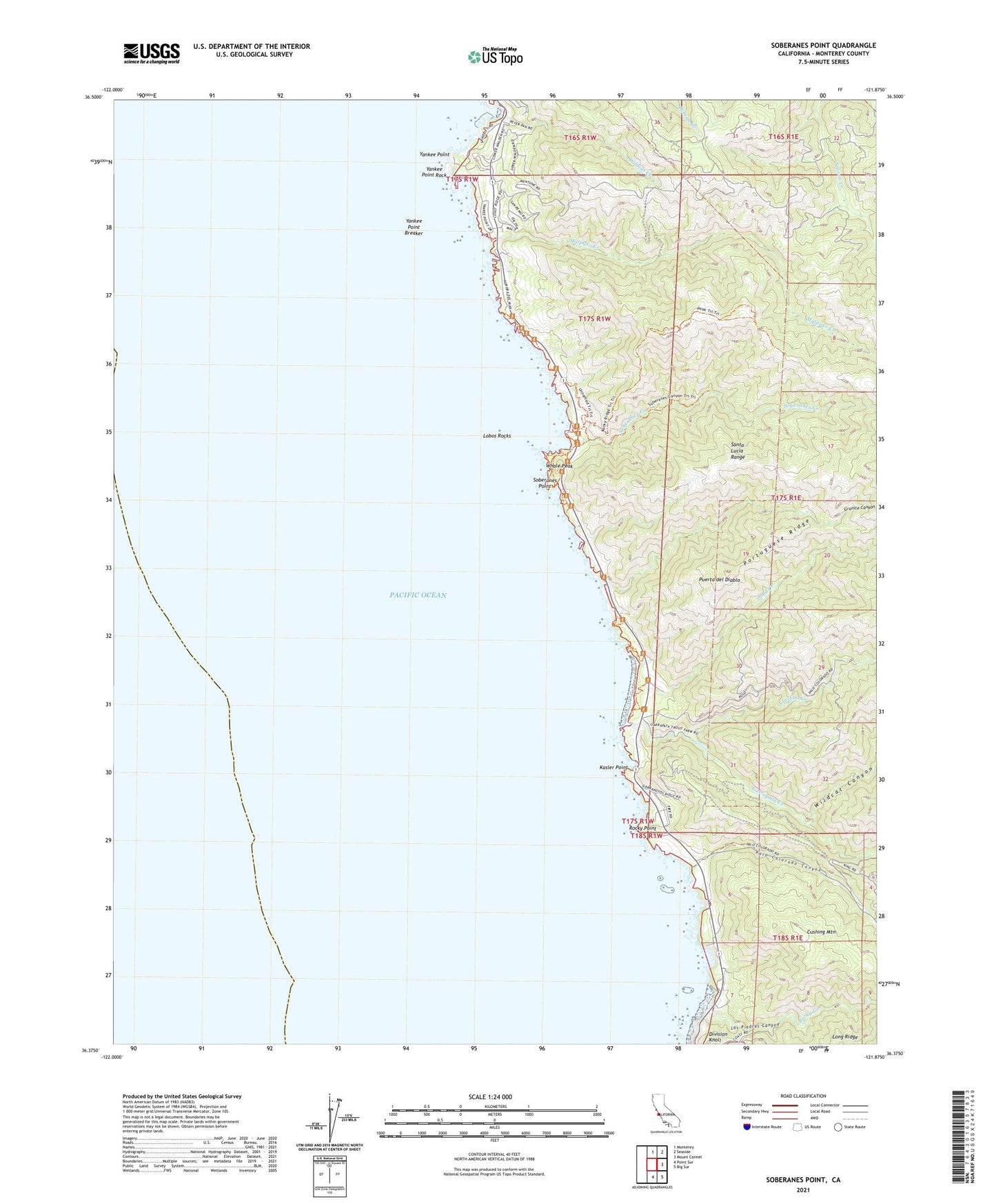
2021 topographic map quadrangle Soberanes Point in the state of California. Scale: 1:24000. Based on the newly updated USGS 7.5' US Topo map series, this map is in the following counties: Monterey. The map contains contour data, water features, and other items you are used to seeing on USGS maps, but also has updated roads and other features. This is the next generation of topographic maps. Printed on high-quality waterproof paper with UV fade-resistant inks.
Quads adjacent to this one:
North: Monterey
Northeast: Seaside
East: Mount Carmel
Southeast: Big Sur
South: Point Sur
This map covers the same area as the classic USGS quad with code o36121d8.
Contains the following named places: Cushing Mountain, Doud Creek, Garrapata Creek, Garrapata State Park, Granite Canyon, Joshua Creek, Kasler Point, Las Piedras Canyon, Lobos Rocks, Malpaso Creek, Notleys Landing, Palo Colorado Canyon, Palo Colorado School, Palo Corona Ranch, Portuguese Ridge, Puerta del Diablo, Rocky Creek, Rocky Point, Rocky Ridge Trail, San Jose Y Sur Chiquito, Soberanes Canyon Trail, Soberanes Creek, Soberanes Point, Whale Peak, Wildcat Canyon, Wildcat Creek, Yankee Point, Yankee Point Breaker, Yankee Point Rock