MyTopo
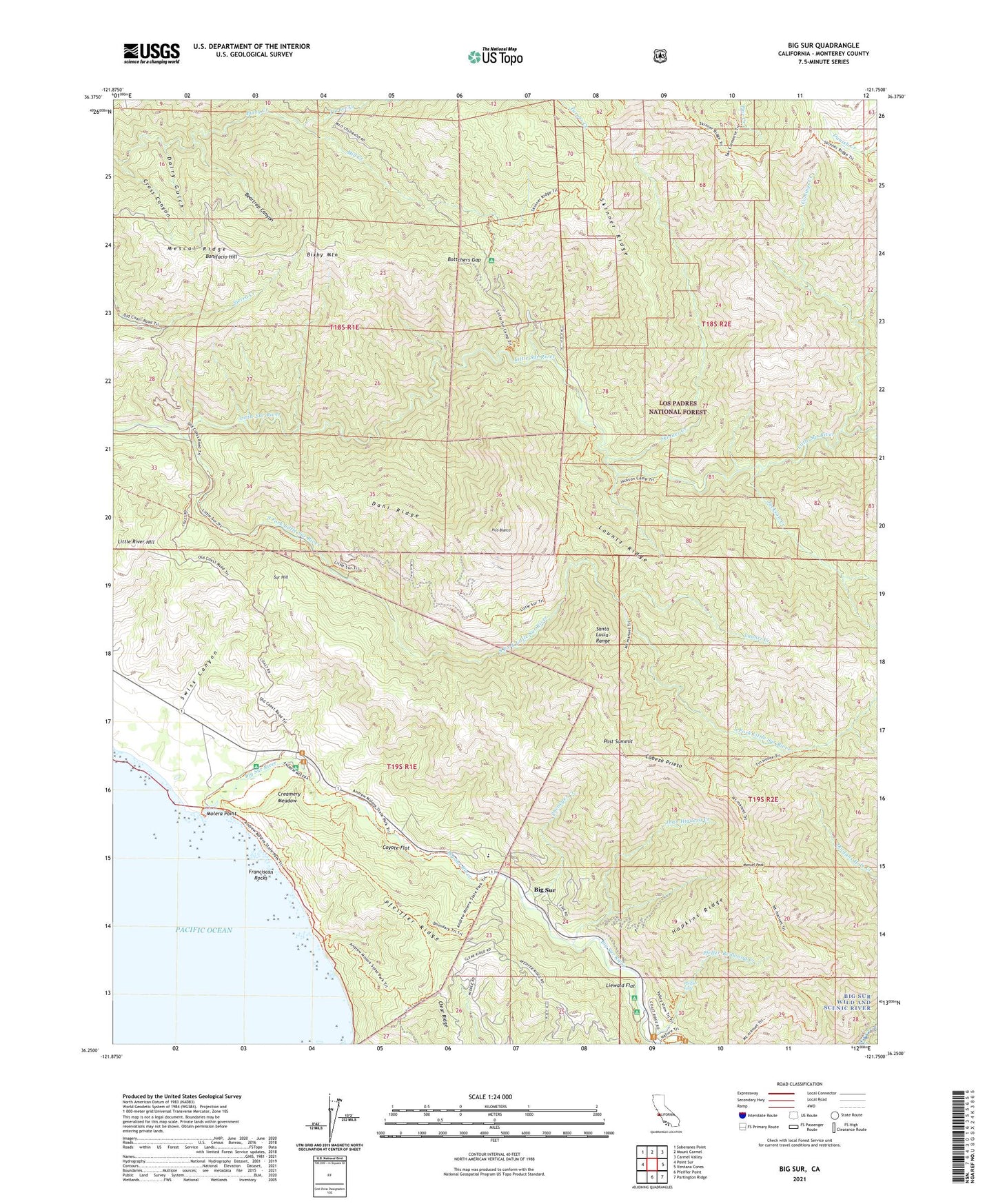
Big Sur California US Topo Map
Couldn't load pickup availability
Also explore the Big Sur Forest Service Topo of this same quad for updated USFS data
2021 topographic map quadrangle Big Sur in the state of California. Scale: 1:24000. Based on the newly updated USGS 7.5' US Topo map series, this map is in the following counties: Monterey. The map contains contour data, water features, and other items you are used to seeing on USGS maps, but also has updated roads and other features. This is the next generation of topographic maps. Printed on high-quality waterproof paper with UV fade-resistant inks.
Quads adjacent to this one:
West: Point Sur
Northwest: Soberanes Point
North: Mount Carmel
Northeast: Carmel Valley
East: Ventana Cones
Southeast: Partington Ridge
South: Pfeiffer Point
This map covers the same area as the classic USGS quad with code o36121c7.
Contains the following named places: Andrew Molera State Park, Bad Gulch, Beartrap Canyon, Big Pines, Big Pines Rustic Campsite, Big Pines Trail, Big Sur, Big Sur River, Bixby Mountain, Bluffs Trail, Bobcat Trail, Bonifacio Hill, Bottchers Gap, Bottchers Recreation Site, Boundary Trail, Buzzards Roost Trail, Cabezo Prieto, Captain Cooper Elementary School, Clear Ridge, Comings Cabin, Comings Creek, Comings Rustic Campsite, Cooper Cabin, Cooper Loop Trail, Cooper Ranch, Cooper School, Coyote Flat, Creamery Meadow, Cross Canyon, Dairy Gulch, Dani Ridge, East Molera Trail, El Sur, Franciscan Rocks, Hopkins Ridge, Jackson Camp, Jackson Creek, Juan Hiquera Creek, Launtz Creek, Launtz Creek Campground, Launtz Ridge, Liewald Flat, Little River Hill, Little Sur Campground, Manuel Peak, Manuel Peak Trail, Mescal Ridge, Mill Creek, Molera Point, Mulero Ranch, Oak Grove Trail, Panorama Trail, Pfeffer-Redwood Creek, Pfeiffer Falls, Pfeiffer Falls Trail, Pfeiffer Ridge, Pheneger Creek, Pico Blanco, Pico Blanco Boy Scout Camp, Pico Blanco Rustic Campsite, Post Summit, River Trail, Skinner Creek, Skinner Ridge, Skinner Ridge Trail, South Fork Little Sur River, Spaghetti Rustic Campsite, Spring Trail, Sur Hill, Swiss Canyon, Tin House Campground, Turner Creek, Turner Creek Trail, Twin Cottonwoods Trail, Vado Campground, Valley View Trail