MyTopo
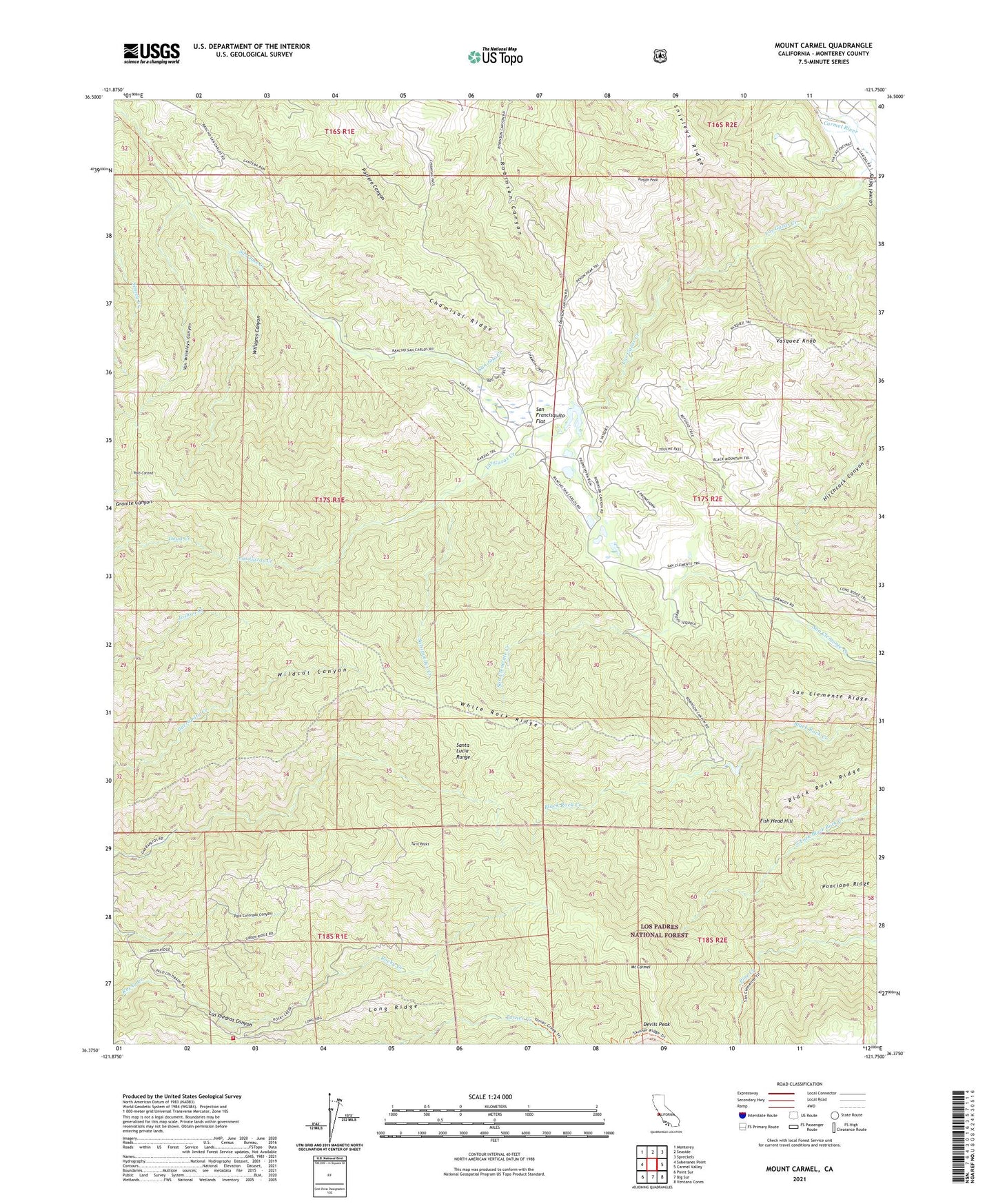
Mount Carmel California US Topo Map
Couldn't load pickup availability
Also explore the Mount Carmel Forest Service Topo of this same quad for updated USFS data
2021 topographic map quadrangle Mount Carmel in the state of California. Scale: 1:24000. Based on the newly updated USGS 7.5' US Topo map series, this map is in the following counties: Monterey. The map contains contour data, water features, and other items you are used to seeing on USGS maps, but also has updated roads and other features. This is the next generation of topographic maps. Printed on high-quality waterproof paper with UV fade-resistant inks.
Quads adjacent to this one:
West: Soberanes Point
Northwest: Monterey
North: Seaside
Northeast: Spreckels
East: Carmel Valley
Southeast: Ventana Cones
South: Big Sur
Southwest: Point Sur
Contains the following named places: Apple Tree Rustic Campsite, Black Rock Creek 643 Dam, Black Rock Ridge, Chamisal Ridge, Devils Peak, Fish Head Hill, Las Gazas Creek, Long Ridge, Mid - Coast Fire Brigade, Mount Carmel, Palo Corona, Pine Creek Camp, Pinyon Peak, Salsipuedes Creek, San Carlos Ranch, San Clemente Ridge, San Francisquito, San Francisquito Flat, Sid Ormsbee Lookout, Snivleys Ridge, Turner Creek Camp, Twin Peaks, Van Winkleys Canyon, Vasquez Knob, White Rock Gun Club, White Rock Lake, White Rock Ridge, Williams Canyon, ZIP Code: 93923