MyTopo
Soledad Mountain California US Topo Map
Couldn't load pickup availability
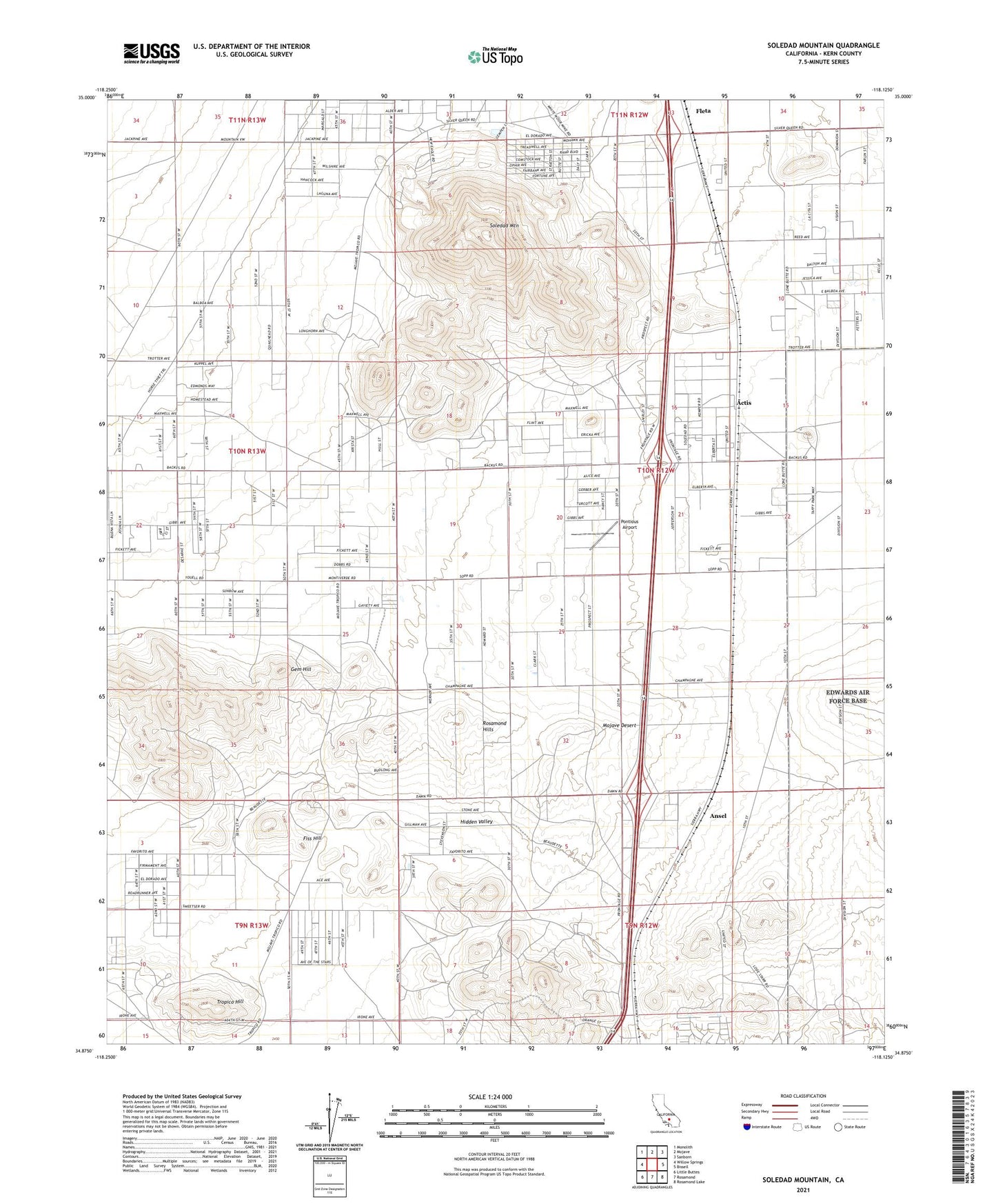
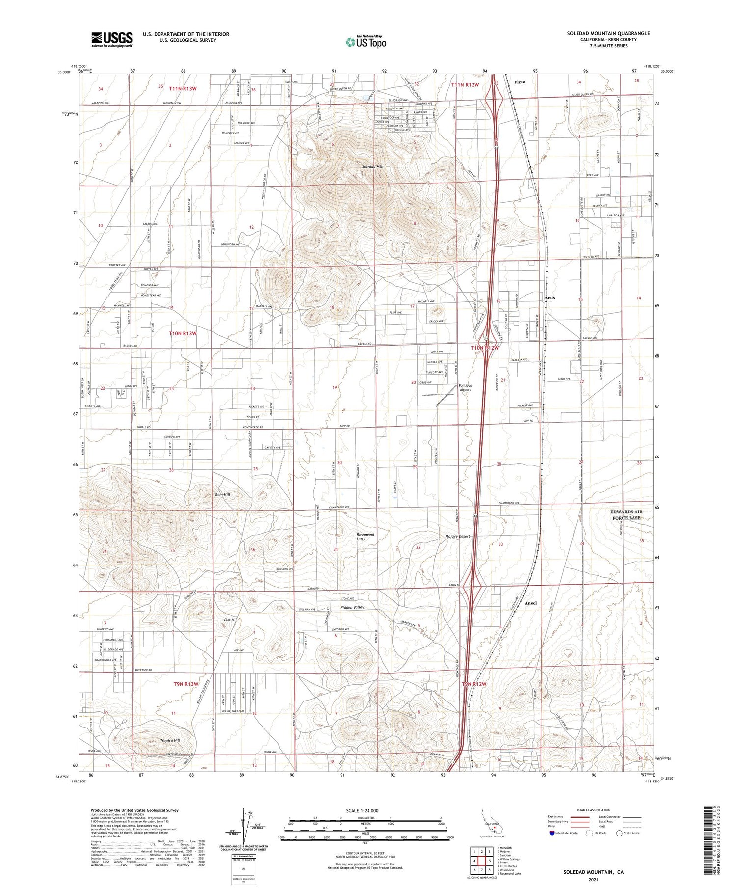
2021 topographic map quadrangle Soledad Mountain in the state of California. Scale: 1:24000. Based on the newly updated USGS 7.5' US Topo map series, this map is in the following counties: Kern. The map contains contour data, water features, and other items you are used to seeing on USGS maps, but also has updated roads and other features. This is the next generation of topographic maps. Printed on high-quality waterproof paper with UV fade-resistant inks.
Quads adjacent to this one:
West: Willow Springs
Northwest: Monolith
North: Mojave
Northeast: Sanborn
East: Bissell
Southeast: Rosamond Lake
South: Rosamond
Southwest: Little Buttes
This map covers the same area as the classic USGS quad with code o34118h2.
Contains the following named places: Actis, Ansel, Bobtail Mines, Double Eagle Mine, Eaires, Elephant Eagle Mine, Fiss Hill, Gem Hill, Gloster, Golden Queen Mine, Hidden Valley, KHXT-FM (Mojave), Pontious Airport, Rosamond Hills, Soledad Mountain, Tip Top Mine, Tropico Hill, Tropico Shaft