
MyTopo
Monolith California US Topo Map
Couldn't load pickup availability
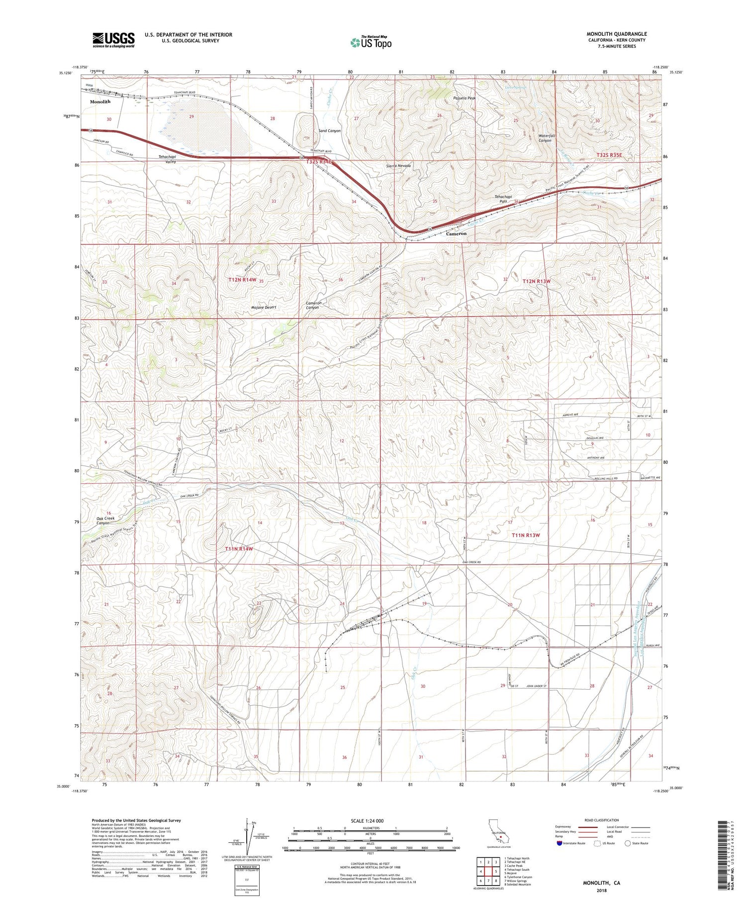
2022 topographic map quadrangle Monolith in the state of California. Scale: 1:24000. Based on the newly updated USGS 7.5' US Topo map series, this map is in the following counties: Kern. The map contains contour data, water features, and other items you are used to seeing on USGS maps, but also has updated roads and other features. This is the next generation of topographic maps. Printed on high-quality waterproof paper with UV fade-resistant inks.
Quads adjacent to this one:
West: Tehachapi South
Northwest: Tehachapi North
North: Tehachapi NE
Northeast: Cache Peak
East: Mojave
Southeast: Soledad Mountain
South: Willow Springs
Southwest: Tylerhorse Canyon
This map covers the same area as the classic USGS quad with code o35118a3.
Contains the following named places: Cameron, Cameron Canyon, Cameron Valley School, Eric, Jameson Ranch, KTPI-FM (Tehachapi), La Rose, La Rose Creek, Lieva Springs, Monolith, Oak Creek Canyon, Pajuela Peak, Proctor Lake, Sand Canyon, Tehachapi Pass, Tehachapi Valley, Waterfall Canyon


