MyTopo
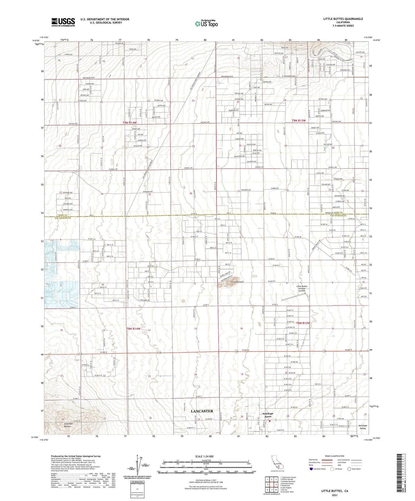
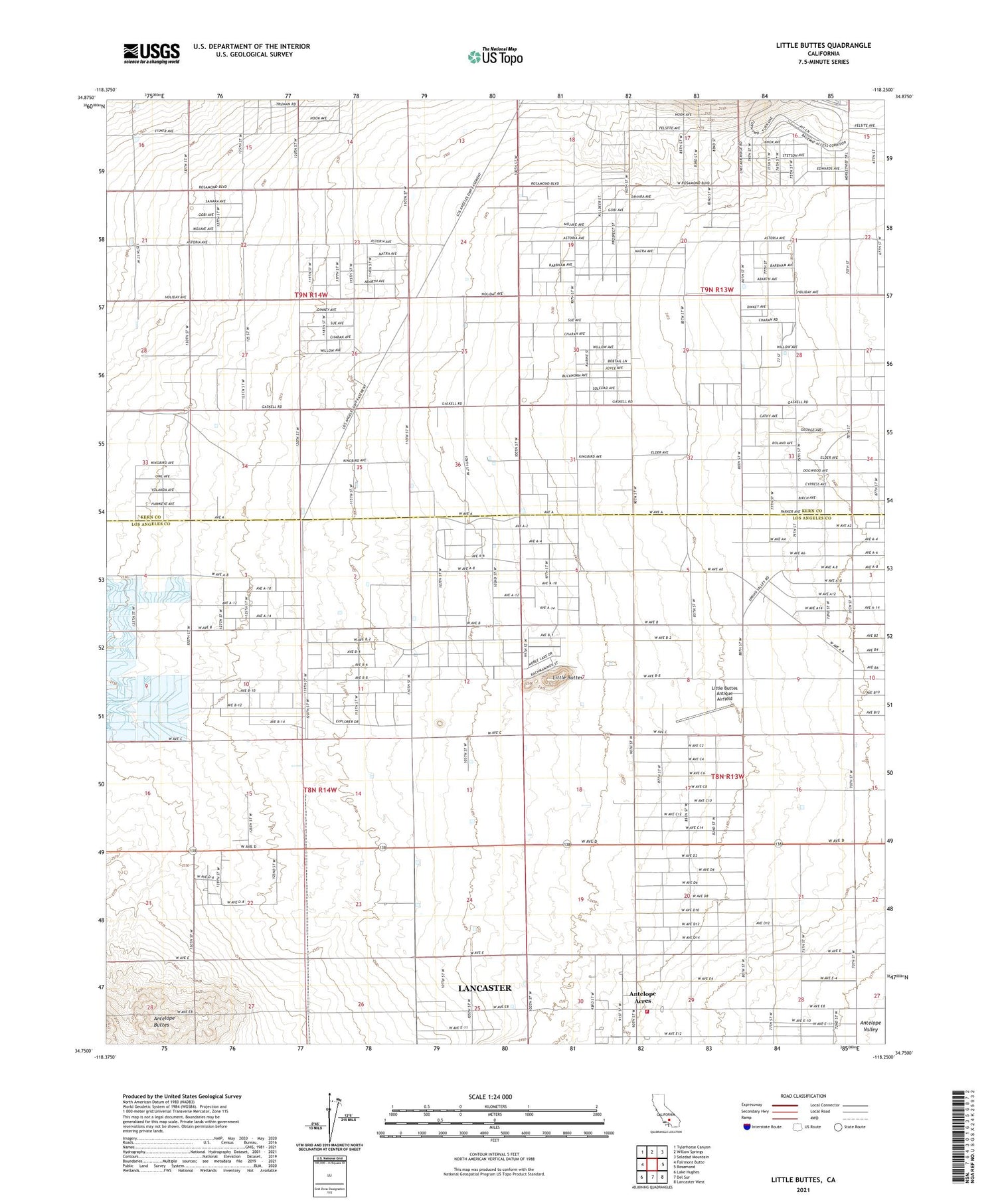
Little Buttes California US Topo Map
Couldn't load pickup availability
2021 topographic map quadrangle Little Buttes in the state of California. Scale: 1:24000. Based on the newly updated USGS 7.5' US Topo map series, this map is in the following counties: Los Angeles, Kern. The map contains contour data, water features, and other items you are used to seeing on USGS maps, but also has updated roads and other features. This is the next generation of topographic maps. Printed on high-quality waterproof paper with UV fade-resistant inks.
Quads adjacent to this one:
West: Fairmont Butte
Northwest: Tylerhorse Canyon
North: Willow Springs
Northeast: Soledad Mountain
East: Rosamond
Southeast: Lancaster West
South: Del Sur
Southwest: Lake Hughes
This map covers the same area as the classic USGS quad with code o34118g3.
Contains the following named places: Antelope Acres, Half Circle G Ranch, Japanese Church, John Hartman Garage Area, Little Buttes, Little Buttes Antique Airfield, Los Angeles County Fire Department Station 112, Rogers School, Willow Springs Raceway, ZIP Code: 93560