MyTopo
Solyo California US Topo Map
Couldn't load pickup availability
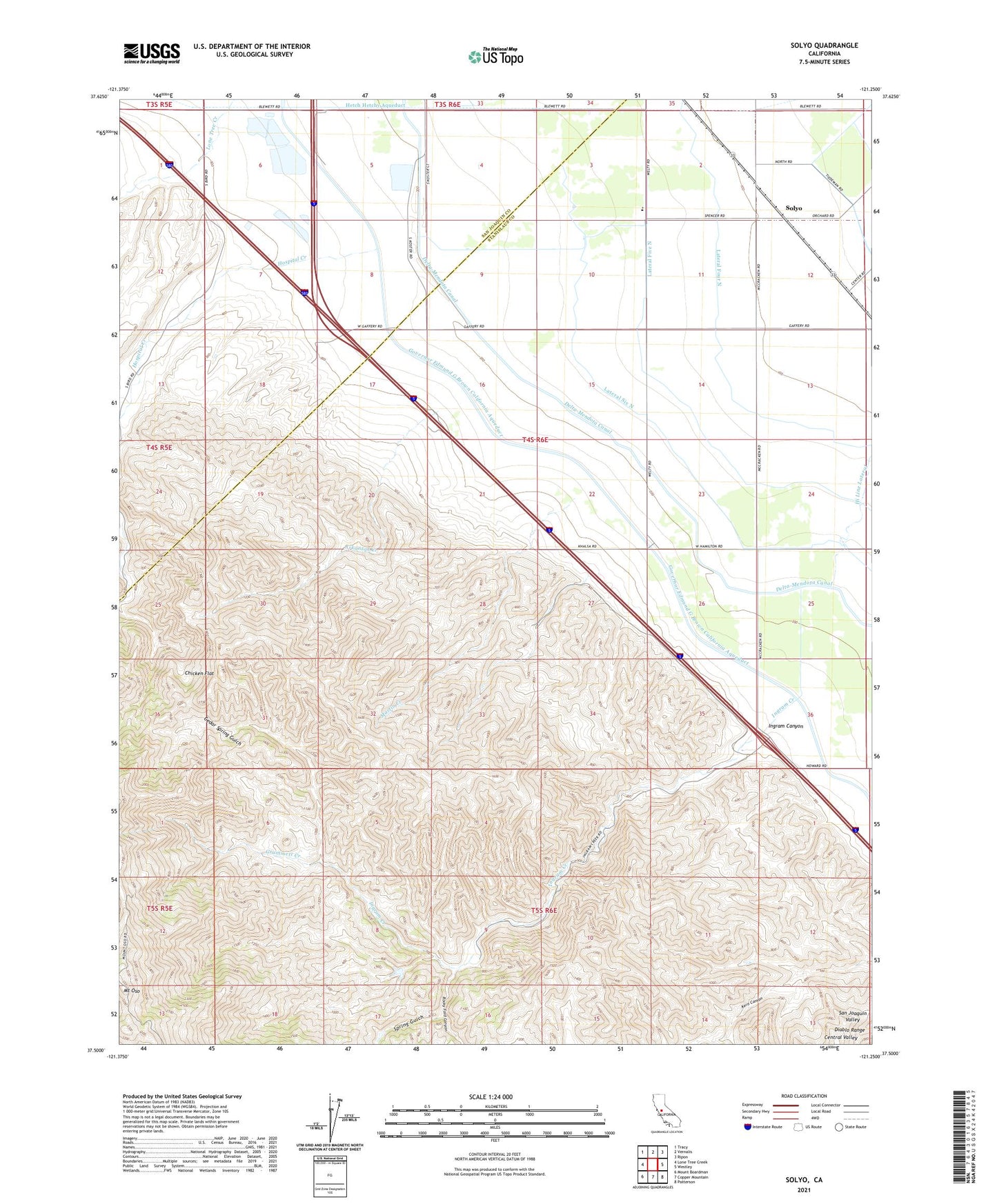
2021 topographic map quadrangle Solyo in the state of California. Scale: 1:24000. Based on the newly updated USGS 7.5' US Topo map series, this map is in the following counties: Stanislaus, San Joaquin. The map contains contour data, water features, and other items you are used to seeing on USGS maps, but also has updated roads and other features. This is the next generation of topographic maps. Printed on high-quality waterproof paper with UV fade-resistant inks.
Quads adjacent to this one:
West: Lone Tree Creek
Northwest: Tracy
North: Vernalis
Northeast: Ripon
East: Westley
Southeast: Patterson
South: Copper Mountain
Southwest: Mount Boardman
This map covers the same area as the classic USGS quad with code o37121e3.
Contains the following named places: Arkansas Creek, Bird Road Quarry, Cedar Spring Gulch, Chicken Flat, Grummett Creek, Ingram Canyon, KBEE-FM (Modesto), KOSO-FM (Patterson), Lateral Five North, Lateral Four North, Lateral Six North, Martin Creek, Mount Oso, Naval Auxiliary Air Station Vernalis, Rocky Ford Canyon, Solyo, Spring Gulch, Transition To Success - Rising Sun Campus, ZIP Code: 95387