
MyTopo
Lone Tree Creek California US Topo Map
Couldn't load pickup availability
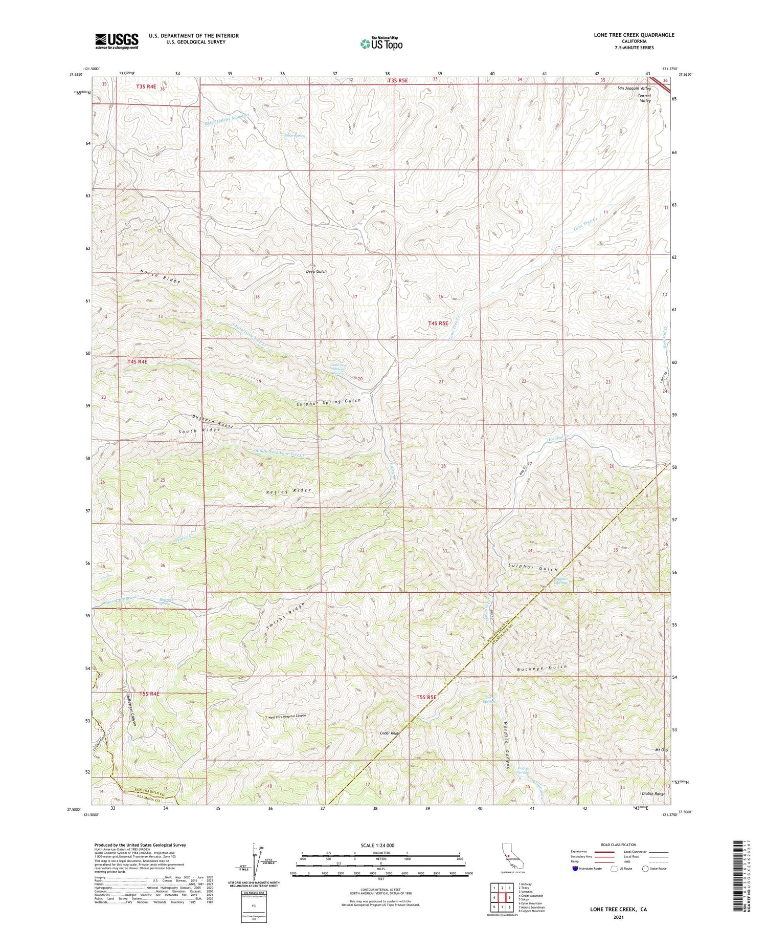
2021 topographic map quadrangle Lone Tree Creek in the state of California. Scale: 1:24000. Based on the newly updated USGS 7.5' US Topo map series, this map is in the following counties: San Joaquin, Stanislaus, Alameda. The map contains contour data, water features, and other items you are used to seeing on USGS maps, but also has updated roads and other features. This is the next generation of topographic maps. Printed on high-quality waterproof paper with UV fade-resistant inks.
Quads adjacent to this one:
West: Cedar Mountain
Northwest: Midway
North: Tracy
Northeast: Vernalis
East: Solyo
Southeast: Copper Mountain
South: Mount Boardman
Southwest: Eylar Mountain
This map covers the same area as the classic USGS quad with code o37121e4.
Contains the following named places: Bluerock Spring, Buckeye Gulch, Buckeye Mines, Buzzard Roost, Cedar Knob, Dutch Freds Place, Elder Spring, Hellsinger Canyon, Hospital Canyon, Ladd Mine, Lone Tree Mineral Spring, Middle Fork Lone Tree Creek, North Fork Lone Tree Creek, North Ridge, Pegleg Creek, Pegleg Ridge, Smiths Ridge, South Ridge, Sperry Springs, Sulphur Gulch, Sulphur Spring Gulch, Sulphur Springs, West Fork Hospital Canyon, Willow Springs


