MyTopo
Mount Boardman California US Topo Map
Couldn't load pickup availability
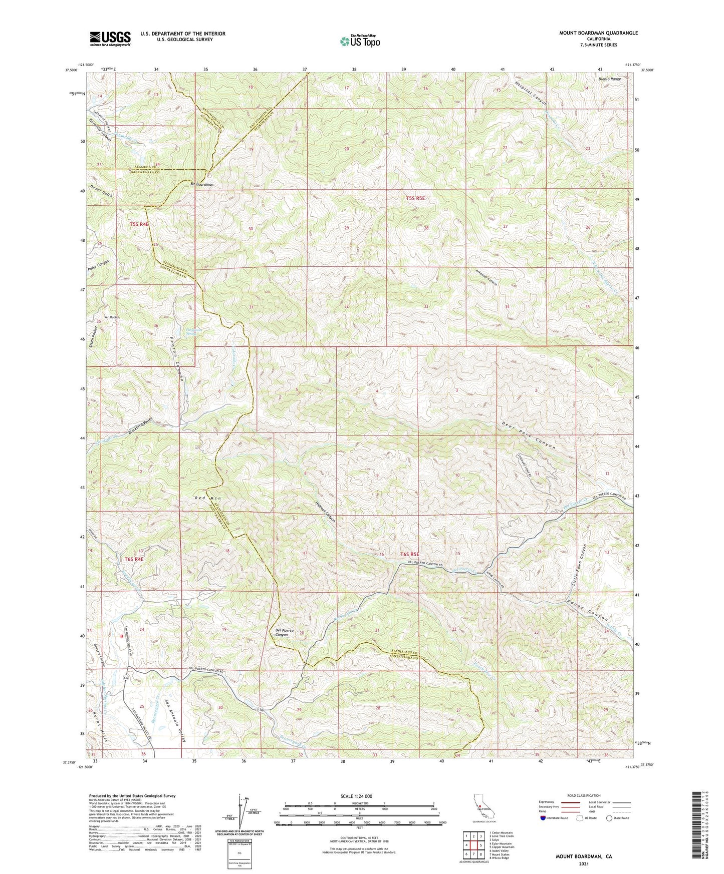
2021 topographic map quadrangle Mount Boardman in the state of California. Scale: 1:24000. Based on the newly updated USGS 7.5' US Topo map series, this map is in the following counties: Stanislaus, Santa Clara, Alameda, San Joaquin. The map contains contour data, water features, and other items you are used to seeing on USGS maps, but also has updated roads and other features. This is the next generation of topographic maps. Printed on high-quality waterproof paper with UV fade-resistant inks.
Quads adjacent to this one:
West: Eylar Mountain
Northwest: Cedar Mountain
North: Lone Tree Creek
Northeast: Solyo
East: Copper Mountain
Southeast: Wilcox Ridge
South: Mount Stakes
Southwest: Isabel Valley
This map covers the same area as the classic USGS quad with code o37121d4.
Contains the following named places: Adobe Canyon, Adobe Creek, Big Rock Dam, CalFire Station 25 - Sweetwater, Deer Park Canyon, Fenton Canyon, Hamilton Ranch, Harney Elementary School, Herman Ranch, Hideout Canyon, Jones Ranch, Kronkite Ranch, Little Fawn Canyon, Livermore Dude Ranch, Mount Boardman, Mount Mocho, Passionate Spring, Peach Tree Creek, Phoenix Mine, Red Mountain, Rodgers Canyon, San Antonio Ranger Station, Schmidt Ranch, Stanislaus County Ranch, Sulphur Springs Creek, Sweetwater Creek, Tripp Ranch, Western Mine, Western Mines, Williams Ranch, Winegar Ranch