MyTopo
Hatch California US Topo Map
Couldn't load pickup availability
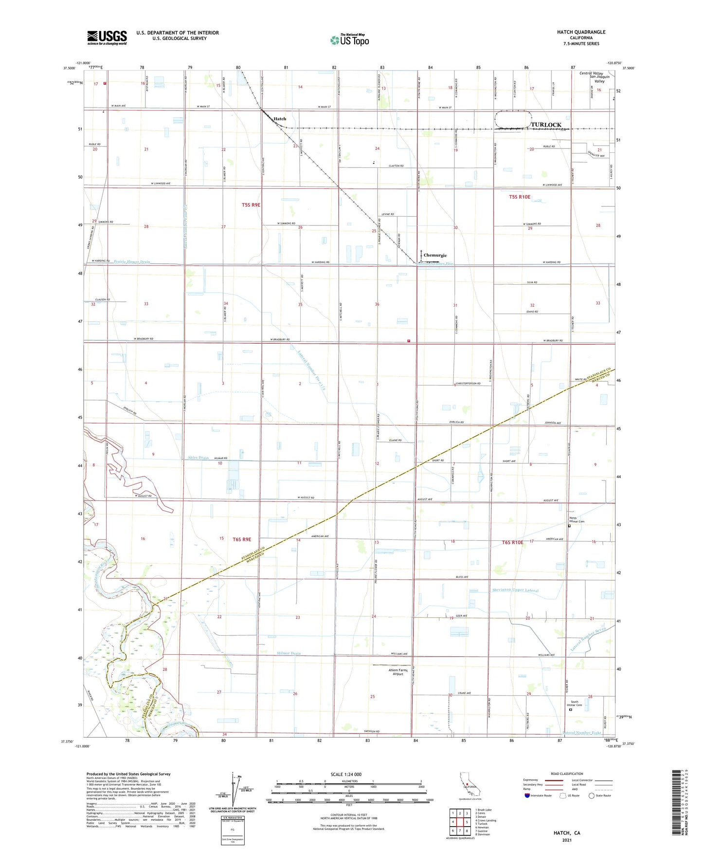
2021 topographic map quadrangle Hatch in the state of California. Scale: 1:24000. Based on the newly updated USGS 7.5' US Topo map series, this map is in the following counties: Stanislaus, Merced. The map contains contour data, water features, and other items you are used to seeing on USGS maps, but also has updated roads and other features. This is the next generation of topographic maps. Printed on high-quality waterproof paper with UV fade-resistant inks.
Quads adjacent to this one:
West: Crows Landing
Northwest: Brush Lake
North: Ceres
Northeast: Denair
East: Turlock
Southeast: Stevinson
South: Gustine
Southwest: Newman
This map covers the same area as the classic USGS quad with code o37120d8.
Contains the following named places: Ables Drain, Ahlem Farms, Ahlem Farms Airport, Azevedo Dairy, Chatom Elementary School, Chemurgic, Circle H Dairy Ranch, Clauss Dairy Farms, Hatch, Helmar School, Hilmar Drain, Horse Drain, Lateral Number Five, Lateral Number Five 1/2, Lateral Number Four 1/2, Lumar Dairy Farms, Mitchell School, Mountain View Fire Protection District, Mountain View Fire Protection District Station 2, Mountain View Middle School, Mountain View School, North Hilmar Cemetery, Prairie Flower Drain, Prairie Flower School, Riverside School, South Hilmar Cemetery, Stadtler Drain, Stevinson Lower Lateral, Stevinson Upper Lateral, Sunwest Jersey Dairy, Tegner School, Washington School, Western States Drain, Yosemite Jersey Dairy, ZIP Codes: 95324, 95380