MyTopo
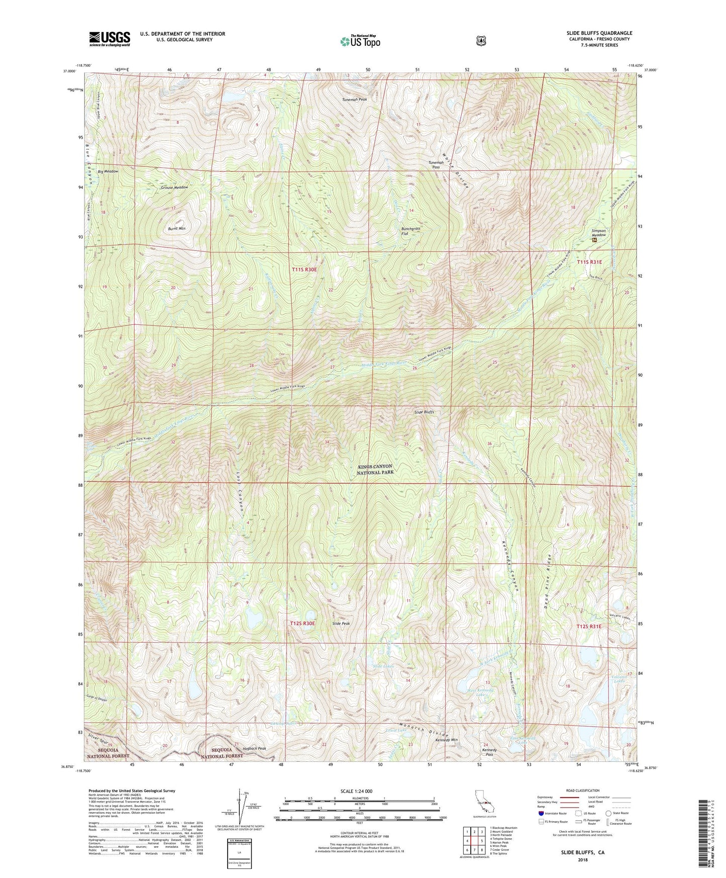
Slide Bluffs California US Topo Map
Couldn't load pickup availability
Also explore the Slide Bluffs Forest Service Topo of this same quad for updated USFS data
2021 topographic map quadrangle Slide Bluffs in the state of California. Scale: 1:24000. Based on the newly updated USGS 7.5' US Topo map series, this map is in the following counties: Fresno. The map contains contour data, water features, and other items you are used to seeing on USGS maps, but also has updated roads and other features. This is the next generation of topographic maps. Printed on high-quality waterproof paper with UV fade-resistant inks.
Quads adjacent to this one:
West: Tehipite Dome
Northwest: Blackcap Mountain
North: Mount Goddard
Northeast: North Palisade
East: Marion Peak
Southeast: The Sphinx
South: Cedar Grove
Southwest: Wren Peak
This map covers the same area as the classic USGS quad with code o36118h6.
Contains the following named places: Alpine Creek, Big Meadow, Blue Canyon, Blue Canyon Falls, Bunchgrass Flat, Burnt Mountain, Dead Pine Ridge, Dog Creek, Dougherty Creek, East Kennedy Lake, Grouse Meadow, Hogback Peak, Horseshoe Creek, Kennedy Canyon, Kennedy Creek, Kennedy Mountain, Kennedy Pass, Lewis Lake, Lightning Corral, Lost Canyon, Rattlesnake Creek, Silver Spur, Simpson Meadow, Slide Bluffs, Slide Creek, Slide Lakes, Slide Peak, Swamp Lakes, Tunemah Pass, Tunemah Peak, Volcanic Lakes, West Fork Kennedy Creek, West Kennedy Lake