
MyTopo
Cedar Grove California US Topo Map
Couldn't load pickup availability
Also explore the Cedar Grove Forest Service Topo of this same quad for updated USFS data
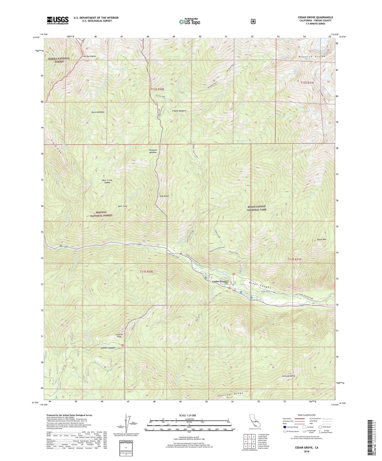
2021 topographic map quadrangle Cedar Grove in the state of California. Scale: 1:24000. Based on the newly updated USGS 7.5' US Topo map series, this map is in the following counties: Fresno. The map contains contour data, water features, and other items you are used to seeing on USGS maps, but also has updated roads and other features. This is the next generation of topographic maps. Printed on high-quality waterproof paper with UV fade-resistant inks.
Quads adjacent to this one:
West: Wren Peak
Northwest: Tehipite Dome
North: Slide Bluffs
Northeast: Marion Peak
East: The Sphinx
Southeast: Sphinx Lakes
South: Mount Silliman
Southwest: Muir Grove
This map covers the same area as the classic USGS quad with code o36118g6.
Contains the following named places: Burns Meadow, Canyon View Campground, Cedar Grove, Choke Creek, Comb Creek, Comb Spur, Deer Cove, Deer Cove Creek, Deer Creek Saddle, Don Cecil Trail, East Fork Grizzly Creek, East Fork Lewis Creek, Frypan Meadow, Grizzly Creek, Grizzly Falls Picnic Area, Grizzly Lakes, Hotel Creek, Kings Canyon, Lewis Creek, Lightning Creek, Lookout Peak, Monarch Divide, Moraine Campground, Mount Harrington, North Mountain, Roaring River, Sentinel Campground, Sentinel Dome, Sheep Creek, Sheep Creek Campground, Sheep Creek Trail, Stag Dome, Summit Meadow, Wildman Meadow, Wren Creek, ZIP Code: 93633


