MyTopo
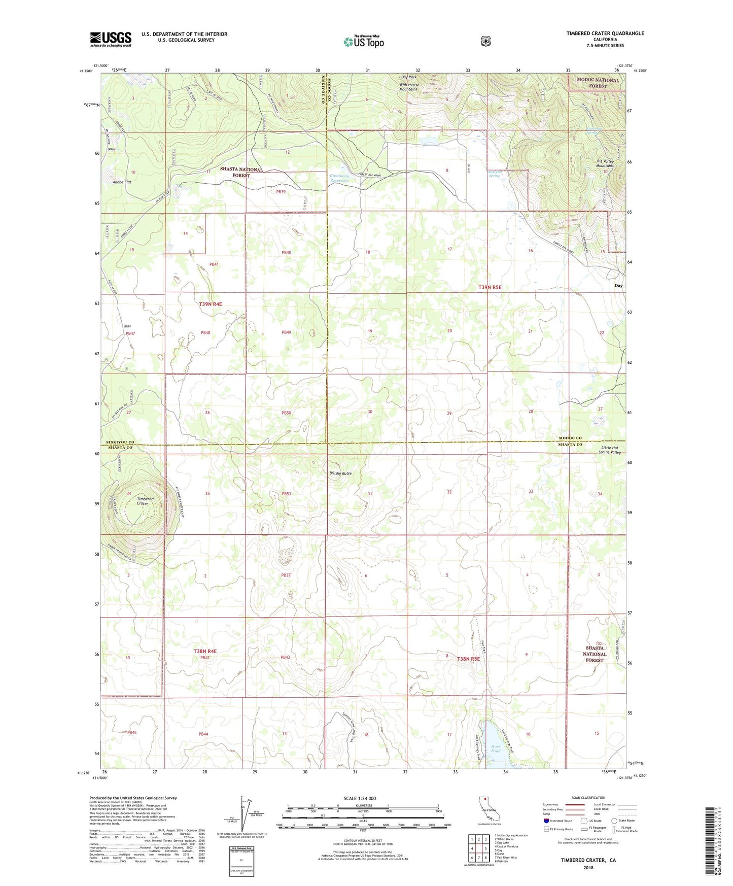
Timbered Crater California US Topo Map
Couldn't load pickup availability
Also explore the Timbered Crater Forest Service Topo of this same quad for updated USFS data
2022 topographic map quadrangle Timbered Crater in the state of California. Scale: 1:24000. Based on the newly updated USGS 7.5' US Topo map series, this map is in the following counties: Shasta, Modoc, Siskiyou. The map contains contour data, water features, and other items you are used to seeing on USGS maps, but also has updated roads and other features. This is the next generation of topographic maps. Printed on high-quality waterproof paper with UV fade-resistant inks.
Quads adjacent to this one:
West: East of Pondosa
Northwest: Indian Spring Mountain
North: White Horse
Northeast: Egg Lake
East: Day
Southeast: Pittville
South: Fall River Mills
Southwest: Dana
This map covers the same area as the classic USGS quad with code o41121b4.
Contains the following named places: Adobe Flat, Adobe Flat Reservoir, Ahjumawi Lava Springs State Park, Bluebrush Spring, Brushy Butte, Day Rock, Gassaway Reservoir, Green Place Reservoir, Little Hot Spring, Little Hot Spring Valley, Redwood Gun Club, Timbered Crater