MyTopo
North Chalone Peak California US Topo Map
Couldn't load pickup availability
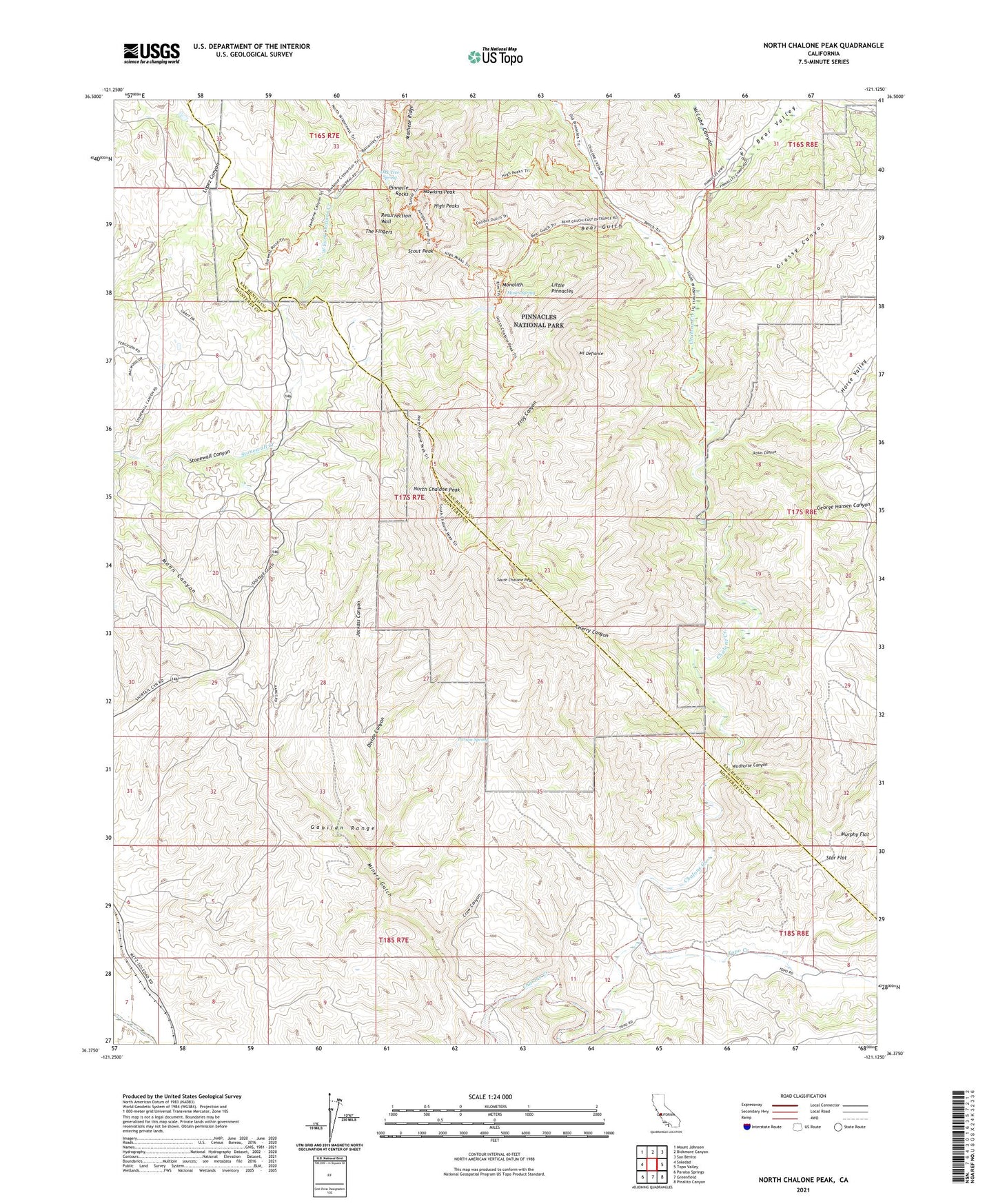
2021 topographic map quadrangle North Chalone Peak in the state of California. Scale: 1:24000. Based on the newly updated USGS 7.5' US Topo map series, this map is in the following counties: Monterey, San Benito. The map contains contour data, water features, and other items you are used to seeing on USGS maps, but also has updated roads and other features. This is the next generation of topographic maps. Printed on high-quality waterproof paper with UV fade-resistant inks.
Quads adjacent to this one:
West: Soledad
Northwest: Mount Johnson
North: Bickmore Canyon
Northeast: San Benito
East: Topo Valley
Southeast: Pinalito Canyon
South: Greenfield
Southwest: Paraiso Springs
This map covers the same area as the classic USGS quad with code o36121d2.
Contains the following named places: Balconies Trail, Bear Creek Picnic Area, Bear Gulch, Bear Gulch Dam, Bear Gulch Reservoir, Bear Gulch Trail, Bear Gulch Visitor Center, Bear Valley, Bench Trail, Chalone Annex Campground, Chalone Creek Campground, Chalone Peak Trail, Chalone Vineyard Airport, Chaparral Campground, Chaparral Overlook, Cherry Canyon, Condor Gulch Trail, Crow Canyon, Divide Canyon, East Entrance Station, Fern Chamber, Frog Canyon, George Hansen Canyon, Grassy Canyon, Hain Wilderness, Hawkins Peak, High Peaks, High Peaks Trail, Horse Valley, Jackass Canyon, Juniper Canyon Trail, KLFA-FM (King City), KLUE-FM (Soledad), Little Pinnacles, Machete Ridge, Mann Canyon, McCabe Canyon, Miners Gulch, Monolith, Moses Spring, Moses Spring Trail, Mount Defiance, North Chalone Peak, Oak Tree Spring, Old Pinnacles Trail, Parson Spring, Pinnacle Rocks, Pinnacles Air Park, Pinnacles Campground, Pinnacles National Park, Pinnacles Wilderness, Resurrection Wall, Rim Trail, Rosas Canyon, Schmidt Ranch, Scout Peak, South Chalone Peak, Star Flat, The Fingers, Topo Creek, Tunnel Trail, Wildhorse Canyon