MyTopo
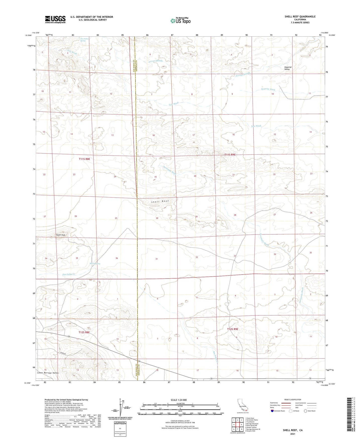
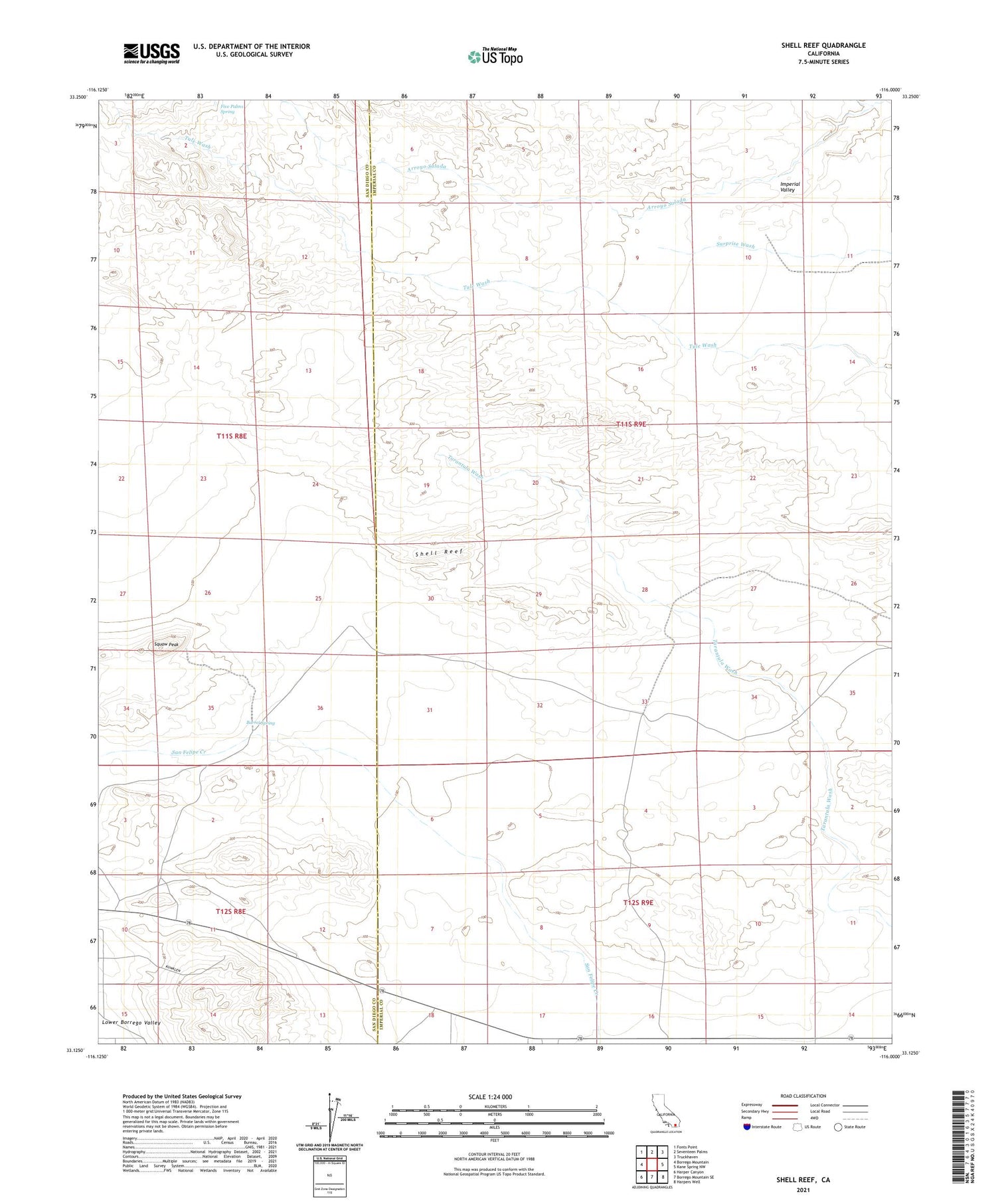
Shell Reef California US Topo Map
Couldn't load pickup availability
2023 topographic map quadrangle Shell Reef in the state of California. Scale: 1:24000. Based on the newly updated USGS 7.5' US Topo map series, this map is in the following counties: Imperial, San Diego. The map contains contour data, water features, and other items you are used to seeing on USGS maps, but also has updated roads and other features. This is the next generation of topographic maps. Printed on high-quality waterproof paper with UV fade-resistant inks.
Quads adjacent to this one:
West: Borrego Mountain
Northwest: Fonts Point
North: Seventeen Palms
Northeast: Truckhaven
East: Kane Spring NW
Southeast: Harpers Well
South: Borrego Mountain SE
Southwest: Harper Canyon
This map covers the same area as the classic USGS quad with code o33116b1.
Contains the following named places: Barrel Spring, Barrel Springs Cultural Preserve, Five Palms Spring, Los Puertecitos Historical Marker, North Fork Arroyo Salada, Palo Verde Wash, Pumpkin Patch, Shell Reef, Squaw Peak, Una Palma, Wolfe Well, ZIP Code: 92004