MyTopo
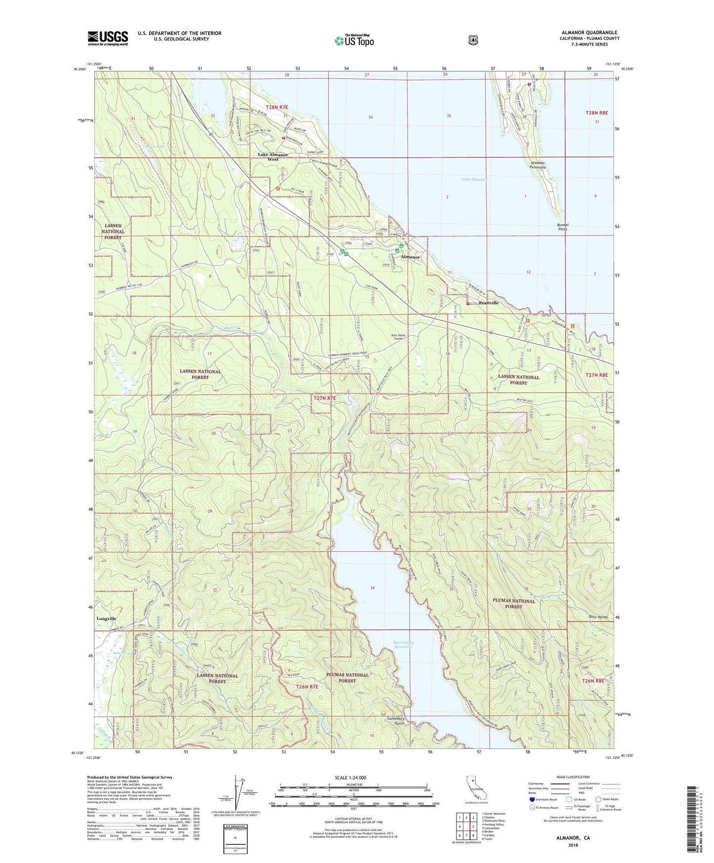
Almanor California US Topo Map
Couldn't load pickup availability
Also explore the Almanor Forest Service Topo of this same quad for updated USFS data
2022 topographic map quadrangle Almanor in the state of California. Scale: 1:24000. Based on the newly updated USGS 7.5' US Topo map series, this map is in the following counties: Plumas. The map contains contour data, water features, and other items you are used to seeing on USGS maps, but also has updated roads and other features. This is the next generation of topographic maps. Printed on high-quality waterproof paper with UV fade-resistant inks.
Quads adjacent to this one:
West: Humbug Valley
Northwest: Stover Mountain
North: Chester
Northeast: Westwood West
East: Canyondam
Southeast: Twain
South: Caribou
Southwest: Belden
This map covers the same area as the classic USGS quad with code o40121b2.
Contains the following named places: Aknabir Canogriybd, Almanor, Almanor - Prattville Fire District, Almanor Campground, Almanor Census Designated Place, Almanor Peninsula, Almanor Post Office, Bunnel Point, Butt Valley Reservoir, Butt Valley Tunnel, Cantebury Gulch, Cool Springs Campground, Humbug Valley, Keefer Ranch, Lake Almanor Country Club, Lake Almanor West, Lake Almanor West Census Designated Place, Longville, Miller Creek, Mule Shoe Mine, Peninsula Fire Protection District Station 2, PG and E Recreation Site, Ponderosa Flat Campground, Prattville, Prattville Census Designated Place, Rock Lake, Soda Spring, West Almanor Community Services District Fire Station