MyTopo
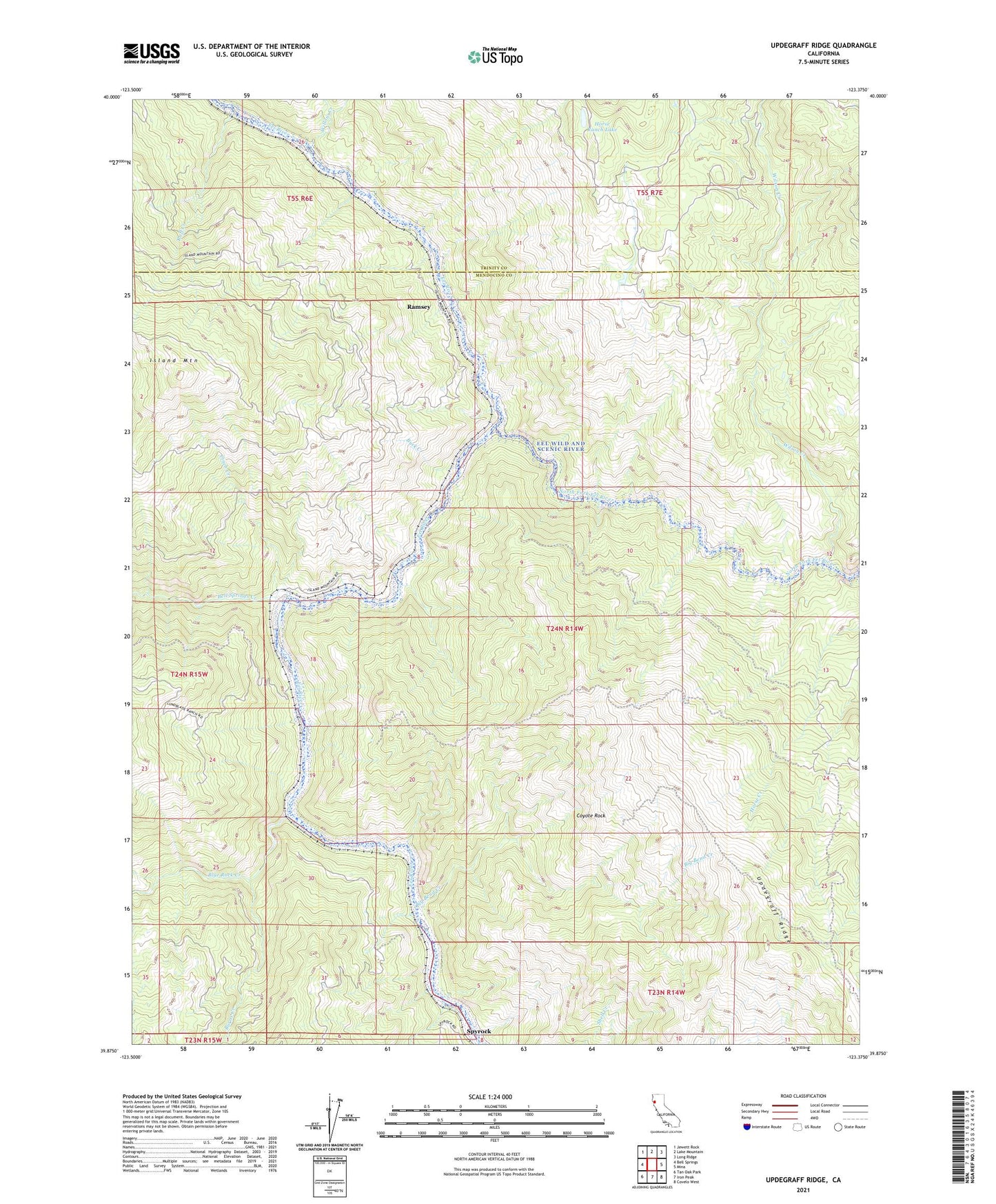
Updegraff Ridge California US Topo Map
Couldn't load pickup availability
2021 topographic map quadrangle Updegraff Ridge in the state of California. Scale: 1:24000. Based on the newly updated USGS 7.5' US Topo map series, this map is in the following counties: Mendocino, Trinity. The map contains contour data, water features, and other items you are used to seeing on USGS maps, but also has updated roads and other features. This is the next generation of topographic maps. Printed on high-quality waterproof paper with UV fade-resistant inks.
Quads adjacent to this one:
West: Bell Springs
Northwest: Jewett Rock
North: Lake Mountain
Northeast: Long Ridge
East: Mina
Southeast: Covelo West
South: Iron Peak
Southwest: Tan Oak Park
This map covers the same area as the classic USGS quad with code o39123h4.
Contains the following named places: Bell Springs, Bell Springs Creek, Big Bend Creek, Big Bend Ranch, Blue Rock Creek, Buck Creek, Burns Creek, Cinch Creek, Coyote Rock, Horse Ranch, Horse Ranch Lake, Island Mountain, Island Mountain Ranch, North Fork Eel River, Raff Creek, Ramsey, Spyrock, Updegraff Ridge, Willow Creek, Wilson Creek