MyTopo
Jewett Rock California US Topo Map
Couldn't load pickup availability
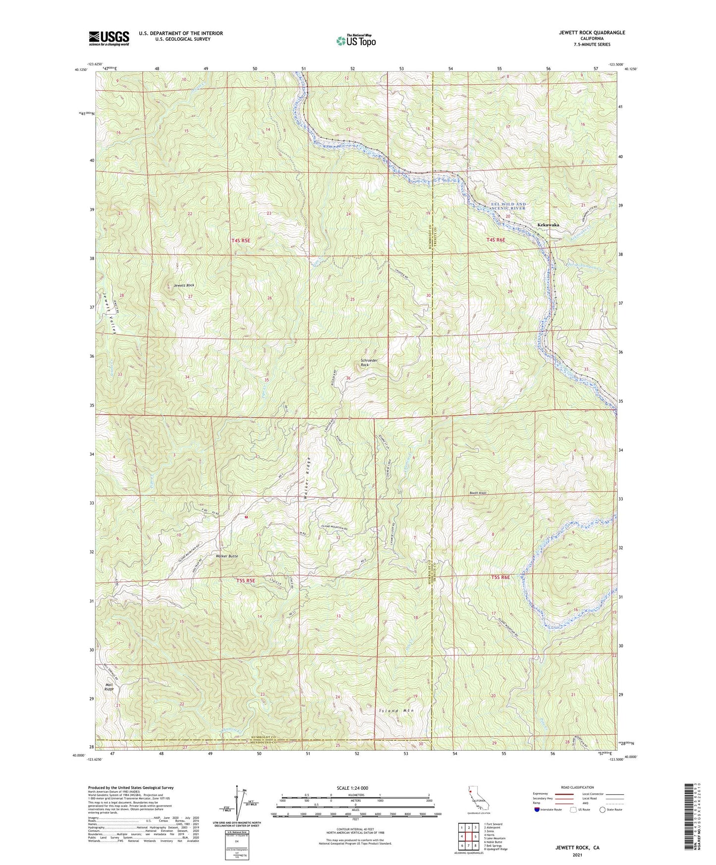
2021 topographic map quadrangle Jewett Rock in the state of California. Scale: 1:24000. Based on the newly updated USGS 7.5' US Topo map series, this map is in the following counties: Humboldt, Trinity, Mendocino. The map contains contour data, water features, and other items you are used to seeing on USGS maps, but also has updated roads and other features. This is the next generation of topographic maps. Printed on high-quality waterproof paper with UV fade-resistant inks.
Quads adjacent to this one:
West: Harris
Northwest: Fort Seward
North: Alderpoint
Northeast: Zenia
East: Lake Mountain
Southeast: Updegraff Ridge
South: Bell Springs
Southwest: Noble Butte
This map covers the same area as the classic USGS quad with code o40123a5.
Contains the following named places: Booth Knoll, Chamise Creek, Dry Creek, Eel Wild and Scenic River, Frenchman Creek, Haman Creek, Jewett Rock, Jewett Valley, Kekawaka, Kekawaka Creek, Lauffer Ranch, Marr Ranch, Palo Verde Volunteer Fire Department, Pine Creek, Pipe Creek, Queatchumpah Creek, Schroeder Rock, Two Hundred and One Spur, Walker Butte, Walker Ridge, White Ranch, Wood Ranch