MyTopo
Upper Lake California US Topo Map
Couldn't load pickup availability
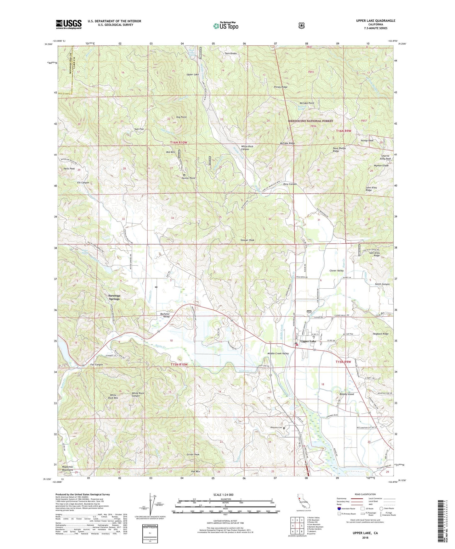
2022 topographic map quadrangle Upper Lake in the state of California. Scale: 1:24000. Based on the newly updated USGS 7.5' US Topo map series, this map is in the following counties: Lake, Mendocino. The map contains contour data, water features, and other items you are used to seeing on USGS maps, but also has updated roads and other features. This is the next generation of topographic maps. Printed on high-quality waterproof paper with UV fade-resistant inks.
Quads adjacent to this one:
West: Cow Mountain
Northwest: Potter Valley
North: Elk Mountain
Northeast: Potato Hill
East: Bartlett Mountain
Southeast: Lucerne
South: Lakeport
Southwest: Purdys Gardens
This map covers the same area as the classic USGS quad with code o39122b8.
Contains the following named places: Alley Creek, Bachelor Valley, Bloody Island, Bloody Island Massacre Historical Marker, Blue Lake School, Chair Creek, Clover Creek, Clover Valley, Clover Valley Continuation High School, Cooper Creek, Dave Phelps Ridge, Dayle Creek, Decy Canyon, Elk Canyon, Fall Canyon, Glen Eden School, Griner Peak, Hells Peak, Hog Point, Hunter Point, Hunter Ranch, John Alley Ridge, Kingdom Hall of Jehovahs Witnesses, Kirkpatrick Creek, Lower Blue Lake, Madrone Spring, McCabe Point, McCabe Ridge, Middle Creek, Middle Creek Valley, Middle Mountain, Middle Mountain Firebreak, Northshore Fire Protection District Station 90 Upper Lake, Pitney Ridge, Plank Cabin Spring, Poe Mountain, Poge Creek, Robinson Cemetery, Robinson Creek, Robinson Rancheria, Rodman Slough, Salt Flat, Salt Flat Creek, Saratoga Springs, Scotts Creek, Seventh Day Adventist Church, Sleeper Peak, Smith Canyon, The Grove School, Tule Lake, Twin Knobs, Upper Lake, Upper Lake Branch Lake County Library, Upper Lake Cemetery, Upper Lake Census Designated Place, Upper Lake Elementary School, Upper Lake High School, Upper Lake Middle School, Upper Lake Post Office, Upper Lake Rancheria, Upper Lake Substation, White Rock Canyon, White Rock Mountain, Witter Springs, Witter Springs Post Office, Youngs Peak, ZIP Codes: 95485, 95493