MyTopo
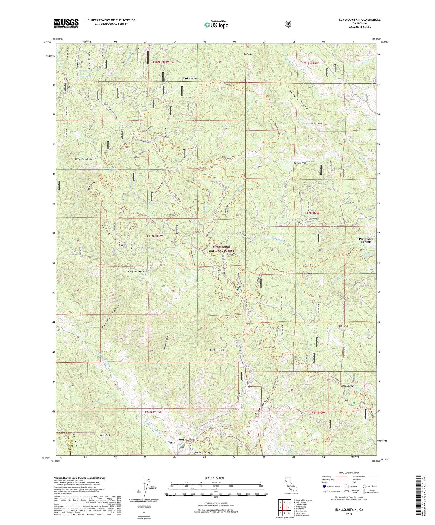
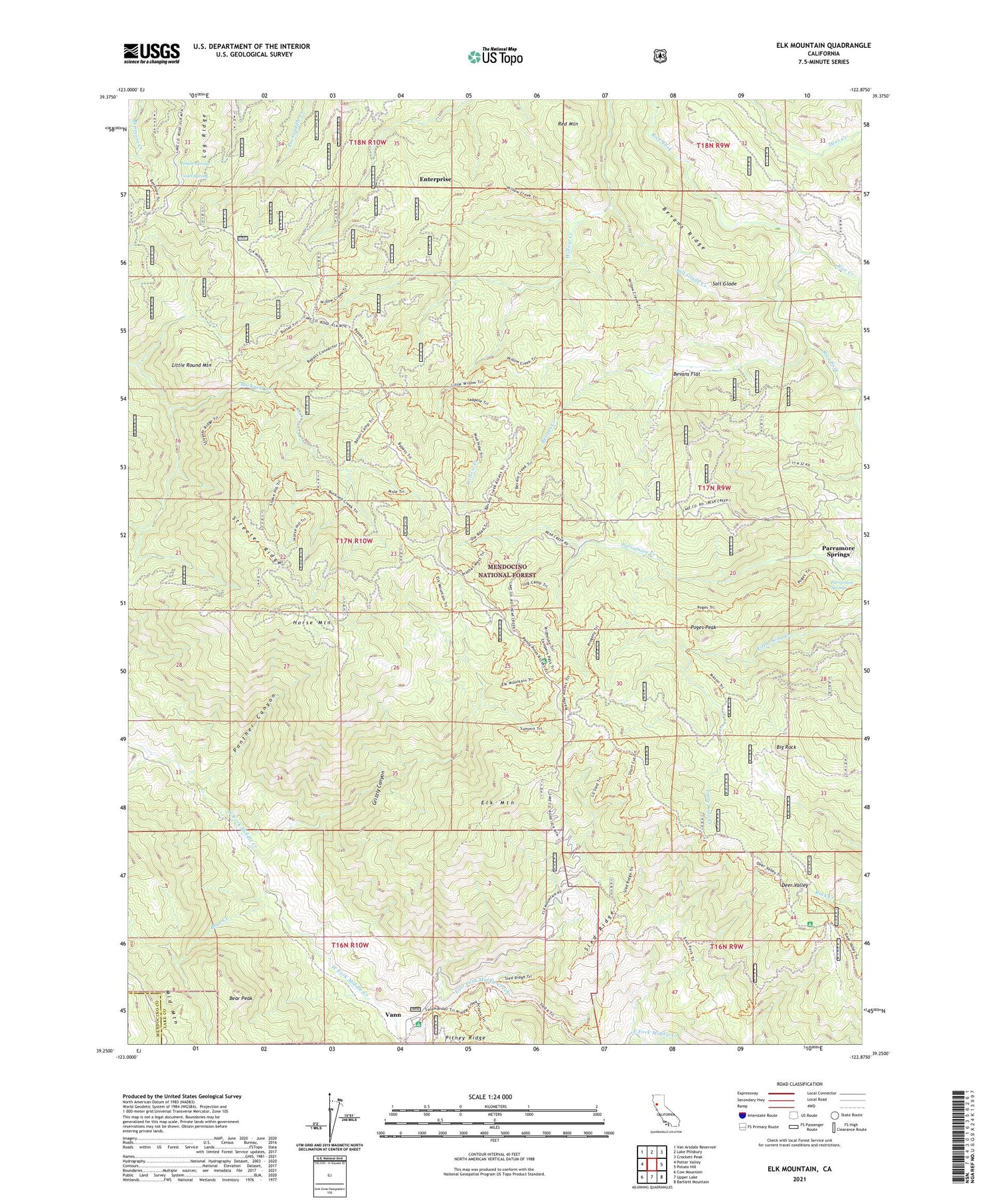
Elk Mountain California US Topo Map
Couldn't load pickup availability
Also explore the Elk Mountain Forest Service Topo of this same quad for updated USFS data
2021 topographic map quadrangle Elk Mountain in the state of California. Scale: 1:24000. Based on the newly updated USGS 7.5' US Topo map series, this map is in the following counties: Lake, Mendocino. The map contains contour data, water features, and other items you are used to seeing on USGS maps, but also has updated roads and other features. This is the next generation of topographic maps. Printed on high-quality waterproof paper with UV fade-resistant inks.
Quads adjacent to this one:
West: Potter Valley
Northwest: Van Arsdale Reservoir
North: Lake Pillsbury
Northeast: Crockett Peak
East: Potato Hill
Southeast: Bartlett Mountain
South: Upper Lake
Southwest: Cow Mountain
This map covers the same area as the classic USGS quad with code o39122c8.
Contains the following named places: Bear Creek, Bear Peak, Bevans Creek, Bevans Flat, Bevans Ridge, Big Rock, Deer Valley, Deer Valley Campground, East Fork Middle Creek, Elk Mountain, Elk Mountain Scenic Viewpoint, Elk Mountain Station, Enterprise, Grizzly Canyon, Horse Mountain, Howard Mill, Howard Mill Station, Little Round Mountain, Log Ridge, Lone Pine Water Trough, Middle Creek Campground, Panther Canyon, Parramore Springs, Pebble Spring, Poges Peak, Prather Mill, Red Mountain, Rice Creek, Salt Glade, Salt Glade Creek, Sled Ridge, Smith Ranch, Streeter Ridge, Three Crossing, Upper Lake-Nice Division, Vann, Violet Spring, West Fork Middle Creek, York Cabin