MyTopo
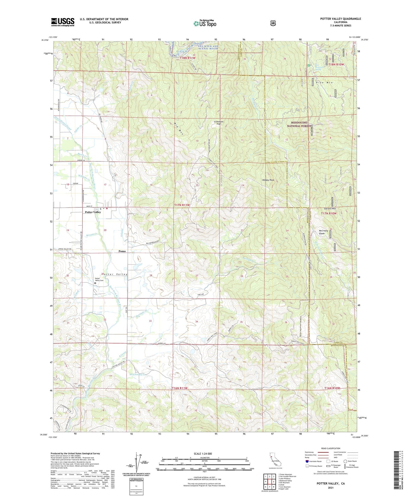
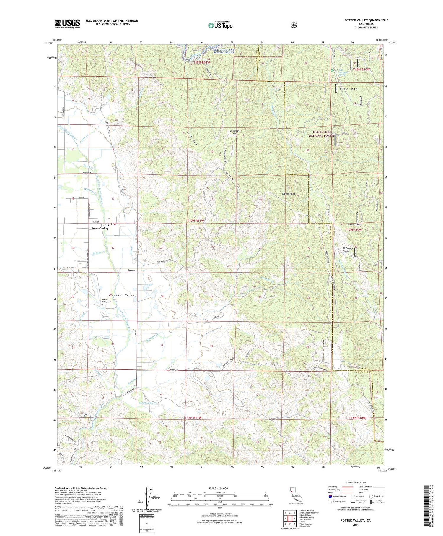
Potter Valley California US Topo Map
Couldn't load pickup availability
Also explore the Potter Valley Forest Service Topo of this same quad for updated USFS data
2021 topographic map quadrangle Potter Valley in the state of California. Scale: 1:24000. Based on the newly updated USGS 7.5' US Topo map series, this map is in the following counties: Mendocino, Lake. The map contains contour data, water features, and other items you are used to seeing on USGS maps, but also has updated roads and other features. This is the next generation of topographic maps. Printed on high-quality waterproof paper with UV fade-resistant inks.
Quads adjacent to this one:
West: Redwood Valley
Northwest: Foster Mountain
North: Van Arsdale Reservoir
Northeast: Lake Pillsbury
East: Elk Mountain
Southeast: Upper Lake
South: Cow Mountain
Southwest: Ukiah
This map covers the same area as the classic USGS quad with code o39123c1.
Contains the following named places: Adobe Creek, Bevans Creek, Burright Creek, Busch Creek, Centerville Continuation High School, East Canal, Fritsche Ranch, Garrett Mountain, Garrett Mountain Lookout, Griffith Place, Guntley Ranch, Ingle Ranch, Irishmans Flat, Kibbey Peak, McCreary Glade, McCreary Place, Mewhinney Creek, Mid Mountain Ranch, Near Ranch, Pine Mountain, Pine Mountain Spring, Pomo, Potter Valley, Potter Valley Cemetery, Potter Valley Census Designated Place, Potter Valley Community Day School, Potter Valley Elementary School, Potter Valley High School, Potter Valley Middle School, Potter Valley Rancheria, Potter Valley Volunteer Fire Department, Powerhouse Canal, Stetson Ranch, White Creek, Williams Creek