MyTopo
Valleton California US Topo Map
Couldn't load pickup availability
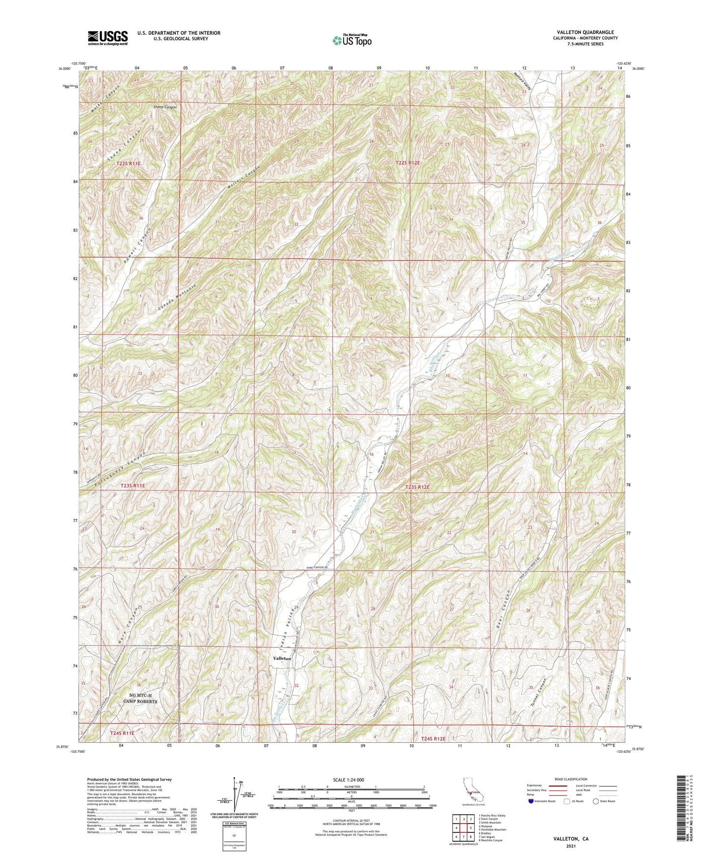
2021 topographic map quadrangle Valleton in the state of California. Scale: 1:24000. Based on the newly updated USGS 7.5' US Topo map series, this map is in the following counties: Monterey. The map contains contour data, water features, and other items you are used to seeing on USGS maps, but also has updated roads and other features. This is the next generation of topographic maps. Printed on high-quality waterproof paper with UV fade-resistant inks.
Quads adjacent to this one:
West: Wunpost
Northwest: Pancho Rico Valley
North: Slack Canyon
Northeast: Smith Mountain
East: Stockdale Mountain
Southeast: Ranchito Canyon
South: San Miguel
Southwest: Bradley
This map covers the same area as the classic USGS quad with code o35120h6.
Contains the following named places: Canada Montuosa, Eagle School, Medford Valley, Valleton, Walters Canyon