
MyTopo
Warm Springs Dam California US Topo Map
Couldn't load pickup availability
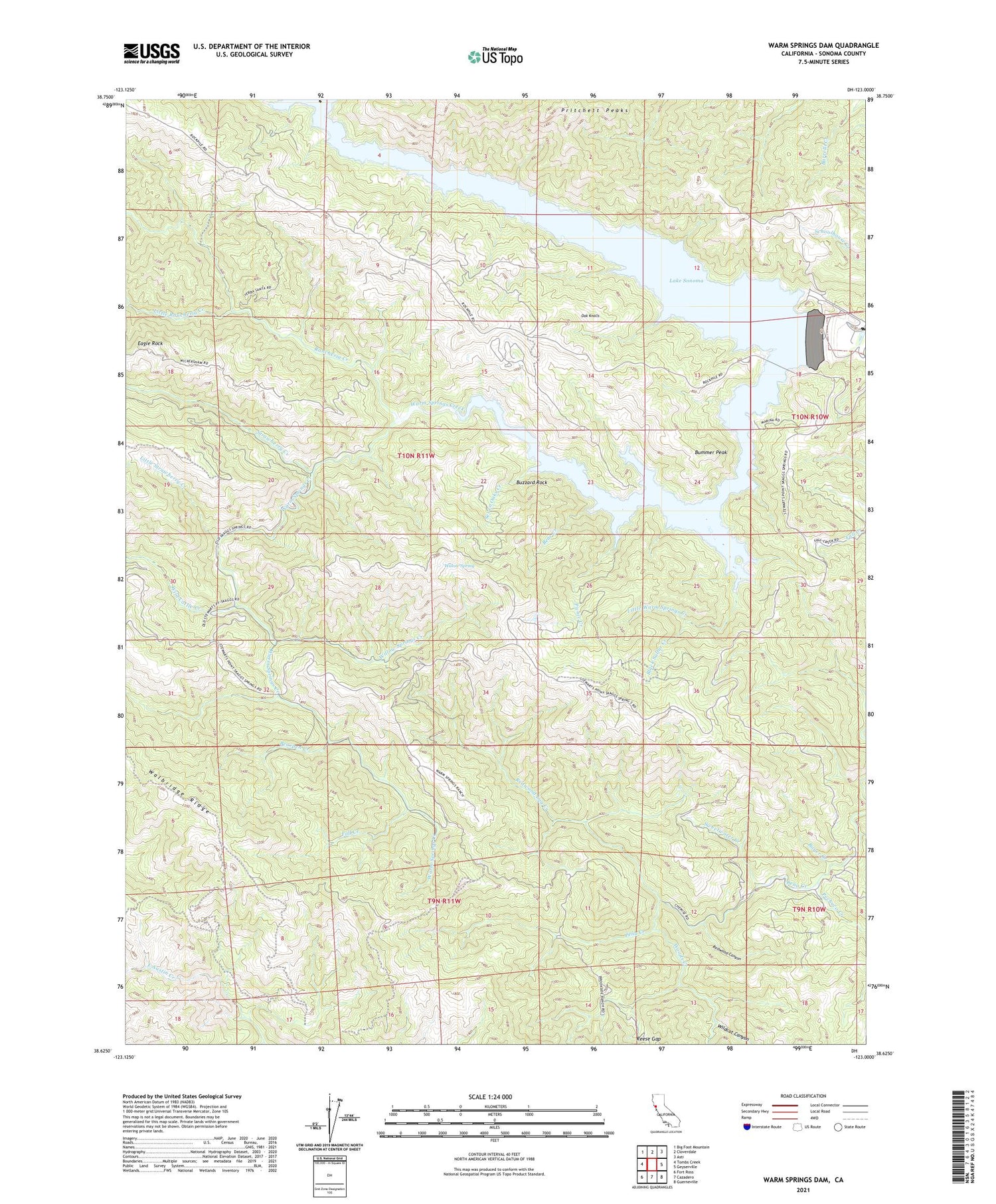
2021 topographic map quadrangle Warm Springs Dam in the state of California. Scale: 1:24000. Based on the newly updated USGS 7.5' US Topo map series, this map is in the following counties: Sonoma. The map contains contour data, water features, and other items you are used to seeing on USGS maps, but also has updated roads and other features. This is the next generation of topographic maps. Printed on high-quality waterproof paper with UV fade-resistant inks.
Quads adjacent to this one:
West: Tombs Creek
Northwest: Big Foot Mountain
North: Cloverdale
Northeast: Asti
East: Geyserville
Southeast: Guerneville
South: Cazadero
Southwest: Fort Ross
This map covers the same area as the classic USGS quad with code o38123f1.
Contains the following named places: Bear Creek, Bearpen Creek, Black Sulfur Creek, Boyer Creek, Bummer Peak, Buzzard Rock, Eagle Rock, Fall Creek, Lake Sonoma, Little Rancheria Creek, Little Strawberry Creek, Little Warm Springs Creek, Oak Knolls, Pechaco Creek, Picnic Creek, Pritchett Peaks, Rancheria Creek, Redwood Canyon, Redwood Log Creek, Reese Gap, Seven Oaks Creek, Skaggs Springs, Strawberry Creek, Sweetwater Creek, Walbridge Ridge, Warm Springs Creek, Warm Springs Dam, Wild Cattle Creek, Wildcat Canyon, Willow Spring, Willow Springs Creek, Woods Creek


