MyTopo
Loma Prieta California US Topo Map
Couldn't load pickup availability
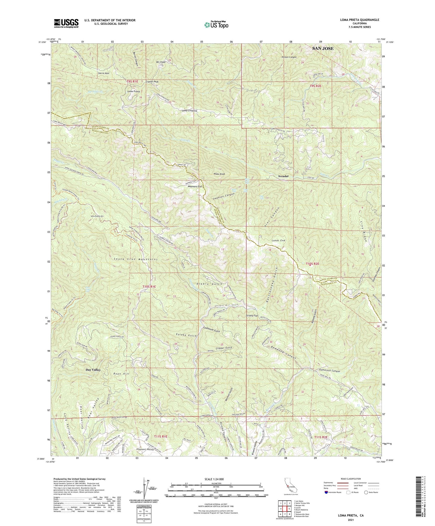
2021 topographic map quadrangle Loma Prieta in the state of California. Scale: 1:24000. Based on the newly updated USGS 7.5' US Topo map series, this map is in the following counties: Santa Cruz, Santa Clara. The map contains contour data, water features, and other items you are used to seeing on USGS maps, but also has updated roads and other features. This is the next generation of topographic maps. Printed on high-quality waterproof paper with UV fade-resistant inks.
Quads adjacent to this one:
West: Laurel
Northwest: Los Gatos
North: Santa Teresa Hills
Northeast: Morgan Hill
East: Mount Madonna
Southeast: Watsonville East
South: Watsonville West
Southwest: Soquel
This map covers the same area as the classic USGS quad with code o37121a7.
Contains the following named places: Alec Canyon, Alec Creek, Basin Falls, Bean Hill, Bear Valley, Black Rock Falls, Browns School, Buzzard Lagoon, Buzzard Lagoon Overview, Canyon Creek Heliport, Clipper Gulch, Cookhouse Gulch, Croy Creek, Croy Ridge, Crystal Peak, Cusacks Trail, Day Valley, Day Valley Census Designated Place, Deer Valley, Diablo Gulch, Eureka Gulch, Eureka School, Ferndale School, Fiver Finger Falls, Future Farmers of America Camp, Gamecock Canyon, Grizzly Flat, Hazeldell School, KBAY-FM (San Jose), KDBQ-FM (Santa Cruz), KKUP-FM (Cupertino), KLXV-TV (San Jose), KNTV-TV (San Jose), KSBW-TV (Salinas), KWSS-FM (Gilroy), Lands End, Loma Chiquita, Loma Prieta, Maymens Flat, Mormon Gulch, Mount Chual, Mountain Home, Nibbs Knob, Ormsby Volunteer Fire Brigade, Ramsey Gulch, Rattlesnake Gulch, Redwood Canyon, Rider Creek, Salesian Elementary and Junior High School, Santa Rosalia Mountain, Shingle Mill Gulch, Sveadal, Swanson Canyon, Triple Falls, Upper Falls, Uvas Canyon County Park