MyTopo
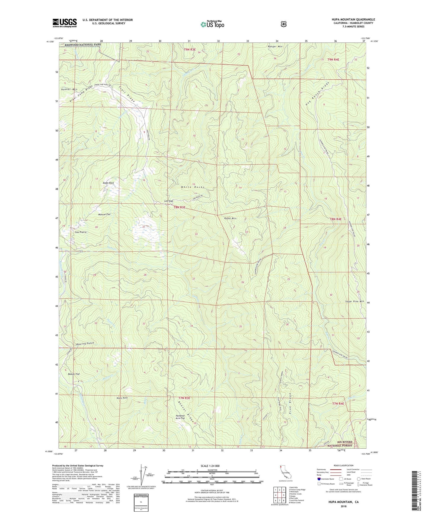
Hupa Mountain California US Topo Map
Couldn't load pickup availability
Also explore the Hupa Mountain Forest Service Topo of this same quad for updated USFS data
2022 topographic map quadrangle Hupa Mountain in the state of California. Scale: 1:24000. Based on the newly updated USGS 7.5' US Topo map series, this map is in the following counties: Humboldt. The map contains contour data, water features, and other items you are used to seeing on USGS maps, but also has updated roads and other features. This is the next generation of topographic maps. Printed on high-quality waterproof paper with UV fade-resistant inks.
Quads adjacent to this one:
West: Panther Creek
Northwest: Bald Hills
North: French Camp Ridge
Northeast: Weitchpec
East: Hoopa
Southeast: Willow Creek
South: Lord-Ellis Summit
Southwest: Blue Lake
This map covers the same area as the classic USGS quad with code o41123a7.
Contains the following named places: Arbor Camp Ridge, Beaver Butte, Beaver Creek, Beaver Flat, Beaver Ridge, Billy Prairie, Cookson Ranch, Cow Prairie, Eagle Rock, Faulkner Prairie, Flyette Prairie, Green Point Elementary School, Hog Ranch Ridge, Hooker Mountain, Hundred Acre Flat, Hupa Mountain, Kings Crossing, Kit Prairie, Lacks Creek, Last Prairie, Long Prairie, Low Gap, Mill Creek, Monroe Flat, North Fork Pasture, Onehundred Acre Prairie, Pine Ridge, Pond Ranch, Potato Patch, Preston Prairie, Redeye Prairie, Roaring Gulch, Round Prairie, Sandy Bar, Sidehill Prairie, Spring Prairie, Stover Creek, Stover Ranch, Studhorse Prairie, Sugar Pine Mountain, Trail Ridge, White Rocks