MyTopo
Devils Rock California US Topo Map
Couldn't load pickup availability
Also explore the Devils Rock Forest Service Topo of this same quad for updated USFS data
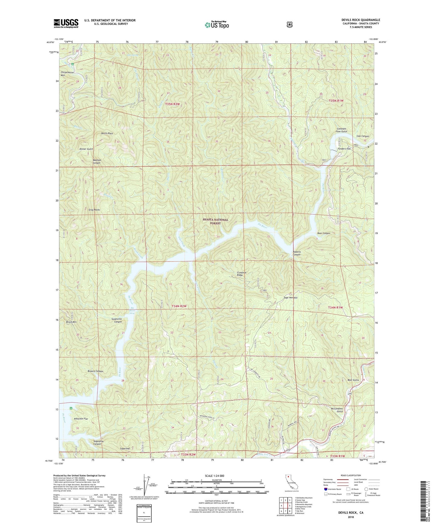
2023 topographic map quadrangle Devils Rock in the state of California. Scale: 1:24000. Based on the newly updated USGS 7.5' US Topo map series, this map is in the following counties: Shasta. The map contains contour data, water features, and other items you are used to seeing on USGS maps, but also has updated roads and other features. This is the next generation of topographic maps. Printed on high-quality waterproof paper with UV fade-resistant inks.
Quads adjacent to this one:
West: Minnesota Mountain
Northwest: Bollibokka Mountain
North: Goose Gap
Northeast: Roaring Creek
East: Montgomery Creek
Southeast: Whitmore
South: Oak Run
Southwest: Bella Vista
This map covers the same area as the classic USGS quad with code o40122g1.
Contains the following named places: Alder Spring, Arbuckle Camp, Arbuckle Flat, Arbuckle Flat Campground, Bars Creek, Bear Canyon, Bear Gulch, Brock Creek, Browns Canyon, Cedar Creek, Chirpchatler Camp, Constant Flow Gulch, Cow Canyon, Croxford Ridge, Devils Rock, Fenders Flat, Flat Creek, Gray Rocks, Low Pass Creek, McCandless Gulch, Mineral School, Potem Creek, Potem Falls, Ripgut Creek, Roberts Canyon, Sage Hen Hill, Shasta County, Squaw Creek Fire Control Station, Stein Creek, Stein Creek Camp, Sugarloaf, Sugarpine Canyon, Susanville Canyon