MyTopo
Montgomery Creek California US Topo Map
Couldn't load pickup availability
Also explore the Montgomery Creek Forest Service Topo of this same quad for updated USFS data
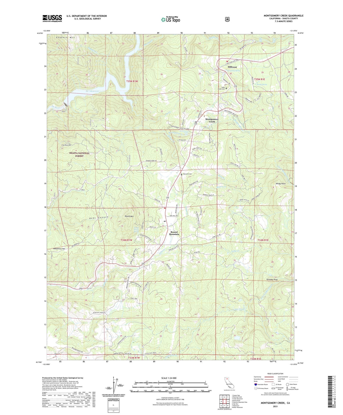
2021 topographic map quadrangle Montgomery Creek in the state of California. Scale: 1:24000. Based on the newly updated USGS 7.5' US Topo map series, this map is in the following counties: Shasta. The map contains contour data, water features, and other items you are used to seeing on USGS maps, but also has updated roads and other features. This is the next generation of topographic maps. Printed on high-quality waterproof paper with UV fade-resistant inks.
Quads adjacent to this one:
West: Devils Rock
Northwest: Goose Gap
North: Roaring Creek
Northeast: Chalk Mountain
East: Hatchet Mountain Pass
Southeast: Miller Mountain
South: Whitmore
Southwest: Oak Run
This map covers the same area as the classic USGS quad with code o40121g8.
Contains the following named places: Brush Patch, By Gonney Spring, Carroll Sand and Gravel Pit, Cedar Creek Elementary School, Dunn Creek, Frank Storey Spring, Halcumb Cemetery, Hatchet Creek, Hillcrest, Hillcrest Forest Fire Station, Hobo Creek Cemetery, Hogback Creek, Kenyon School, Lick Creek, Lion Slide Falls, Lion Wash Falls, Little Round Mountain, Manzanita Hill, Mill Creek, Minnow Creek, Montgomery Creek, Montgomery Creek Census Designated Place, Montgomery Creek Elementary School, Montgomery Creek Falls, Montgomery Creek Post Office, Montgomery Creek Rancheria, Montgomery Creek Volunteer Fire Company Station 71, Montgomery Creek Volunteer Fire Company Station 71 Substation, Moody Spring, Mountain School, North Fork Little Cow Creek, North Fork Montgomery Creek, Pit 7 Reservoir, Pit Number 7 97-122 Dam, Round Mountain, Round Mountain Census Designated Place, Round Mountain Post Office, South Fork Montgomery Creek, Tolladay Peak, Willow Creek, Windy Point, ZIP Code: 96084