MyTopo
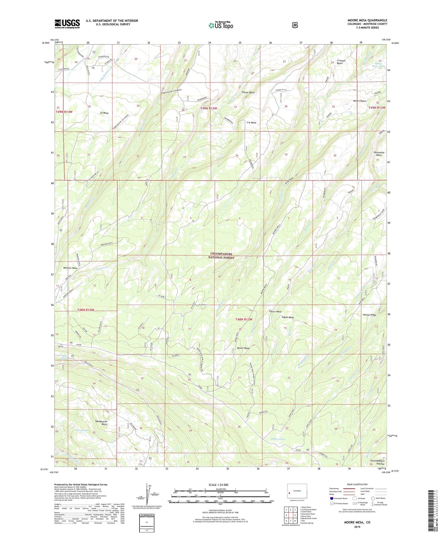
Moore Mesa Colorado US Topo Map
Couldn't load pickup availability
Also explore the Moore Mesa Forest Service Topo of this same quad for updated USFS data
2022 topographic map quadrangle Moore Mesa in the state of Colorado. Scale: 1:24000. Based on the newly updated USGS 7.5' US Topo map series, this map is in the following counties: Montrose. The map contains contour data, water features, and other items you are used to seeing on USGS maps, but also has updated roads and other features. This is the next generation of topographic maps. Printed on high-quality waterproof paper with UV fade-resistant inks.
Quads adjacent to this one:
West: Starvation Point
Northwest: Kelso Point
North: Cottonwood Basin
Northeast: Camel Back
East: Davis Point
Southeast: Antone Spring
South: Ute
Southwest: Big Bucktail Creek
This map covers the same area as the classic USGS quad with code o38108d3.
Contains the following named places: 25 Mesa Guard Station, 41 Cow Camp, 7 N Mesa, Ashley Ridge, Beach Cow Camp, Blackburn Cow Camp, Boyden Cow Camp, Cobb Spring, Grassy Lake, Hilkey Pond, Kitty Creek, Monitor Mesa, Monitor Mesa Trail, Montrose County, Moore Basin, Moore Mesa, Moore Mesa Trail, Payne Mesa, Roubideau Trail, Tabeguache Overlook, Traver Mesa