MyTopo
Arkansas Mountain Colorado US Topo Map
Couldn't load pickup availability
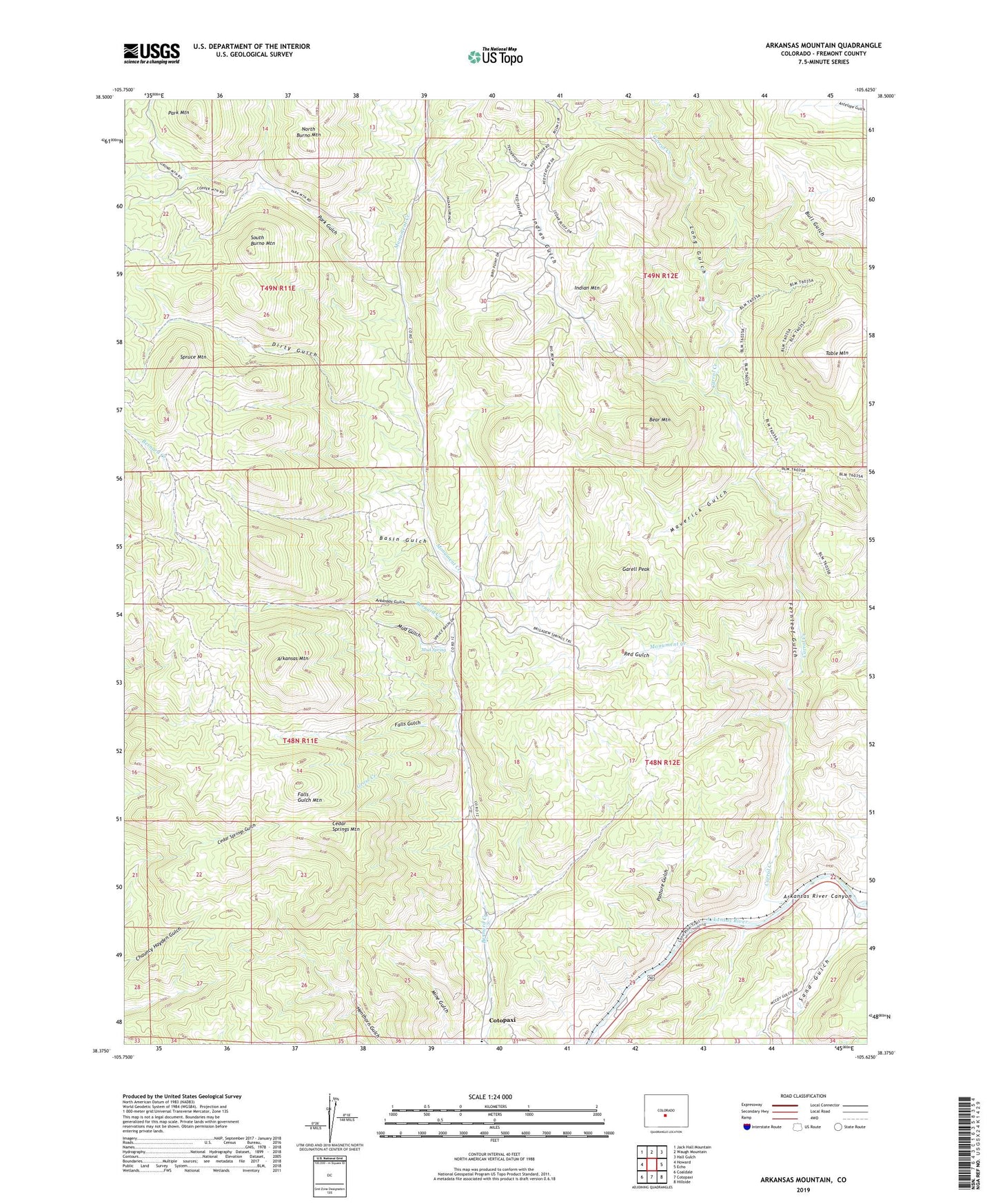
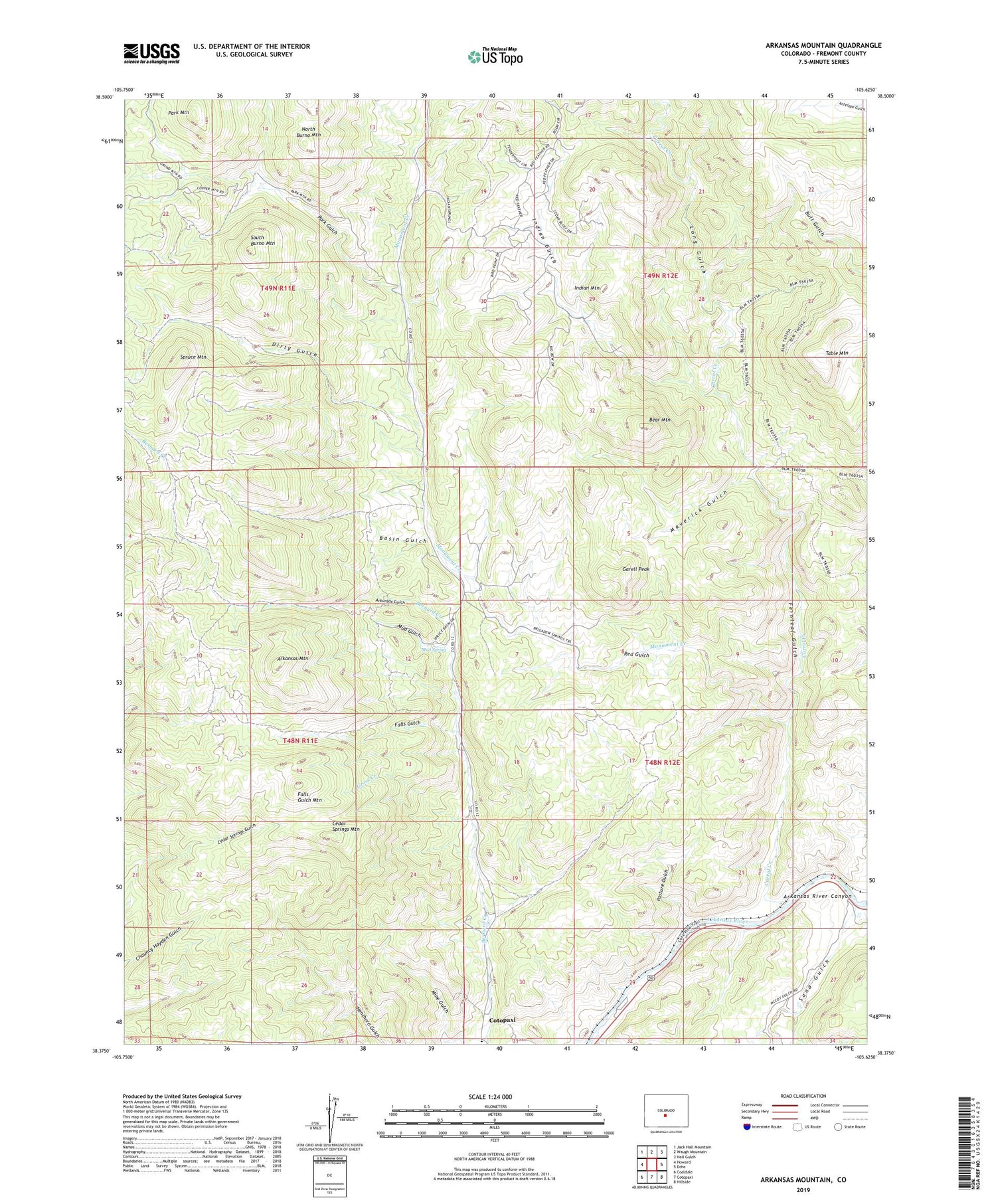
2022 topographic map quadrangle Arkansas Mountain in the state of Colorado. Scale: 1:24000. Based on the newly updated USGS 7.5' US Topo map series, this map is in the following counties: Fremont. The map contains contour data, water features, and other items you are used to seeing on USGS maps, but also has updated roads and other features. This is the next generation of topographic maps. Printed on high-quality waterproof paper with UV fade-resistant inks.
Quads adjacent to this one:
West: Howard
Northwest: Jack Hall Mountain
North: Waugh Mountain
Northeast: Hall Gulch
East: Echo
Southeast: Hillside
South: Cotopaxi
Southwest: Coaldale
This map covers the same area as the classic USGS quad with code o38105d6.
Contains the following named places: Arkansas Gulch, Arkansas Mountain, Basin Gulch, Bear Mountain, Carrol Creek, Cedar Springs Mountain, Cotopaxi Census Designated Place, Cotopaxi Mine, Dirty Gulch, Falls Gulch, Falls Gulch Mountain, Fernleaf Gulch, Garell Peak, Gross Creek, Indian Gulch, Indian Gulch Mine, Indian Mountain, Long Gulch, Maverick Gulch, Monument Creek, Mud Gulch, Mud Spring, North Burno Mountain, Park Gulch, Park Mountain, Pasture Gulch, Red Gulch, Sand Gulch, South Burno Mountain, Spruce Mountain, Table Mountain