MyTopo
Echo Colorado US Topo Map
Couldn't load pickup availability
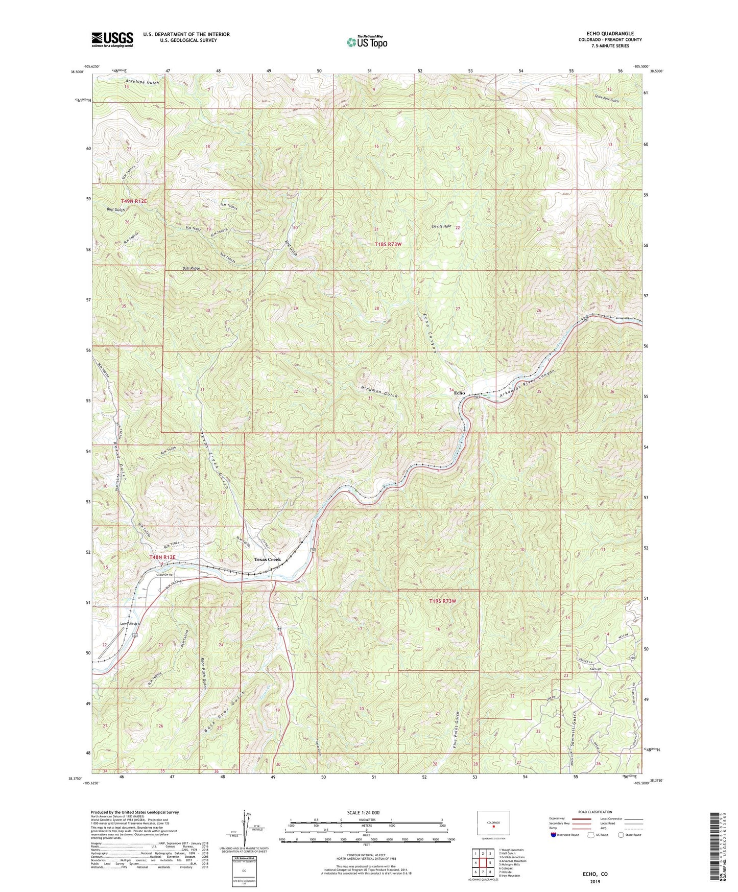
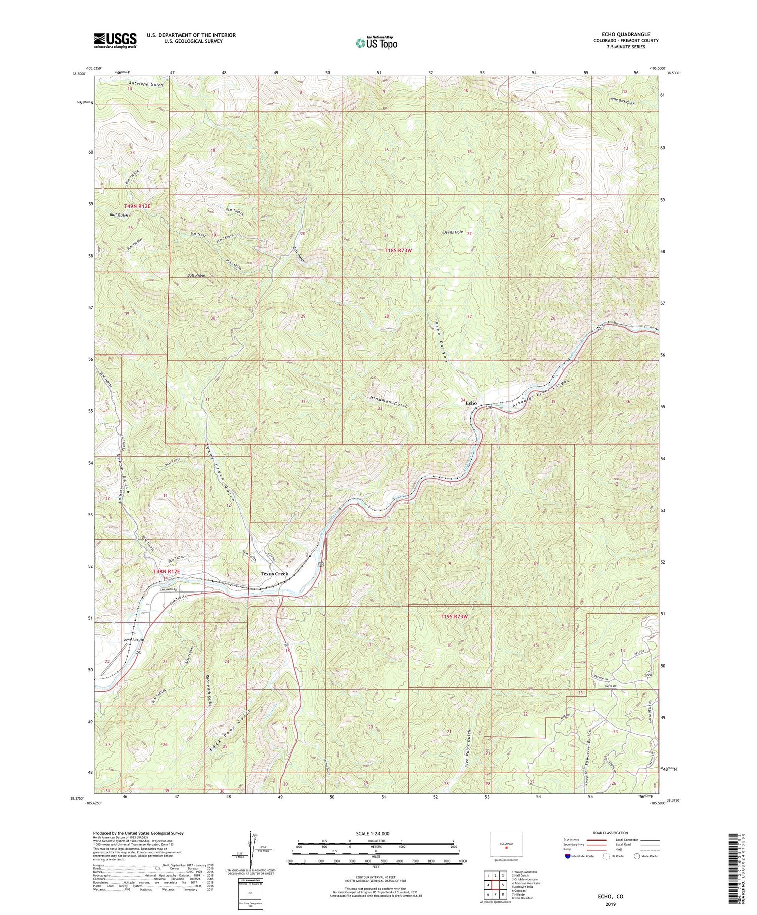
2022 topographic map quadrangle Echo in the state of Colorado. Scale: 1:24000. Based on the newly updated USGS 7.5' US Topo map series, this map is in the following counties: Fremont. The map contains contour data, water features, and other items you are used to seeing on USGS maps, but also has updated roads and other features. This is the next generation of topographic maps. Printed on high-quality waterproof paper with UV fade-resistant inks.
Quads adjacent to this one:
West: Arkansas Mountain
Northwest: Waugh Mountain
North: Hall Gulch
Northeast: Gribble Mountain
East: McIntyre Hills
Southeast: Iron Mountain
South: Hillside
Southwest: Cotopaxi
This map covers the same area as the classic USGS quad with code o38105d5.
Contains the following named places: Antelope Gulch, Back Door Gulch, Big Emma Claim, Bull Gulch, Bull Gulch Mine, Bull Ridge, Bull Ridge Mine, Cotopaxi Division, Devils Hole, Dreamer Mine, East Gulch, Echo, Echo Canyon, Five Point Gulch, Hindman Gulch, Lowe Airstrip, Misery Mine Group, Navajo Claim, Race Path Gulch, Reese Gulch, Texas Creek, Texas Creek Gulch, Texas Creek Mine, Tezak Airport, Thomas Gulch, Zingheim Quarry