
MyTopo
Coaldale Colorado US Topo Map
Couldn't load pickup availability
Also explore the Coaldale Forest Service Topo of this same quad for updated USFS data
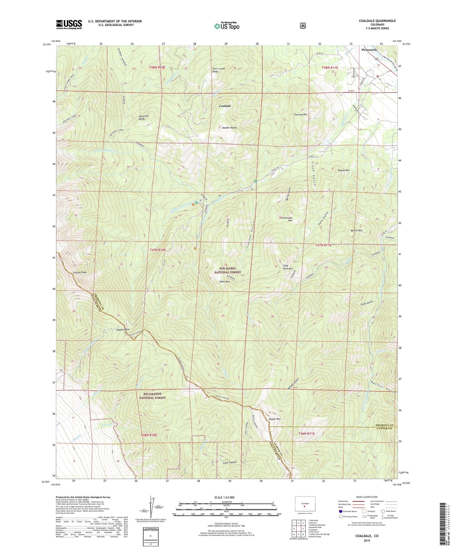
2022 topographic map quadrangle Coaldale in the state of Colorado. Scale: 1:24000. Based on the newly updated USGS 7.5' US Topo map series, this map is in the following counties: Fremont, Saguache, Custer. The map contains contour data, water features, and other items you are used to seeing on USGS maps, but also has updated roads and other features. This is the next generation of topographic maps. Printed on high-quality waterproof paper with UV fade-resistant inks.
Quads adjacent to this one:
West: Bushnell Peak
Northwest: Wellsville
North: Howard
Northeast: Arkansas Mountain
East: Cotopaxi
Southeast: Electric Peak
South: Valley View Hot Springs
Southwest: Villa Grove
This map covers the same area as the classic USGS quad with code o38105c7.
Contains the following named places: Battle Mountain, Black Mountain Trail, Coaldale, Coaldale Census Designated Place, Fleming Mountain, Foots Gulch, Galena Peak, Hamilton Baldy, Hayden Baldy, Hayden Creek, Hayden Creek Campground, Hayden Pass, Indian Creek, Italian Gulch, Middle Prong Hayden Creek, Millball Gulch, Mockingbird Claim, Nipple Mountain, No Name Lead Mine, North Piney Creek, North Prong Hayden Creek, Pole Gulch, Quarry Creek, Rattler Gulch, Rattlesnake Mountain, Round Mountain, Round Mountain Mine, Short Creek Baldy, Slide Rock Mountain, South Piney Creek, South Prong, Spring Gulch, Steel Canyon Trail, Table Mountain, Trash Gulch, Western Fremont Fire Protection District Station 1 Coaldale, Wolf Creek, ZIP Code: 81222


