MyTopo
Barela Colorado US Topo Map
Couldn't load pickup availability
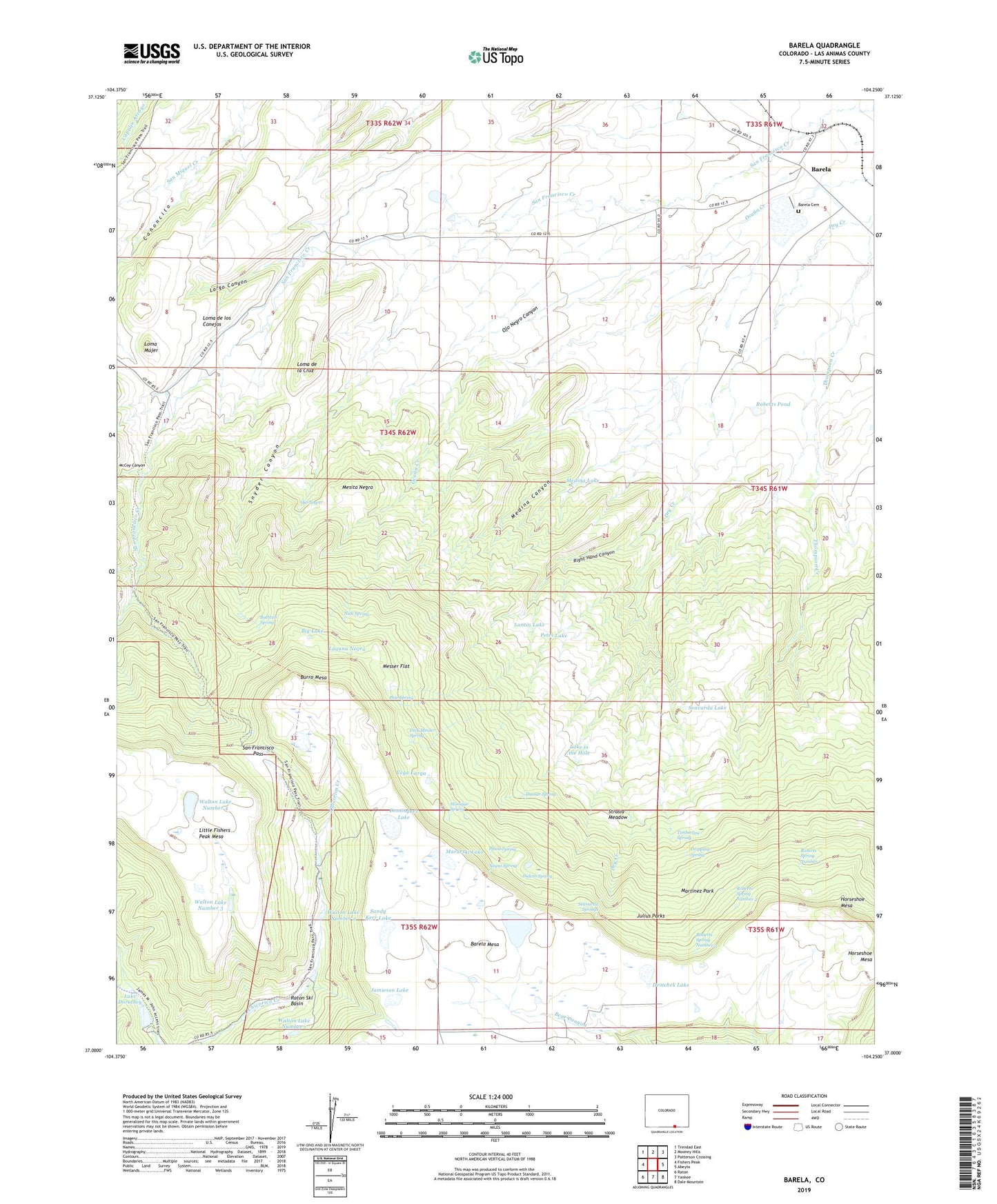
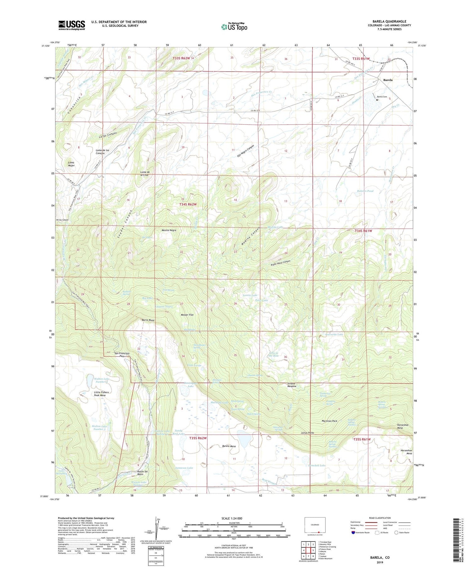
2022 topographic map quadrangle Barela in the state of Colorado. Scale: 1:24000. Based on the newly updated USGS 7.5' US Topo map series, this map is in the following counties: Las Animas. The map contains contour data, water features, and other items you are used to seeing on USGS maps, but also has updated roads and other features. This is the next generation of topographic maps. Printed on high-quality waterproof paper with UV fade-resistant inks.
Quads adjacent to this one:
West: Fishers Peak
Northwest: Trinidad East
North: Mooney Hills
Northeast: Patterson Crossing
East: Abeyta
Southeast: Dale Mountain
South: Yankee
Southwest: Raton
This map covers the same area as the classic USGS quad with code o37104a3.
Contains the following named places: Archibald Upper Ditch, Barela, Barela Cemetery, Bathtub Spring, Big Lake, Burro Mesa, Canoncito, Demchek Lake, Dick Messer Spring, Didero Spring, Dominguez Lake, Dripping Spring, Dry Creek, Dussar Spring, East Fork Schwachheim Creek, Hermosa Dam, Hermosa Valley Reservoir, Hoffman Lake, Horseshoe Mesa, Jamieson Lake, Julius Parks, Laguna Negra, Lake Dorothey, Lake in the Hole, Lantin Lake, Largo Canyon, Loma de la Cruz, Loma de los Conejos, Loma Mujer, Mararski Lake, Mararski Mine, Martinez Park, McCoy Canyon, Medina Canyon, Medina Lake, Mesita Negra, Messer Flat, Monique Spring, Negro Spring, Nick Spring, Ocana Creek, Ojo Negro, Ojo Negro Canyon, Paula Spring, Pete Spring, Petes Lake, Raton Ski Basin, Right Hand Canyon, Roberts Pond, Roberts Spring Number 1, Roberts Spring Number 2, Roberts Spring Number 3, San Francisco Pass, Sandoval Ditch, Sandy Kerr Lake, Seavarda Lake, Seavarda Springs, Snyder Canyon, Strasia Meadow, Timberline Spring, Vega Larga, Walton Detention Number 1 Dam, Walton Detention Reservoir Number 1, Walton Lake Number 1, Walton Lake Number 2, Walton Lake Number 3, Walton Lake Number 4