MyTopo
Trinidad East Colorado US Topo Map
Couldn't load pickup availability
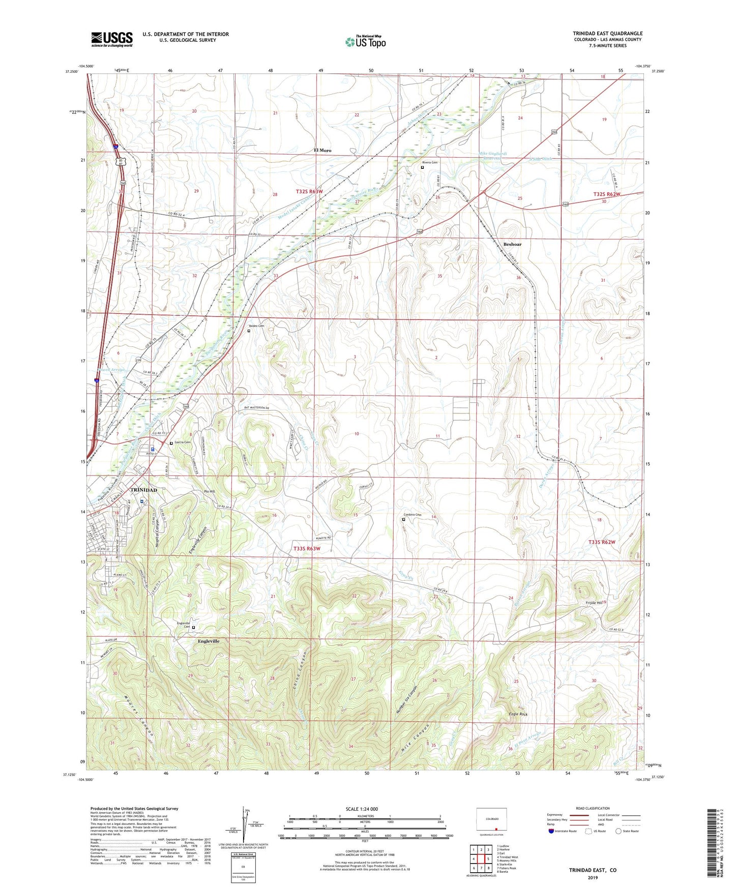
2022 topographic map quadrangle Trinidad East in the state of Colorado. Scale: 1:24000. Based on the newly updated USGS 7.5' US Topo map series, this map is in the following counties: Las Animas. The map contains contour data, water features, and other items you are used to seeing on USGS maps, but also has updated roads and other features. This is the next generation of topographic maps. Printed on high-quality waterproof paper with UV fade-resistant inks.
Quads adjacent to this one:
West: Trinidad West
Northwest: Ludlow
North: Hoehne
Northeast: Earl
East: Mooney Hills
Southeast: Barela
South: Fishers Peak
Southwest: Starkville
This map covers the same area as the classic USGS quad with code o37104b4.
Contains the following named places: Ave Maria Shrine, Beshoar, Chilili Ditch, China Canyon, China Creek, City of Trinidad, Cordova Cemetery, Duran Arroyo, Eagle Rock, East Street School, El Moro, El Moro Census Designated Place, Engle Mine, Engleville, Engleville Canyon, Engleville Cemetery, Engleville Mine, Frijole Hill, Garcia Cemetery, Gray Creek, Helen Mine, Highland Mine, Highline Mine, Hospital Canyon, Las Animas County Fairgrounds, Las Animas County Jail, Las Animas County Sheriff's Office, Mike Gagliardi Dam, Mike Gagliardi Reservoir, Mount San Rafael Heliport, Mount San Rafael Hospital, Nile Canyon, Number Six Canyon, Picketwire Ditch, Pio Hill, Pioneer Ditch Number 1, Powell Arroyo, Rivera Cemetery, Trinidad Ambulance District, Trinidad Division, Trinidad Police Department, Trinidad Police Department Jail, Valdez Cemetery, Welte Pit