MyTopo
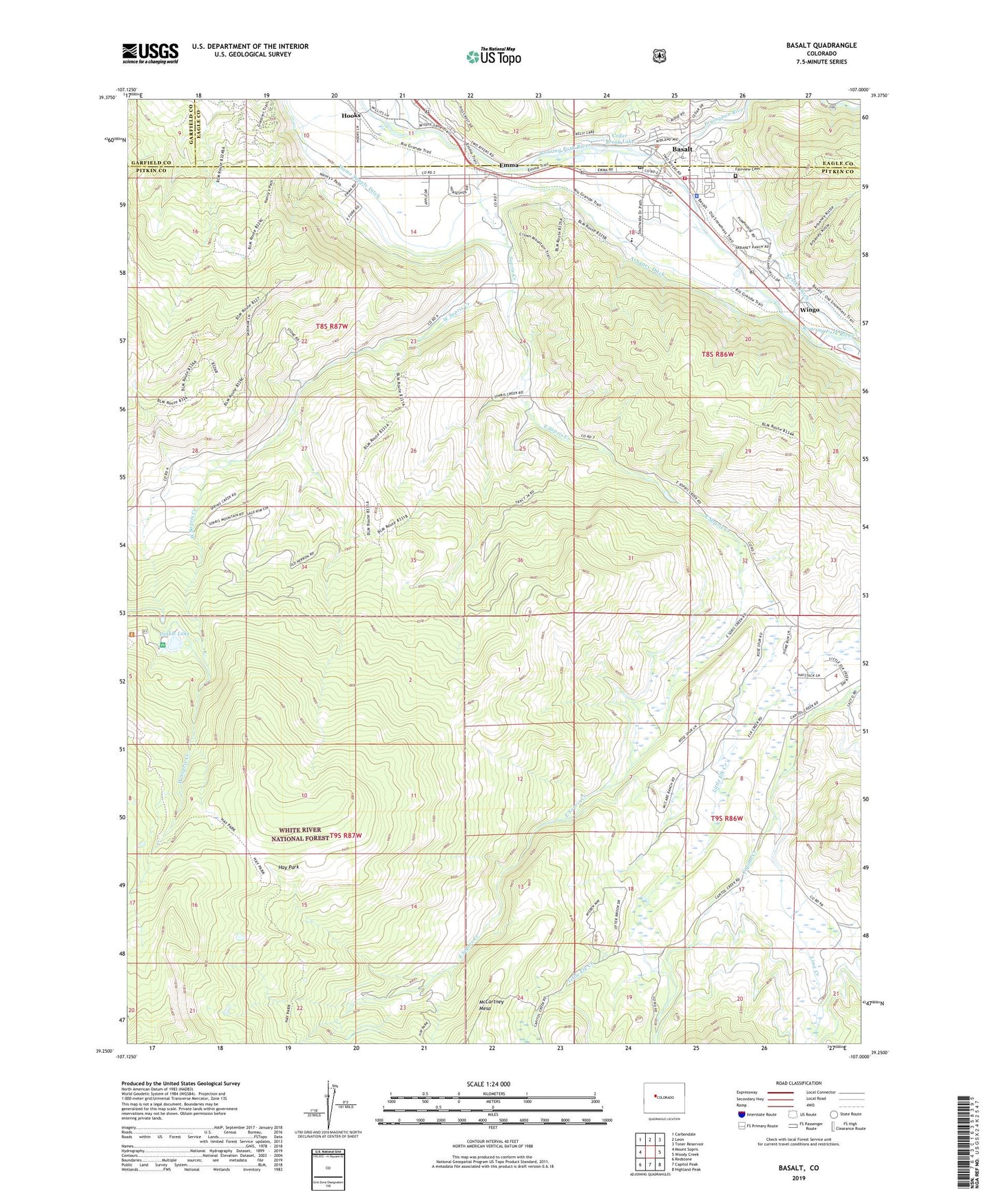
Basalt Colorado US Topo Map
Couldn't load pickup availability
Also explore the Basalt Forest Service Topo of this same quad for updated USFS data
2022 topographic map quadrangle Basalt in the state of Colorado. Scale: 1:24000. Based on the newly updated USGS 7.5' US Topo map series, this map is in the following counties: Pitkin, Eagle, Garfield. The map contains contour data, water features, and other items you are used to seeing on USGS maps, but also has updated roads and other features. This is the next generation of topographic maps. Printed on high-quality waterproof paper with UV fade-resistant inks.
Quads adjacent to this one:
West: Mount Sopris
Northwest: Carbondale
North: Leon
Northeast: Toner Reservoir
East: Woody Creek
Southeast: Highland Peak
South: Capitol Peak
Southwest: Redstone
This map covers the same area as the classic USGS quad with code o39107c1.
Contains the following named places: Basalt, Basalt and Rural Fire Protection District Station 41, Basalt Police Department, Basalt Post Office, Basalt Work Center, Bionaz Group Mine, Cedar Brook Lake, Dinkle Lake, Dinkle Lake Day Use Area, East Sopris Creek, Emma, Fairview Cemetery, Fryingpan River, Hay Park, Home Supply Ditch, Homeward Bound Quarry, Hooks, Lake Ann Dam, Lake Ann Reservoir, Lime Creek, McCartney Mesa, Saco, Saint Benedict Monastery, Sopris Creek, Town of Basalt, West Sopris Creek, Wingo