MyTopo
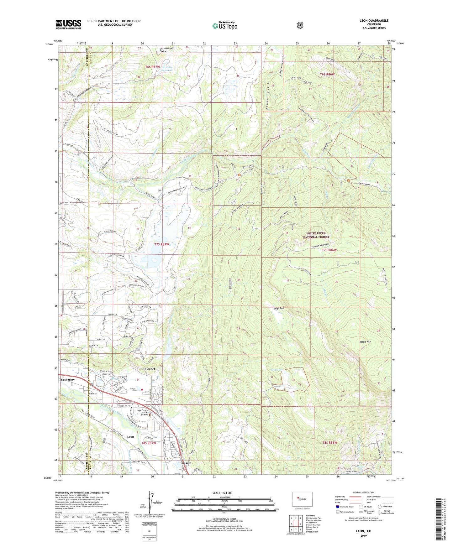
Leon Colorado US Topo Map
Couldn't load pickup availability
Also explore the Leon Forest Service Topo of this same quad for updated USFS data
2022 topographic map quadrangle Leon in the state of Colorado. Scale: 1:24000. Based on the newly updated USGS 7.5' US Topo map series, this map is in the following counties: Eagle, Garfield. The map contains contour data, water features, and other items you are used to seeing on USGS maps, but also has updated roads and other features. This is the next generation of topographic maps. Printed on high-quality waterproof paper with UV fade-resistant inks.
Quads adjacent to this one:
West: Carbondale
Northwest: Shoshone
North: Cottonwood Pass
Northeast: Suicide Mountain
East: Toner Reservoir
Southeast: Woody Creek
South: Basalt
Southwest: Mount Sopris
This map covers the same area as the classic USGS quad with code o39107d1.
Contains the following named places: Basalt and Rural Fire Protection District El Jebel Station 42, Basalt Mountain, Blue Creek, Blue Creek Trail, Bowers Gulch, Catherine Census Designated Place, Cattle Creek Guard Station, Center Creek, Eagle County Sheriff's Office El Jebel Substation, El Jebel, El Jebel Census Designated Place, High Park, Kelly Lake, Kelly Pond Dam, Kelly Pond Reservoir, Leon, McNulty Dam, McNulty Reservoir, Mill Creek, Mount Sopris Tree Nursery, North Fork Cattle Creek, Sleepy Creek, Spring Park Dam, Spring Park Reservoir, Thompson Creek, Whitnach Falls