MyTopo
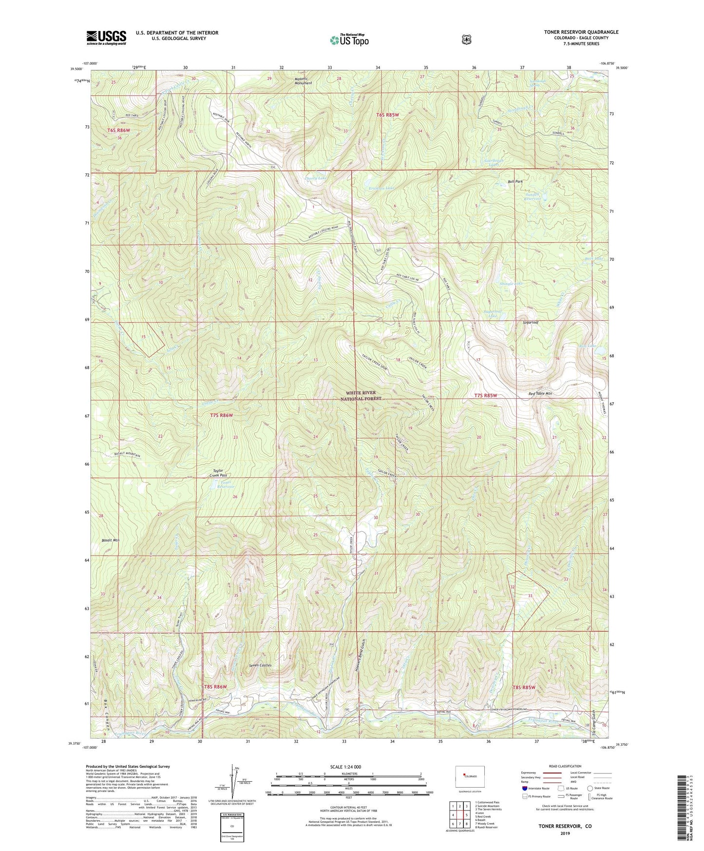
Toner Reservoir Colorado US Topo Map
Couldn't load pickup availability
Also explore the Toner Reservoir Forest Service Topo of this same quad for updated USFS data
2022 topographic map quadrangle Toner Reservoir in the state of Colorado. Scale: 1:24000. Based on the newly updated USGS 7.5' US Topo map series, this map is in the following counties: Eagle. The map contains contour data, water features, and other items you are used to seeing on USGS maps, but also has updated roads and other features. This is the next generation of topographic maps. Printed on high-quality waterproof paper with UV fade-resistant inks.
Quads adjacent to this one:
West: Leon
Northwest: Cottonwood Pass
North: Suicide Mountain
Northeast: The Seven Hermits
East: Red Creek
Southeast: Ruedi Reservoir
South: Woody Creek
Southwest: Basalt
This map covers the same area as the classic USGS quad with code o39106d8.
Contains the following named places: Box Canyon, Buck Lake, Bull Park, Cap-K-Ranch, Castle View Ranch, Cherry Lake, Downey Creek, Duffs Cabin, East Downey Creek, Erickson Lake, Hoovers Bend Gulch, Iola Creek, Otto Creek, Parkville, Rim Lake, Seven Castles, Seven Castles Creek, Shingle Lake, Smith Dam, Sourdough Creek, Sourdough Lakes, Sourdough Spring, Sugarloaf, Sugarloaf Lake, Sundell Reservoir, Swamp Creek, Taylor Creek, Taylor Creek Pass, Tie Camp Gulch, Toner Creek, Toner Reservoir, Wilson Creek, Yeoman Creek