MyTopo
Parshall Colorado US Topo Map
Couldn't load pickup availability
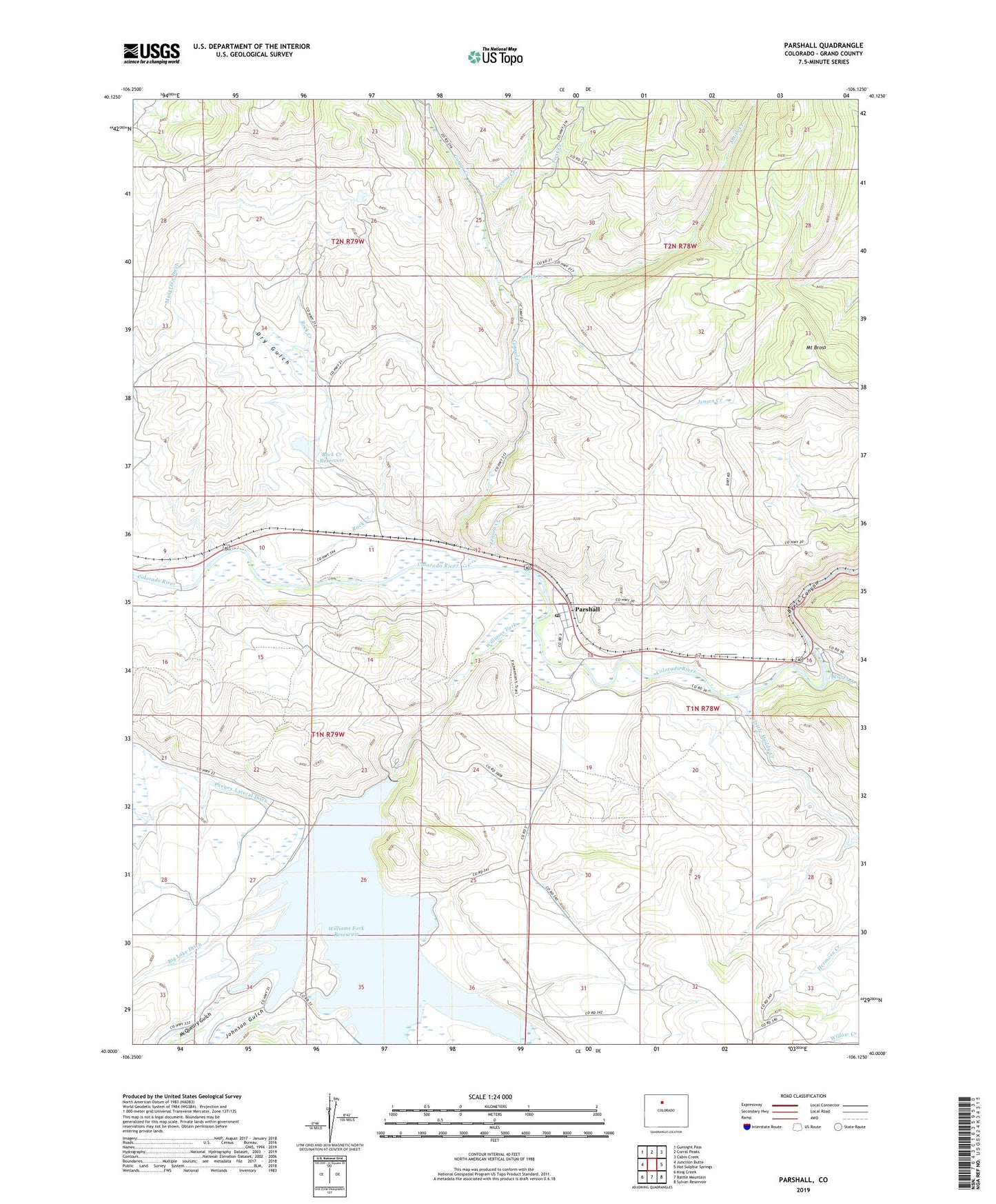
2022 topographic map quadrangle Parshall in the state of Colorado. Scale: 1:24000. Based on the newly updated USGS 7.5' US Topo map series, this map is in the following counties: Grand. The map contains contour data, water features, and other items you are used to seeing on USGS maps, but also has updated roads and other features. This is the next generation of topographic maps. Printed on high-quality waterproof paper with UV fade-resistant inks.
Quads adjacent to this one:
West: Junction Butte
Northwest: Gunsight Pass
North: Corral Peaks
Northeast: Cabin Creek
East: Hot Sulphur Springs
Southeast: Sylvan Reservoir
South: Battle Mountain
Southwest: King Creek
This map covers the same area as the classic USGS quad with code o40106a2.
Contains the following named places: Battle Creek, Beaver Creek, Big Lake Ditch, Byers Canyon, Colorado State Rifle Range, Copper Creek, Corral Creek, Dry Gulch, First Creek, Flat, Gilbert Campground, Jensen Creek, Johnson Gulch, Kinney Creek, Kitchen Creek, Little Muddy Creek, McQueary Gulch, Musgrave Dam, Musgrave Ditch, Musgrave Reservoir, Parshall, Parshall Census Designated Place, Parshall Post Office, Rock Creek, Rock Creek Dam, Rock Creek Reservoir, Second Creek, Smith Creek, Williams Fork, Williams Fork Dam, Williams Fork Reservoir