MyTopo
Gunnison Colorado US Topo Map
Couldn't load pickup availability
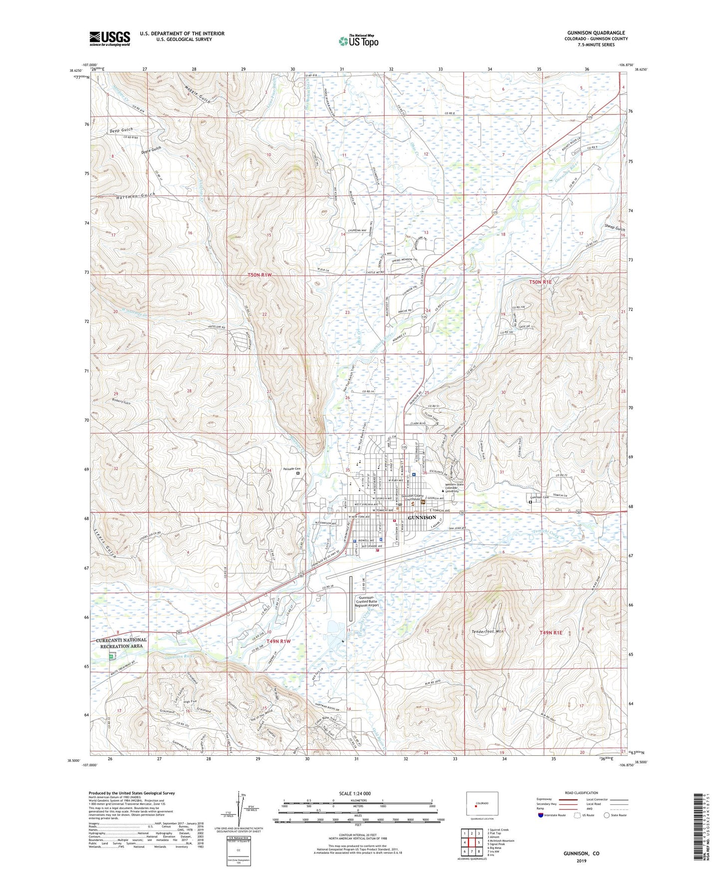
2022 topographic map quadrangle Gunnison in the state of Colorado. Scale: 1:24000. Based on the newly updated USGS 7.5' US Topo map series, this map is in the following counties: Gunnison. The map contains contour data, water features, and other items you are used to seeing on USGS maps, but also has updated roads and other features. This is the next generation of topographic maps. Printed on high-quality waterproof paper with UV fade-resistant inks.
Quads adjacent to this one:
West: McIntosh Mountain
Northwest: Squirrel Creek
North: Flat Top
Northeast: Almont
East: Signal Peak
Southeast: Iris
South: Iris NW
Southwest: Big Mesa
This map covers the same area as the classic USGS quad with code o38106e8.
Contains the following named places: Aberdeen, Alpine Hall, American Legion Memorial Park, Antelope Creek, Aspinall-Wilson Conference Center, Beckwith Hall, Blackstock Elementary School, Blinberry Gulch, Cemetery, Chipeta Hall, Church of Christ, Church of the Good Samaritan, City of Gunnison, College Union, Colorado Hall, Coronado Hall, Court House Square, Crawford Hall, Deep Gulch, Dinosaur Reconstruction Lab, Dolores Hall, Doyle Gulch, Escalante Hall, First Baptist Church, Gold Basin Creek, Gunnison, Gunnison - Crested Butte Regional Airport Fire Department, Gunnison Cemetery, Gunnison County Court House, Gunnison County Detention Center, Gunnison County Fairgrounds, Gunnison County Sheriff's Office, Gunnison High School, Gunnison Lake School, Gunnison Municipal Building, Gunnison Police Department, Gunnison Post Office, Gunnison Valley Health Hospital, Gunnison Valley Hospital Emergency Medical Services, Gunnison Valley Hospital Heliport, Gunnison Volunteer Fire Department, Gunnison-Crested Butte Regional Airport, Hartman Gulch, Hermosa Hall, Jorgensen Recreation Complex, Keating Hall, KGUC-AM (Gunnison), KGUC-FM (Gunnison), KVLE-FM (Gunnison), KWSB-FM (Gunnison), Legion Park Golf Course, Leslie J Savage Library, Lou Jay Resort, Maggie Gulch, McCabe Ranch, Meadows Shopping Center, Mears Hall, Moffal Hall, Mount Calvary Lutheran Church, Mountaineer Stadium, O Leary Elementary School, Ohio Creek, Ophir Hall, Paragon School, Paul W Wright Gymnasium, Pine Street School, Pioneer Museum, Presidents House, Quigley Hall, Robidoux Hall, Ruland Middle School, Saint Peters Catholic Church, Shavano Hall, Sheep Gulch, Steers Gulch, Taylor Hall, Tenderfoot Mountain, Teocalli Hall, The Community Church, Thornton Ranch, Tomichi Creek, Tomichi Hall - Health Center, Ute Hall, Webster Hall - Young at Heart Senior Citizen Center, West Antelope Creek, Western Colorado University, ZIP Code: 81231