
MyTopo
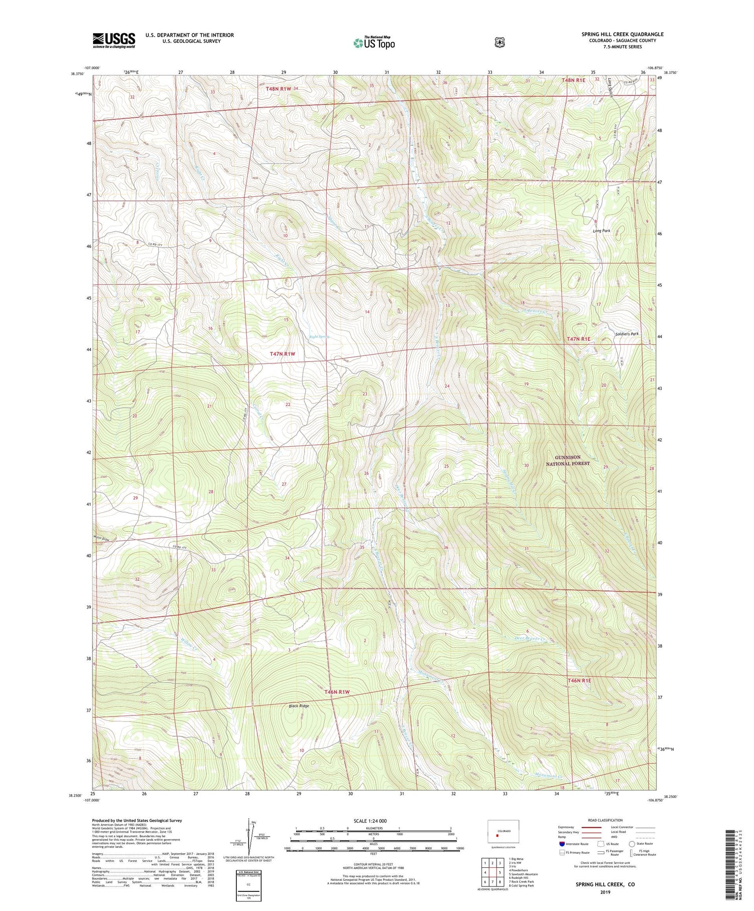
Spring Hill Creek Colorado US Topo Map
Couldn't load pickup availability
Also explore the Spring Hill Creek Forest Service Topo of this same quad for updated USFS data
2022 topographic map quadrangle Spring Hill Creek in the state of Colorado. Scale: 1:24000. Based on the newly updated USGS 7.5' US Topo map series, this map is in the following counties: Saguache. The map contains contour data, water features, and other items you are used to seeing on USGS maps, but also has updated roads and other features. This is the next generation of topographic maps. Printed on high-quality waterproof paper with UV fade-resistant inks.
Quads adjacent to this one:
West: Powderhorn
Northwest: Big Mesa
North: Iris NW
Northeast: Iris
East: Sawtooth Mountain
Southeast: Cold Spring Park
South: Rock Creek Park
Southwest: Rudolph Hill
This map covers the same area as the classic USGS quad with code o38106c8.
Contains the following named places: Big Mud Pond, Black Ridge, Continental Mine, Cooper Ranch, Deer Beaver Creek, East Beaver Creek, Little Mud Pond, Long Park, Mergelmann Cow Camp, Midland Mine, Monument Creek, Right Creek, Right Spring, Shelton Ranch, Soldiers Park, Spring Hill Creek, Watts Homestead, Willow Creek Group Mine


