MyTopo
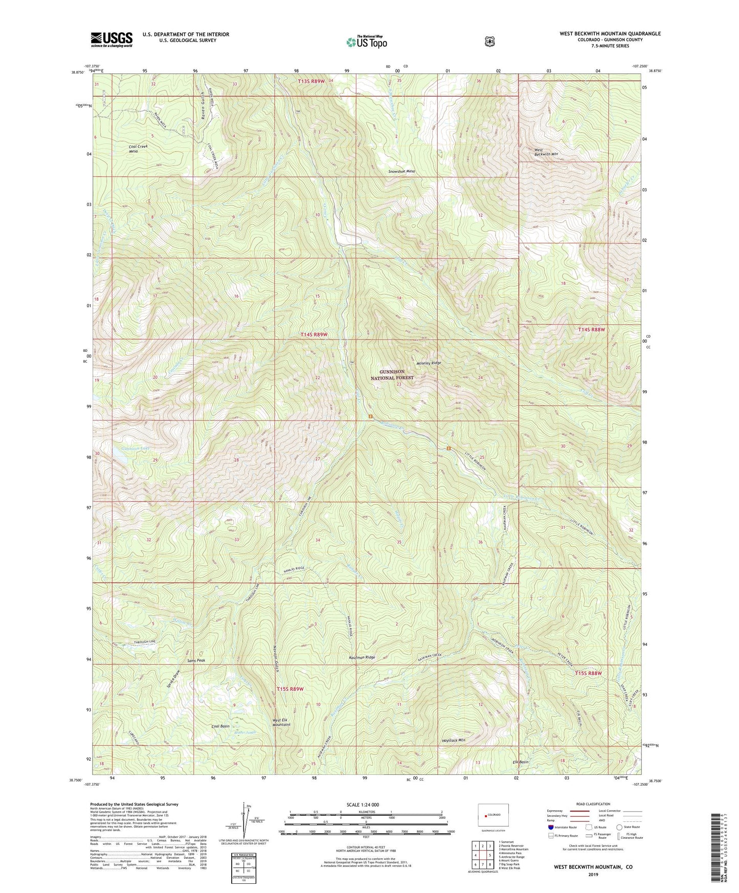
West Beckwith Mountain Colorado US Topo Map
Couldn't load pickup availability
Also explore the West Beckwith Mountain Forest Service Topo of this same quad for updated USFS data
2022 topographic map quadrangle West Beckwith Mountain in the state of Colorado. Scale: 1:24000. Based on the newly updated USGS 7.5' US Topo map series, this map is in the following counties: Gunnison. The map contains contour data, water features, and other items you are used to seeing on USGS maps, but also has updated roads and other features. This is the next generation of topographic maps. Printed on high-quality waterproof paper with UV fade-resistant inks.
Quads adjacent to this one:
West: Minnesota Pass
Northwest: Somerset
North: Paonia Reservoir
Northeast: Marcellina Mountain
East: Anthracite Range
Southeast: West Elk Peak
South: Big Soap Park
Southwest: Mount Guero
This map covers the same area as the classic USGS quad with code o38107g3.
Contains the following named places: Beaver Jungle, Cascade Creek, Cliff Creek, Coal Basin, Cutler Creek, Davenport Ranch, Gunnison Lake, Hammond Trail, Kaufman Creek, Little Gunnison Creek, Little Robinson Cow Camp, Little Robinson Creek, Navajo Cabin, Navajo Gulch, Peter Creek, Ranger Creek, Robinson Creek, Sams Peak, Snowshoe Mesa, Spruce Draw, Wapiti Creek, West Beckwith Mountain, Willow Creek